Iceland 2021 trip - Part 3: Northern Iceland
Day 8 (July 31, 2021): Hamvik to Akureyri (Day's driving distance: 432 km, total trip distance: 1567.2 km)
Now we left the Westfjords behind and returned to the "mainland" of Iceland. We returned to the Ring Road (Route 1) and before long reached Blönduós. This is a town that we had been to during our trip two years ago, except now we were traveling in the opposite direction.
(Click on each image to see the high-resolution version)
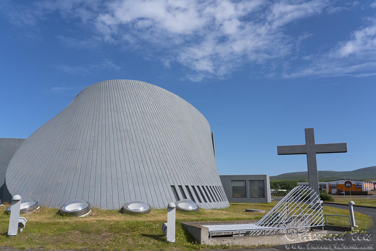
Blonduoskirkja
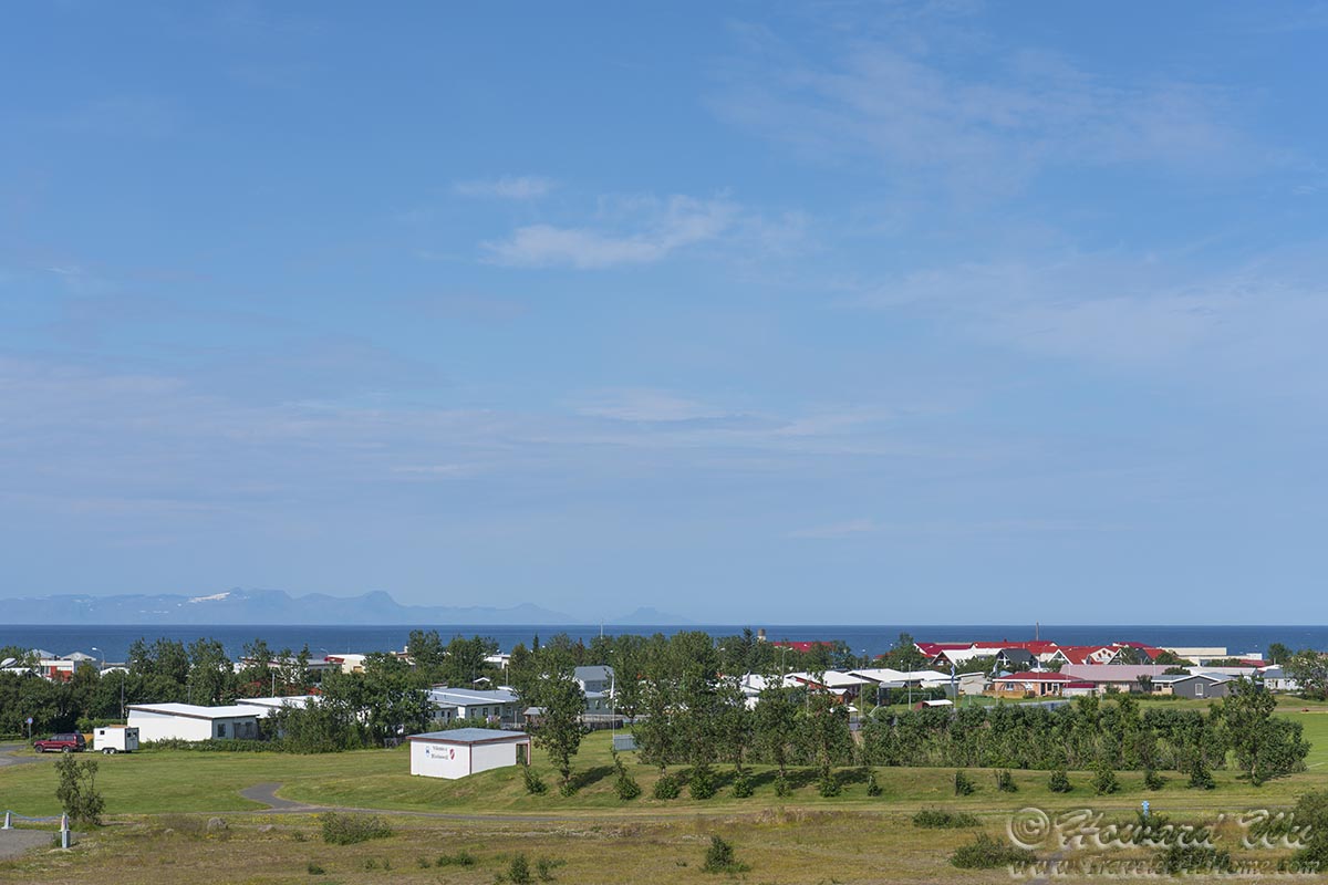
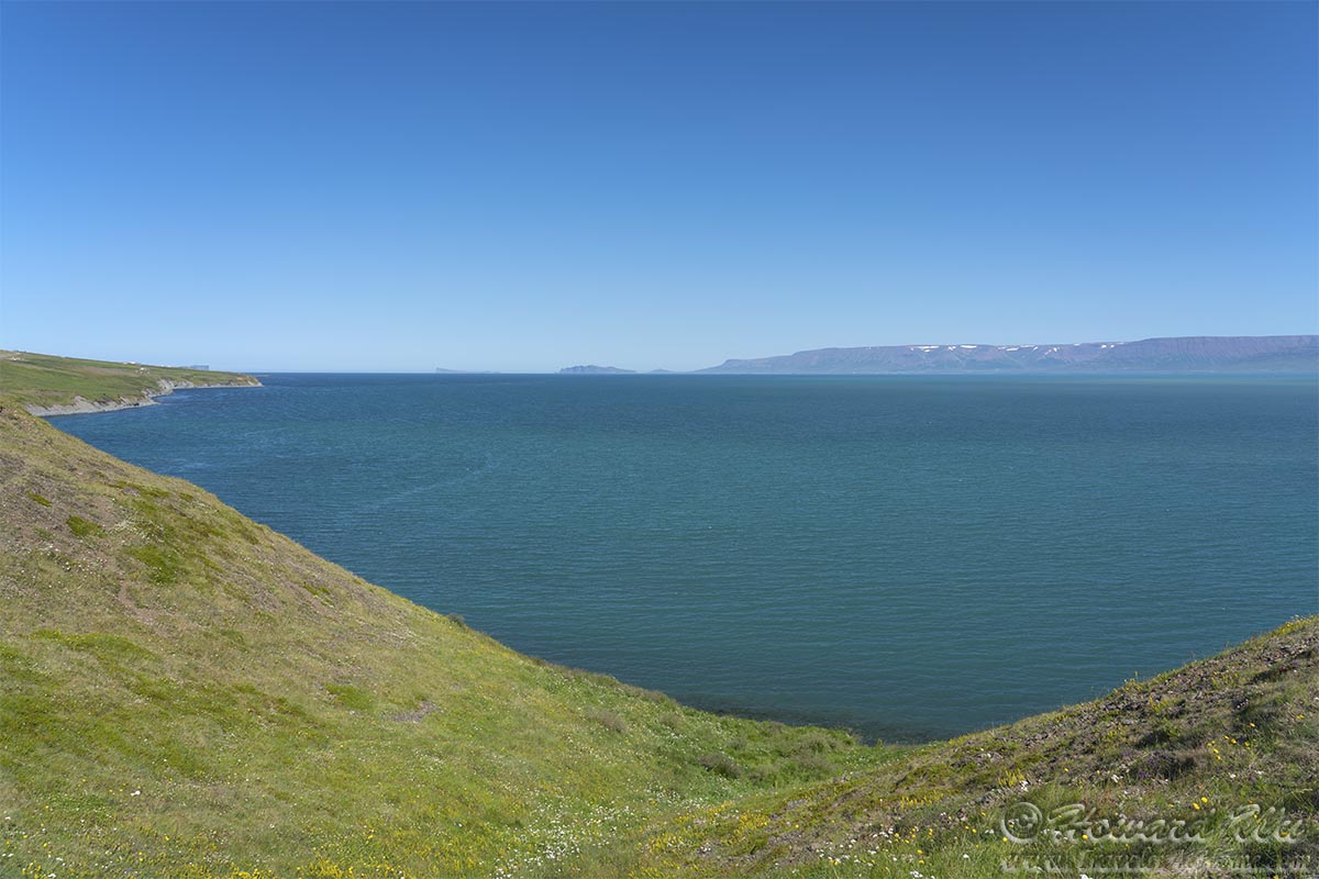
From Blönduós, we had our last glimpse of the snowcapped mountains of the Westfjords, but they seemed far away now.
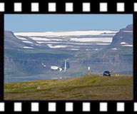
Blonduos
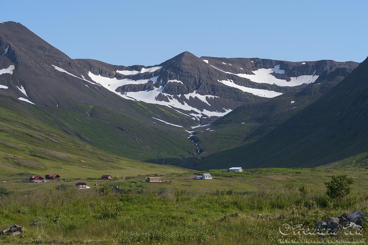
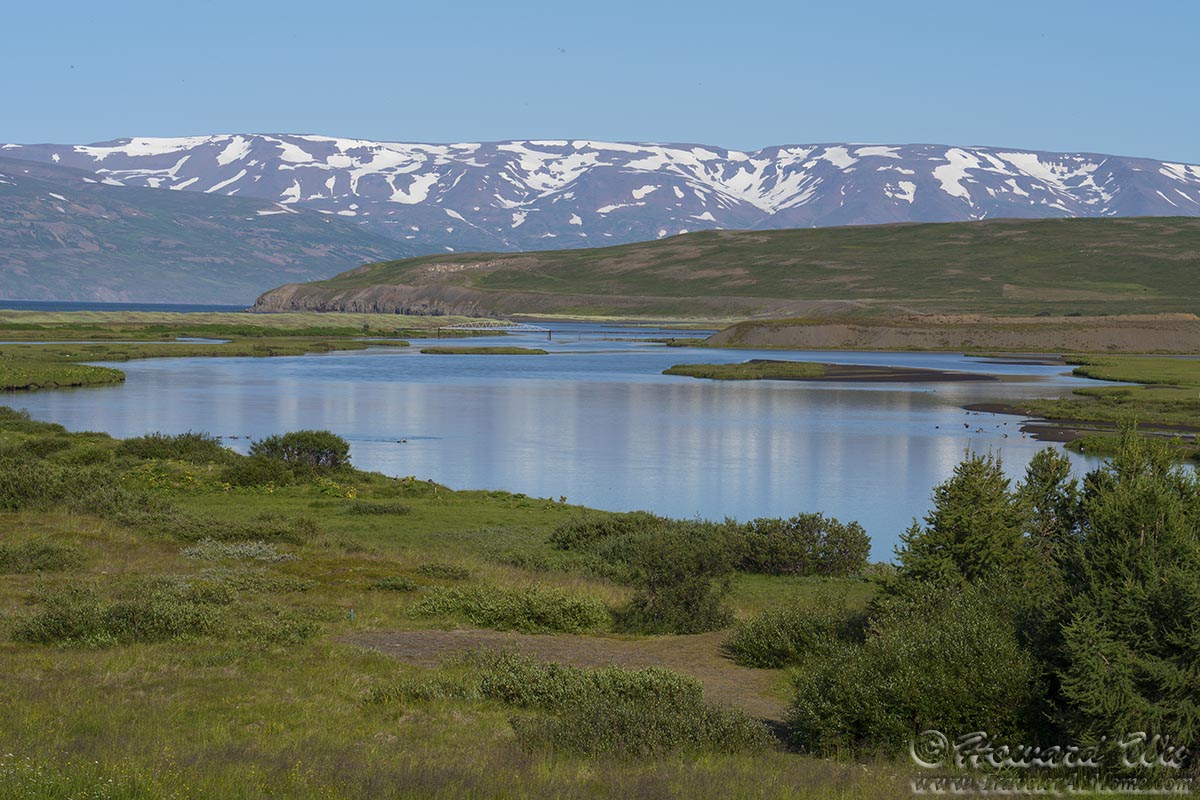
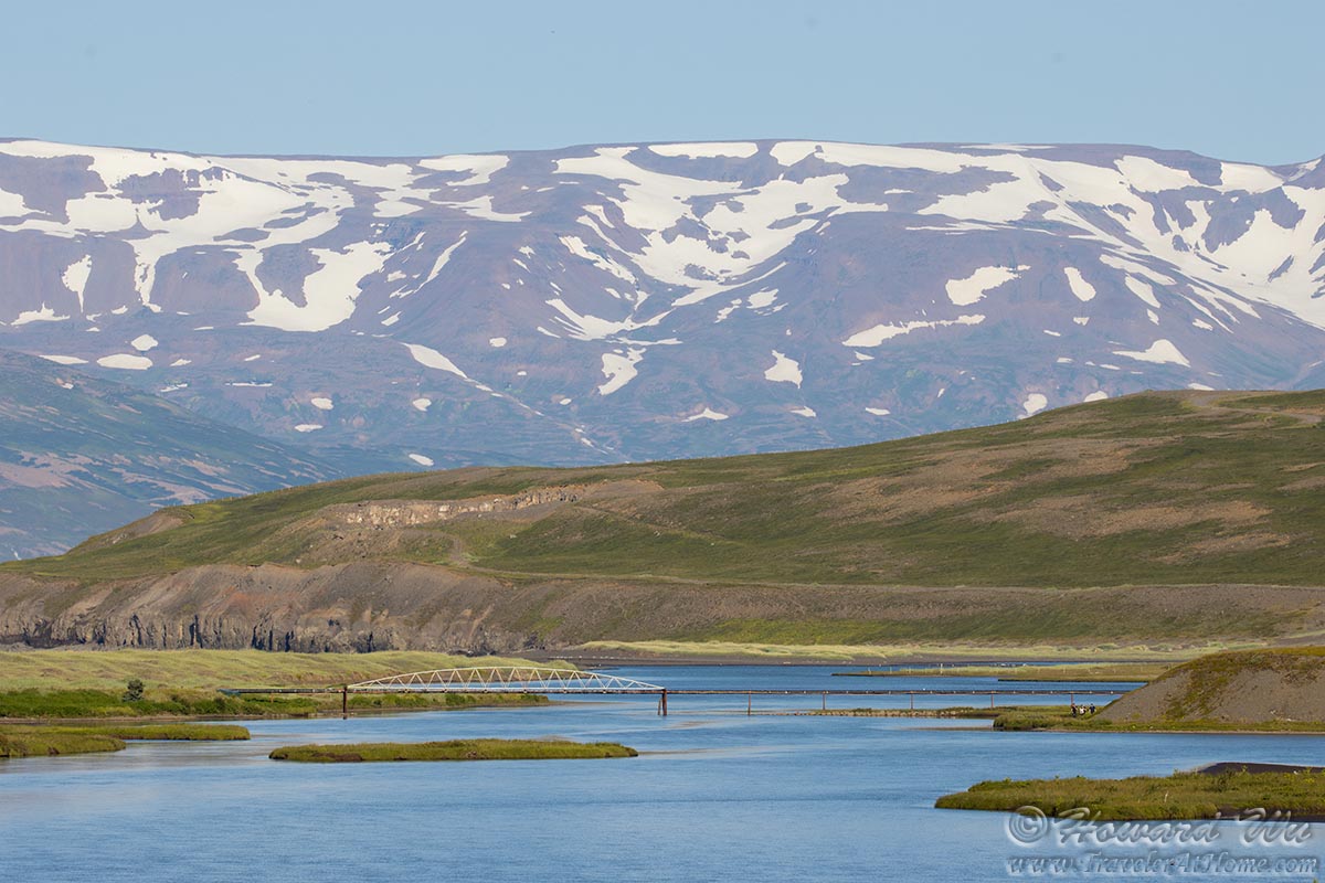
But we soon veered off the Ring Road again. This time we had more time, so we had the luxury of visiting more remote town and villages. Our next destination was Siglufjörður, the northernmost town of mainland Iceland, and we took secondary roads toward that direction. But the picturesque scenery tempted us to make frequent stops.
Northern Iceland
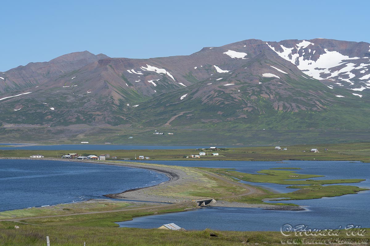
Northern Iceland
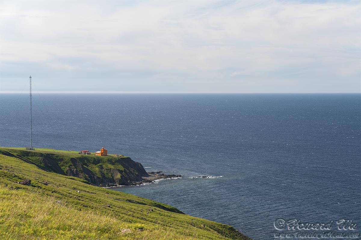
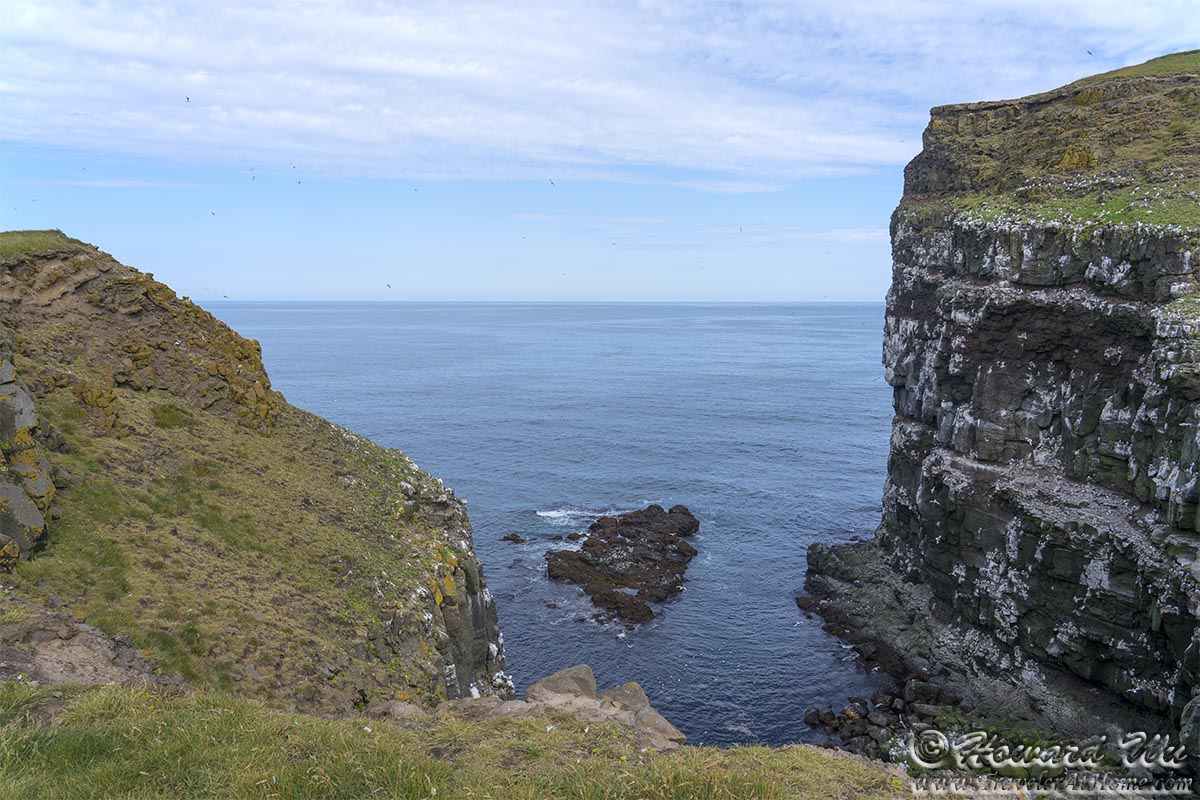
At last we reached the headland just before Siglufjörður. We stopped there to take in the scene. From there we could see the Saudanes lighthouse standing guard at the tip of the Trollaskagi Peninsula.
Saudanes Lighthouse
Headland
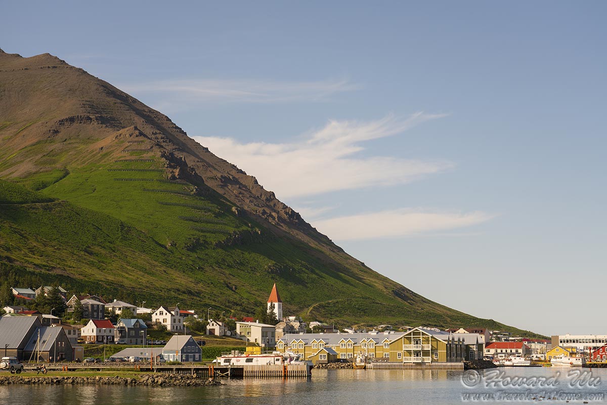
Through a one-way tunnel we entered Siglufjörður.
Siglufjörður
There was a free concert in town, and for the first time since the pandemic began, we found oursevles in a crowd. We soaked in the sun, listened to the music, and enjoyed some local skyr (Icelandic yogurt) and blueberries.
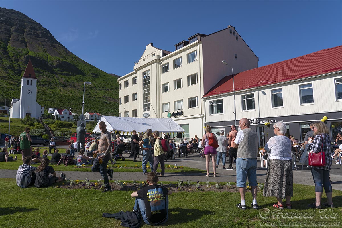
Siglufjörður

Siglufjörður
We trolled in town too. Some of the houses still kept the Icelandic turf house tradition.
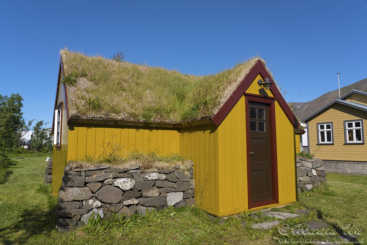
Siglufjörður turf house
Siglufjörður is also where the Icelandic TV crime series Trapped was filmed -- we did not know at the time, and only watched the series after we got home; when we watched it, we recognized the town instantly.
Siglufjörður
Siglufjörður
But the traveler's curse was at work again -- we had to move on. We drove through the village of Dalvík, where we would catch a ferry the next day. The light was just splendid when we got there, and we could not resist stopping for more pictures.
Dalvík
Dalvík
Just outside town is a small red house that stands by the fjord, it is one of the cutest house I have ever seen.
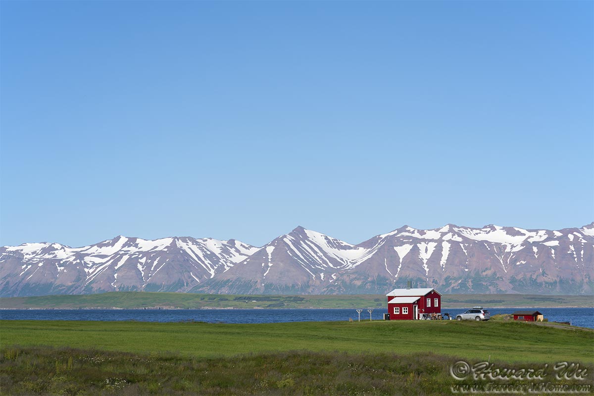
Little Red House
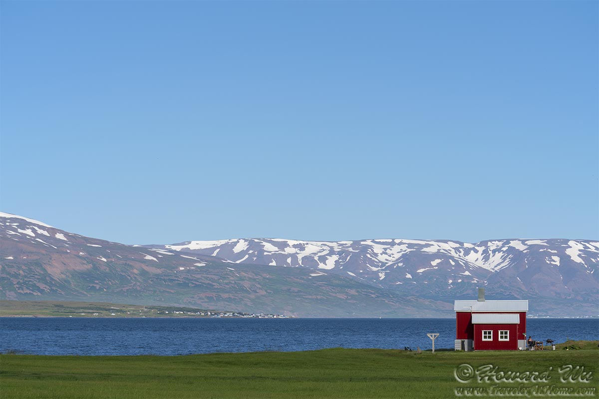
Little Red House
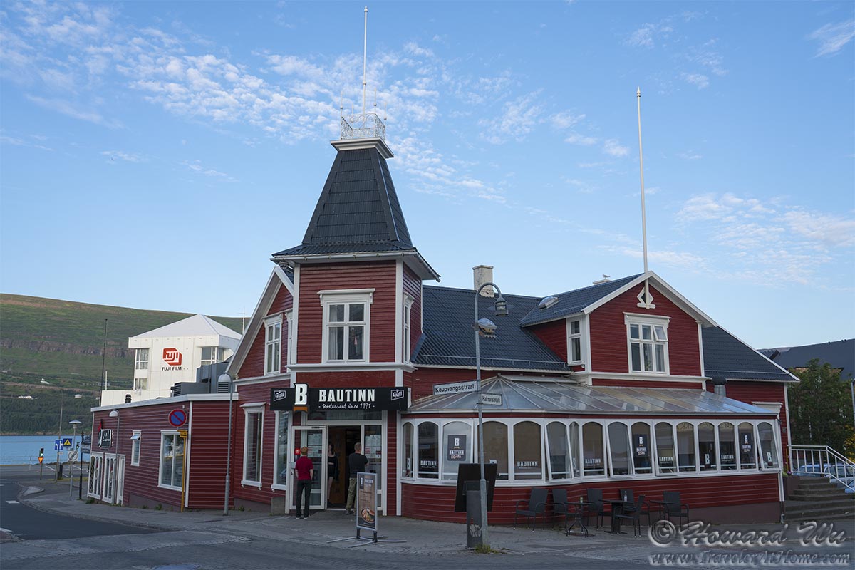
After a long day's drive, we finally reached Akureyri. The long summer day allowed us to still take a stroll in town.
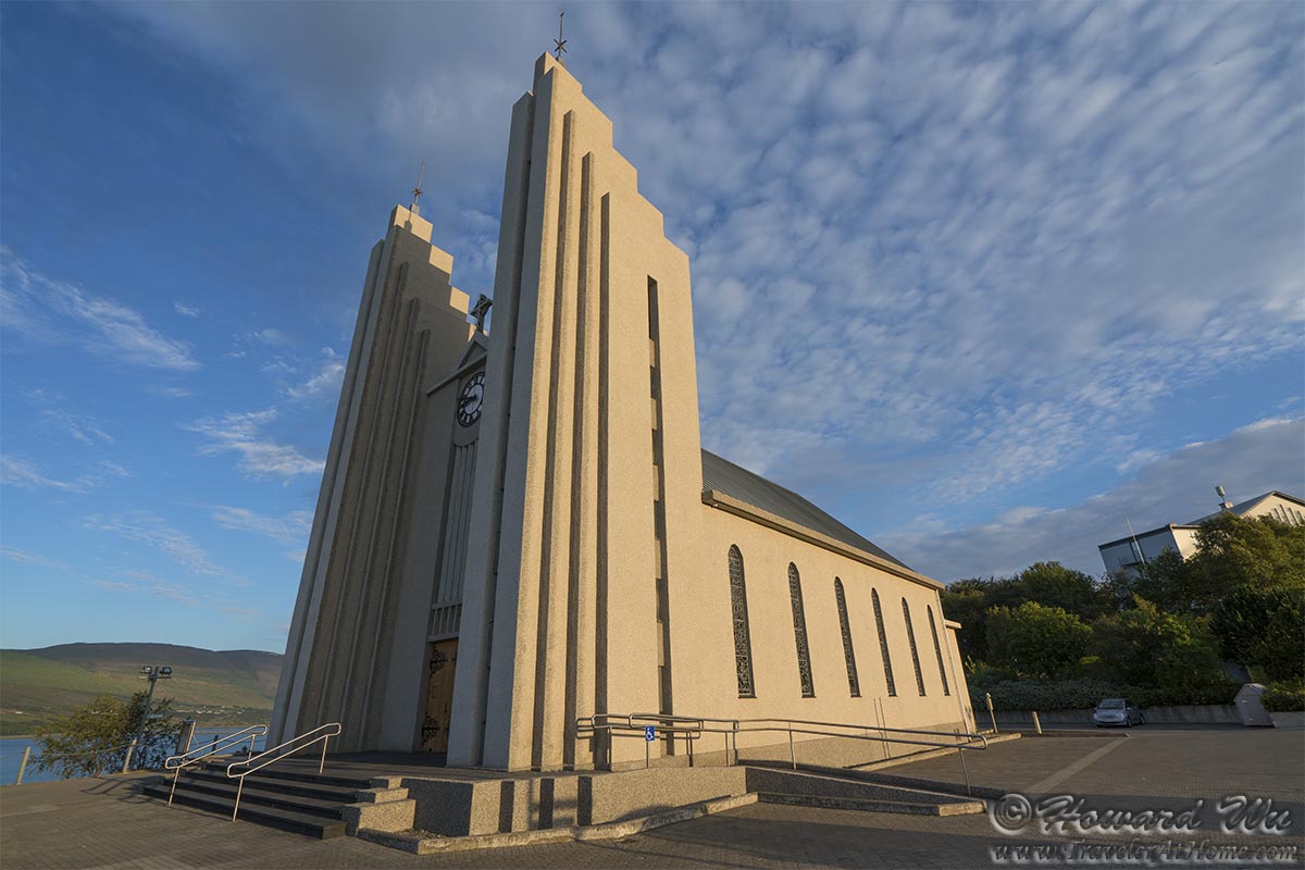
Akureyrarkirkja
Akureyri
Akureyri
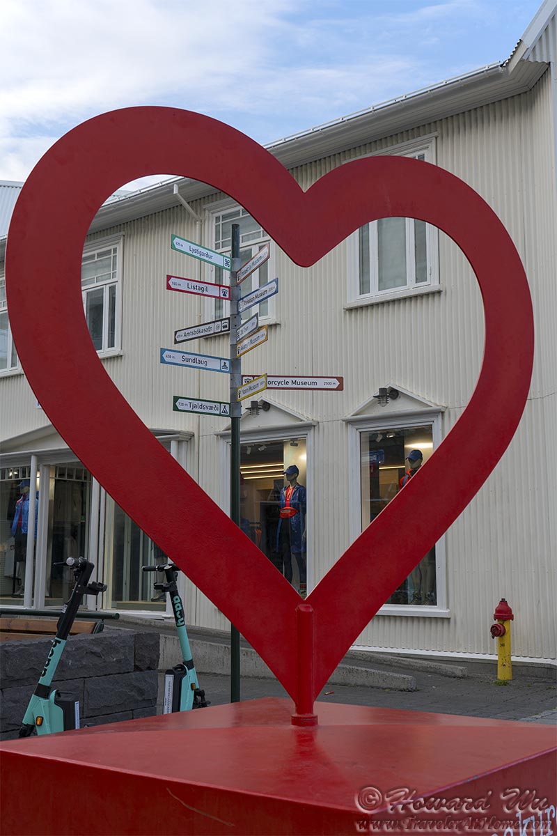
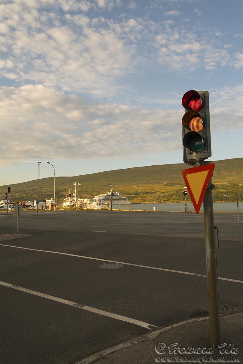
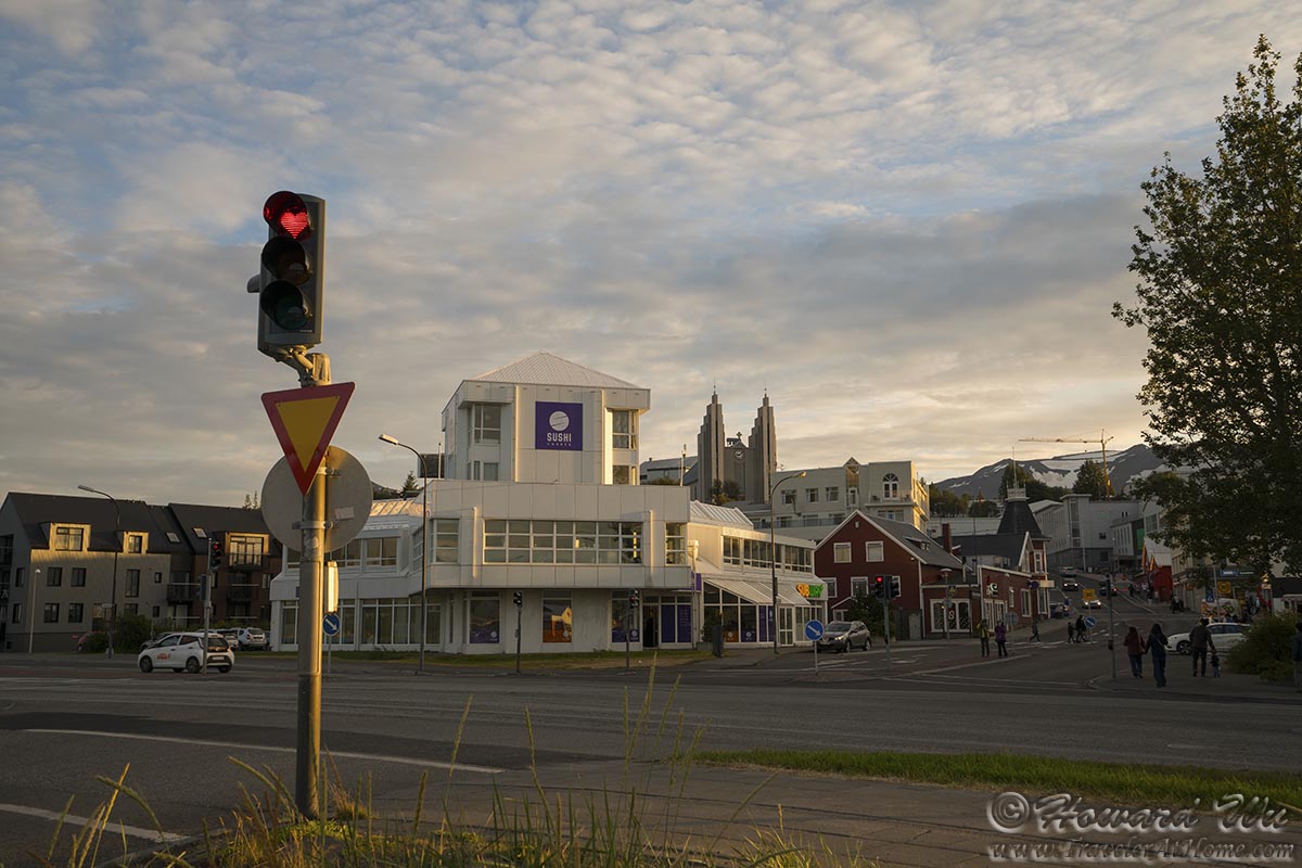
Akureyri has the most unique traffic lights: the red light is heart-shaped. We saw them on our trip two years ago, and now we had ample time to take pictures of them.
Akureyri
Akureyri
Day 9 (August 1, 2021): Day Trip to Grimsey Island (Day's driving distance: 88.2 km, Total trip distance: 1655.4 km)
A new day, and a new month. And we would break new grounds on this day -- we would cross the Arctic Circle. We boarded the ferry in Dalvík and headed toward Grimsey Island, Iceland's northernmost territory.
As our ship pulled out of Dalvík, we admired the seascape. We moved past Hrísey Island, then the small island of Hrólfssker, where a lighthouse stands.

Hrolfssker Lighthouse
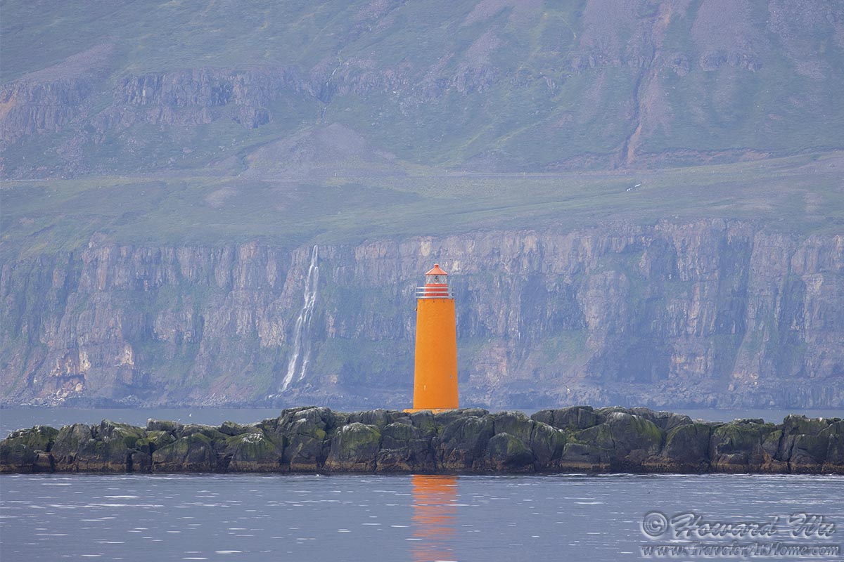
Hrolfssker Lighthouse
We encountered many dolphins in the sea. I believe these are White-beaked Dolphins.
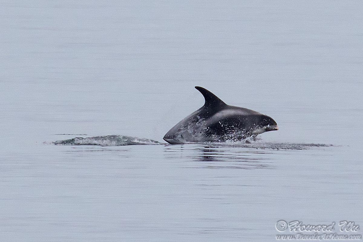
Dolphin
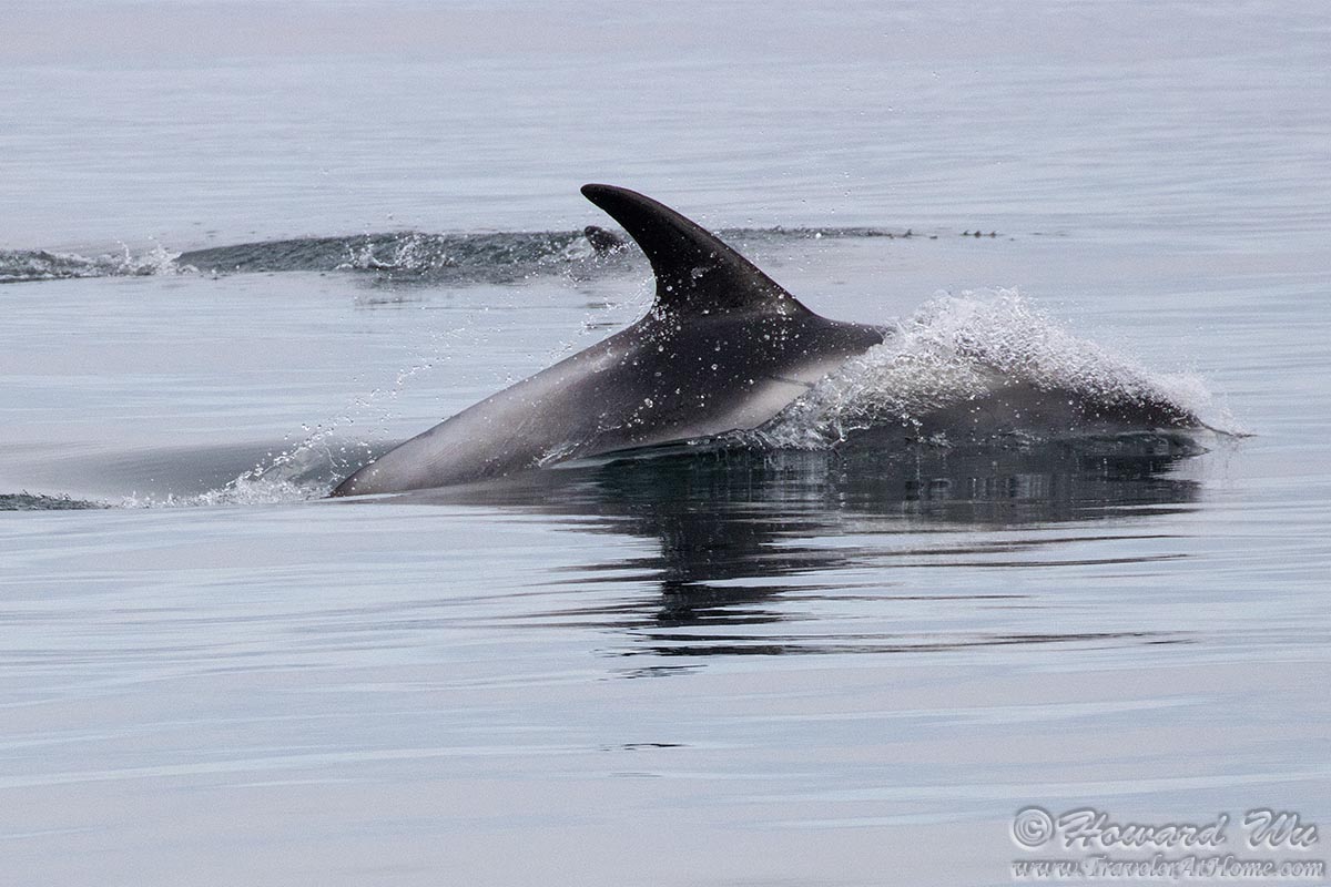
Dolphin
There were also many jellyfish floating eerily in the water.
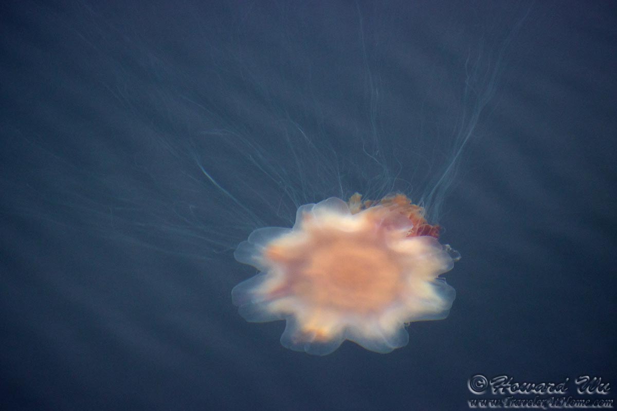
Jellyfish
Numerous seabirds were fishing in the water or flying around, such as this Northern Fulmar.
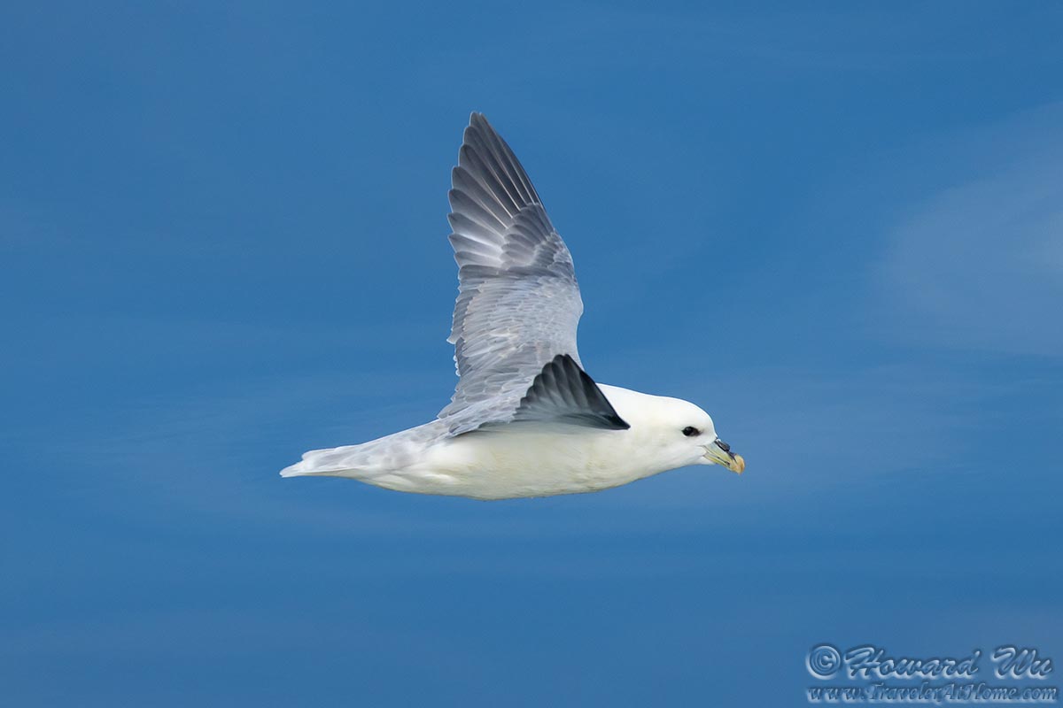
Northern Fulmar
After more than 3 hours of sailing, at last Grimsey Island was in sight. In due course, our ship docked in the harbor.
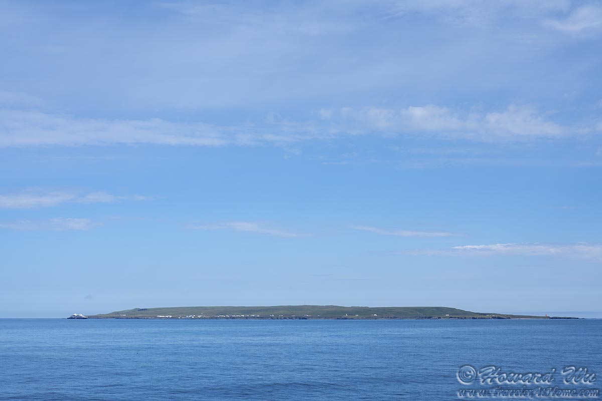
Grimsey Island
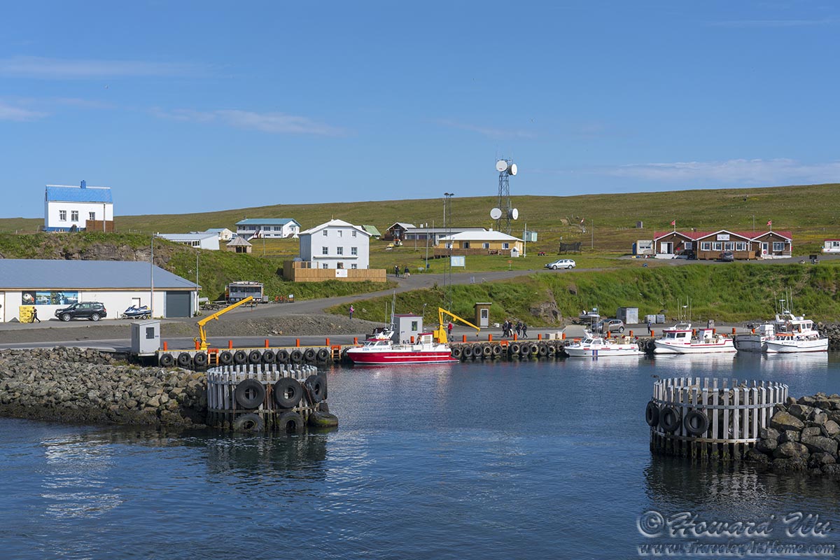
Grimsey Harbor
After disembarking from the ferry ship, we started our hike toward the Arctic Circle. A road sign made sure we were in the right direction.

Grimsey Road Signs
The rail took us to the northern end of the island and to higher ground. Soon the dramatic cliffs with nesting Atlantic Puffins appeared, and in the distance, the "Arctic Sphere" was in view.

Grimsey Island
But I was momentarily distracted by a small bird. I did not think I had ever seen it before, but it also looked somewhat familiar. Then it dawned on me that this was a female Snow Bunting in summer plumage.
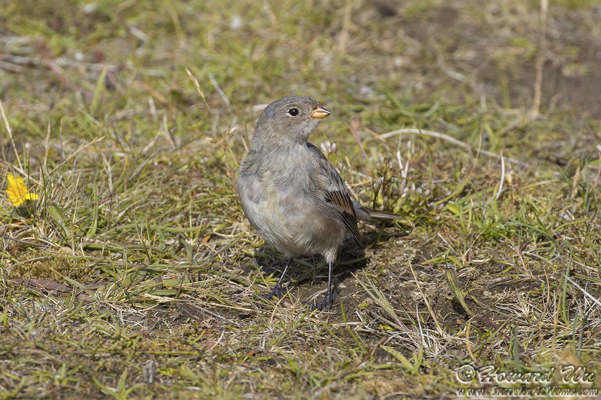
Snow Bunting
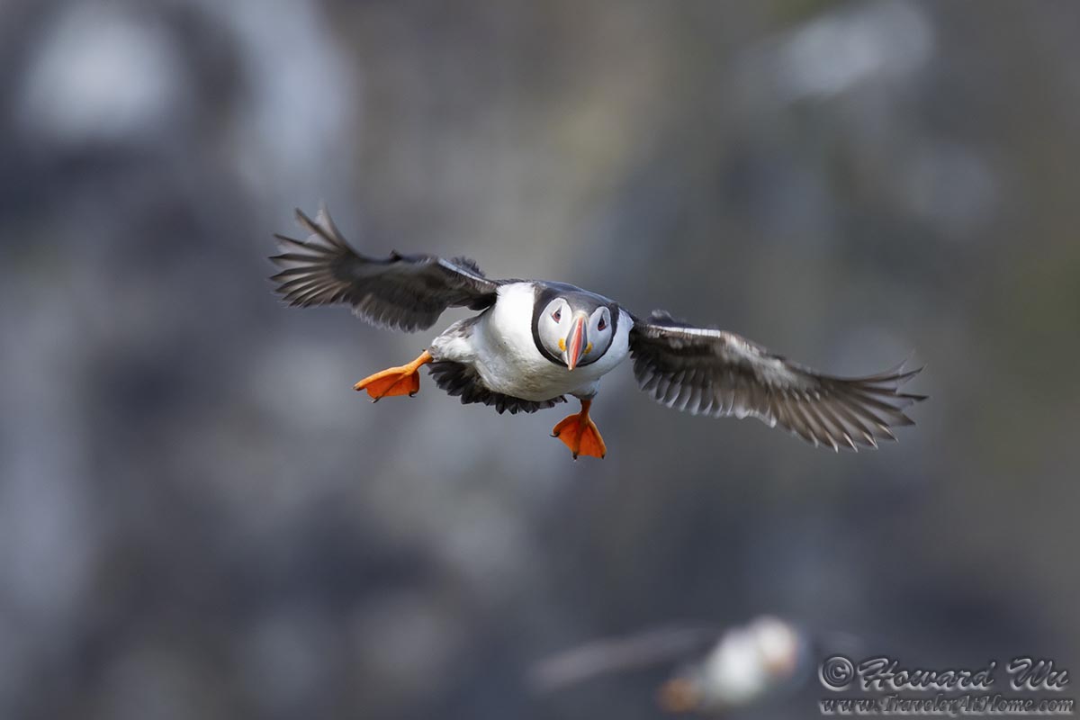
There were many Atlantic Puffins nesting on the cliffs on Grimsey, but we had limited time before the departure of the ferry, and we hurried along.
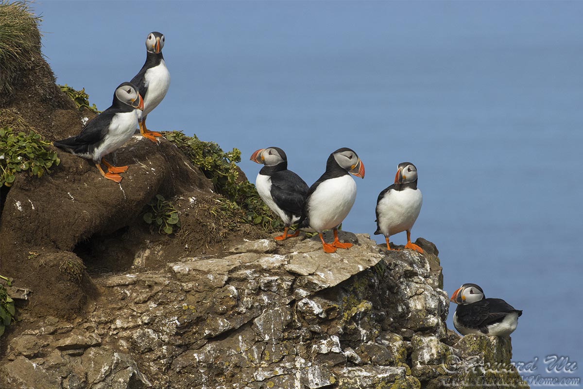
Atlantic Puffins
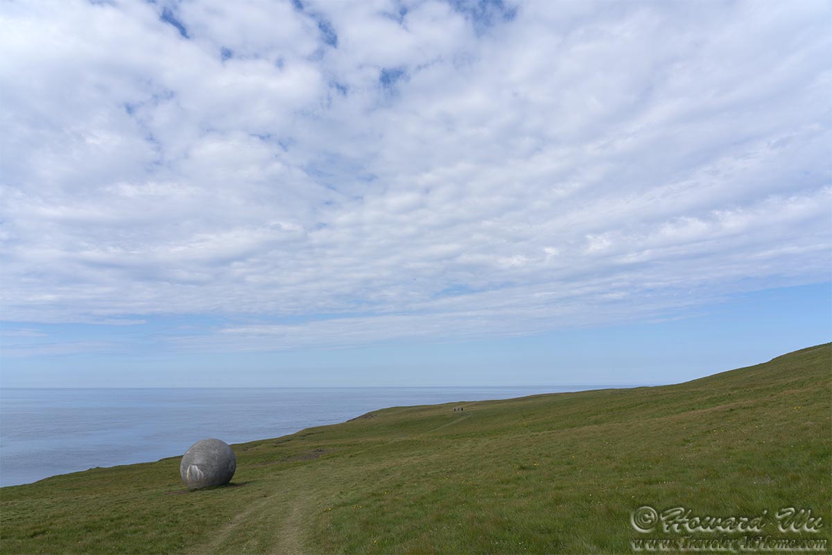
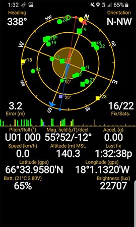
At last, we reached the Orbis et Globus (Circle and Sphere) on the Arctic Circle. Interestingly, the Arctic Circle is not static, but drifting every year. Currently, it's drifting north at a rate of more than 14 meters per year, so the monument itself is being moved every year to match the exact location of the Arctic Circle. By 2047, the Arctic Circle will no longer pass Grimsey Island. I guess we got there at the nick of time!
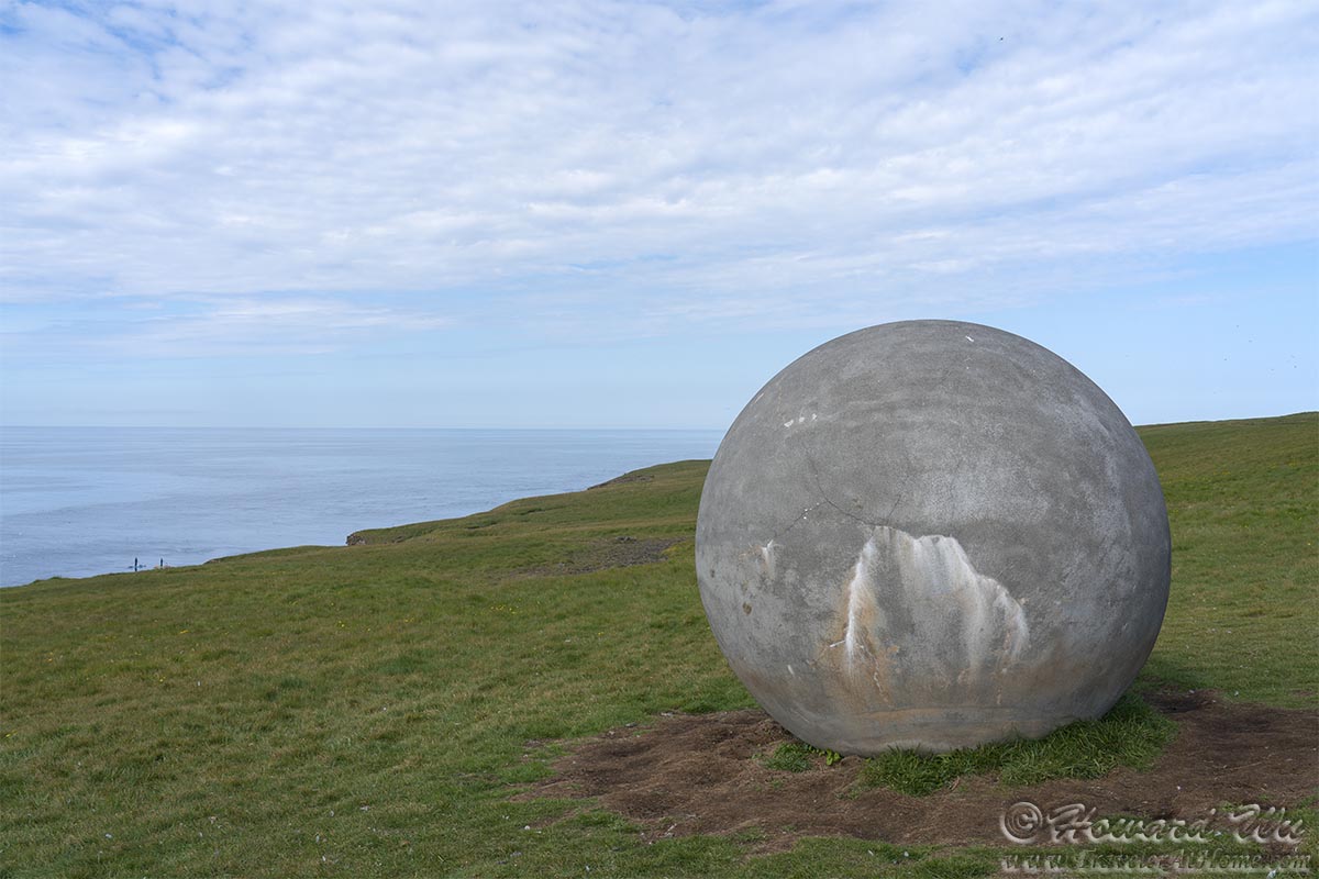
Arctic Sphere
Arctic Sphere
Because the "Arctic Sphere" (as I call it) is moved at set intervals, and the Arctic Circle is constantly drifting, to make sure that we actually crossed it, we walked farther north, to the northern tip of the island. I took GPS readings on my phone to further confirm it. And it is confirmed! The Arctic Circle has a latitude of 66°33′48.9″ (this itself is not fixed but constantly changing), and my phone recorded 66°33.9580′ (nearly 66°34'), it is safe to say that we crossed it.
Of course, this is all a bit silly. The important thing is that we took the trip to Grimsey Island and enjoyed the journey along the way.
Now that our objective was achieved, we relaxed and spent more time watching the nesting Atlantic Puffins.
Atlantic Puffin
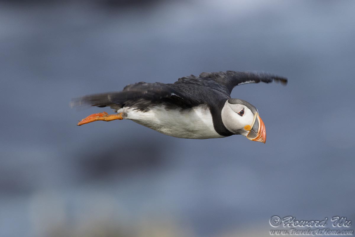
Atlantic Puffin
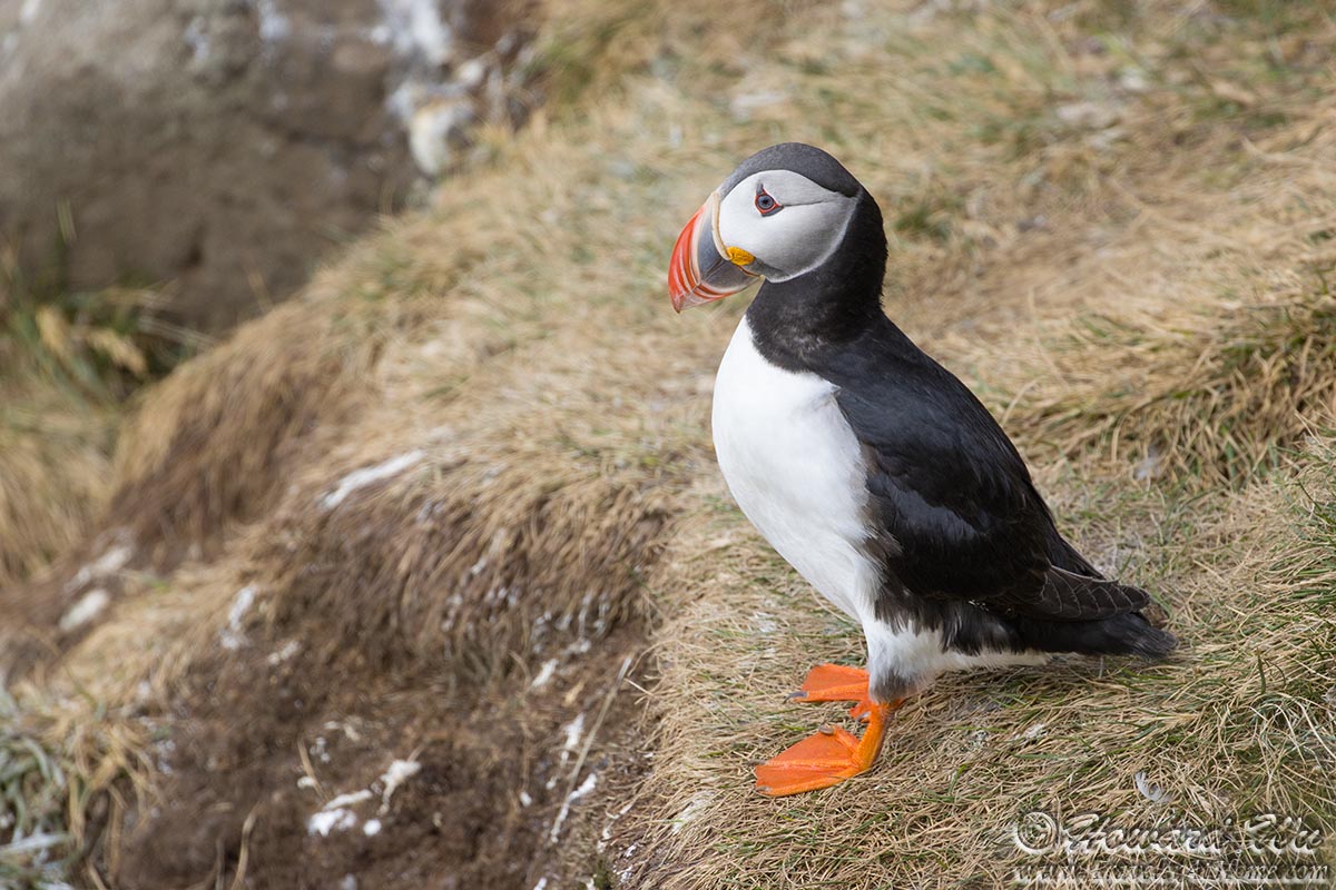
Atlantic Puffin
We also enjoyed the scenery at this outpost of Iceland.
Grimsey Island

Grimsey Island
There were some grazing Icelandic horses on the island, which provided us company. However, on the way back, we took the wrong turn on the unmarked trail and were nearly lost. Because we had to be back to the ferry, the only one that runs each day, before it departed, we had to cut across the steep slope to get back to the harbor. It was one of the most stressful times during this trip, but eventually we made it with about 15 minutes to spare.

Horse
As the ferry left Grimsey Island, we looked back from the deck. The Grimsey Island Church bid us farewell. Sadly, just the month after our visit, it was destroyed by fire.
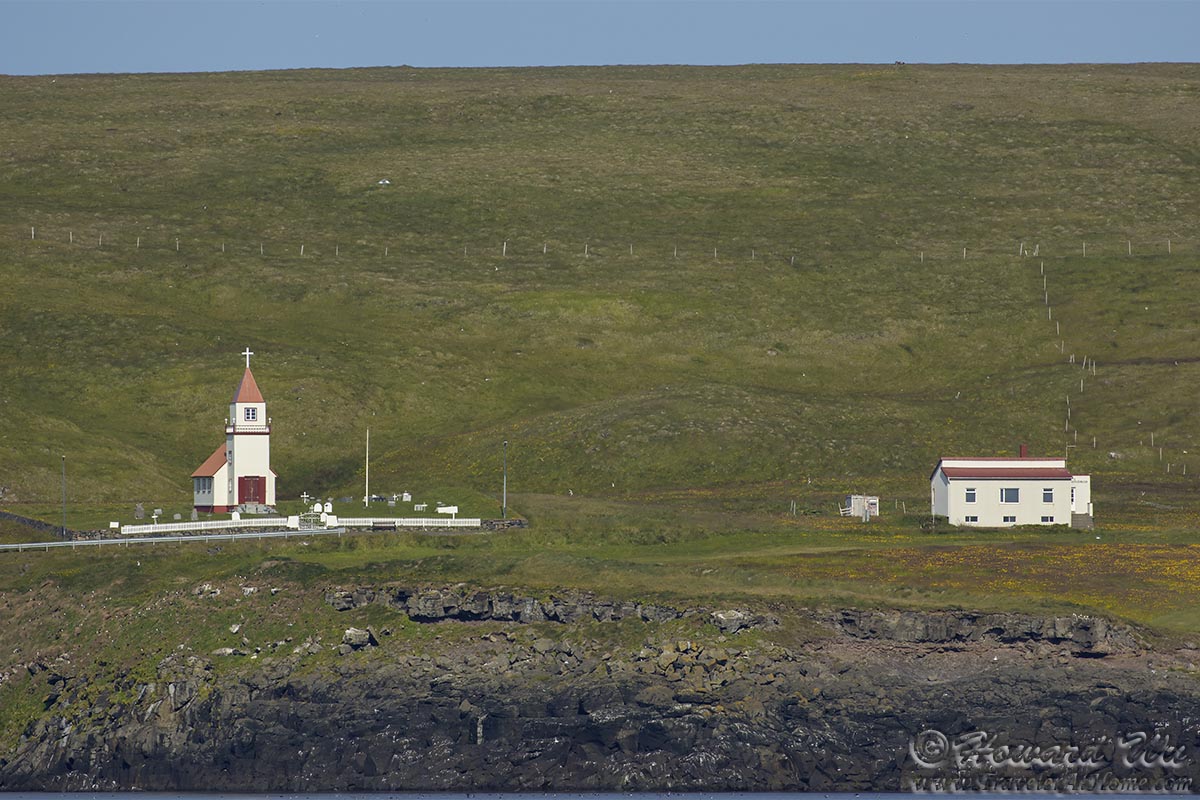
Grimsey Church
Day 10 (August 2, 2021): Akureyri to Egilsstadir (Day's driving distance: 364.9 km, Total trip distance: 2020.3 km)
Now we were past the halfway point of the trip, but we were still at the "top" (northern edge) of Iceland. The advantage of having taken a trip two years before manifested itself: now we could skip the Lake Myvatn area which we visited two years ago and take different detours. And the one we took this time was Húsavík, the location for the movie Eurovision Song Contest: The Story of Fire Saga (at the time, I did not even know the movie, which I am not a fan of and which was a good thing -- we could visit it without any preconception).

Húsavík Church

Húsavík Church

Húsavík
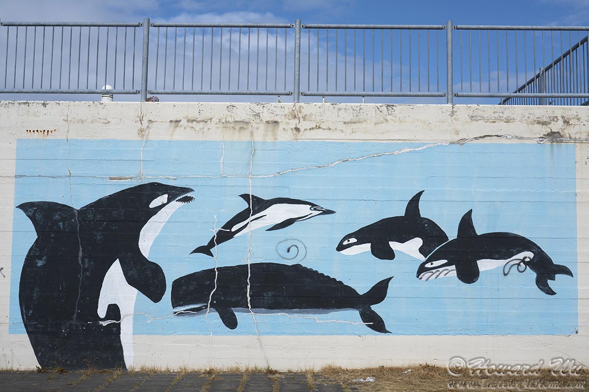
Húsavík is known as "the whale watching capital of Europe", and there were many whale-watching tours at the harbor. They also had a mural which made sure visitors won't forget about this (but of course someone had to vandalize it).
Whale Mural
But we did not have time for whale watching; we just strolled along the harbor and admired the ships and some beautiful boats docked there.
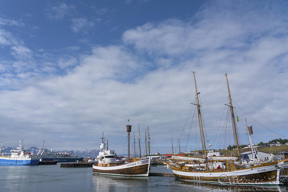
Húsavík Harbor
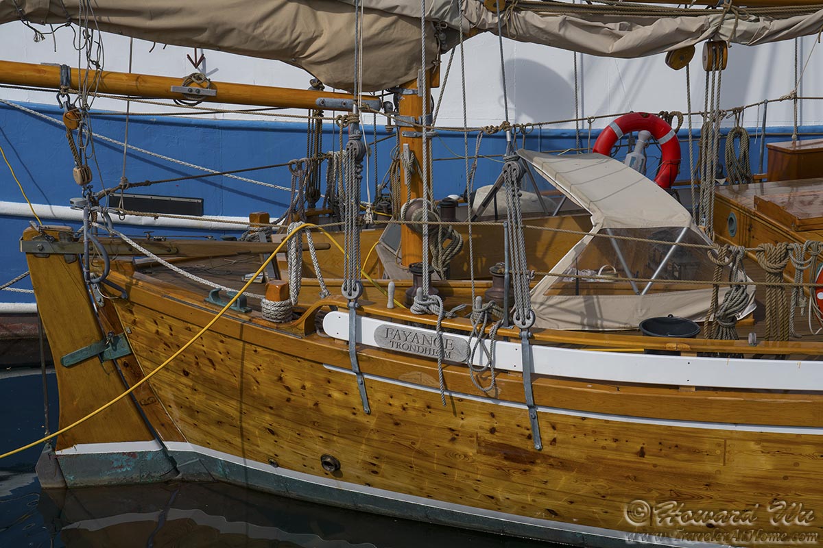
Boat
On the way out of town, we stopped by the lighthouse to look across the fjord.
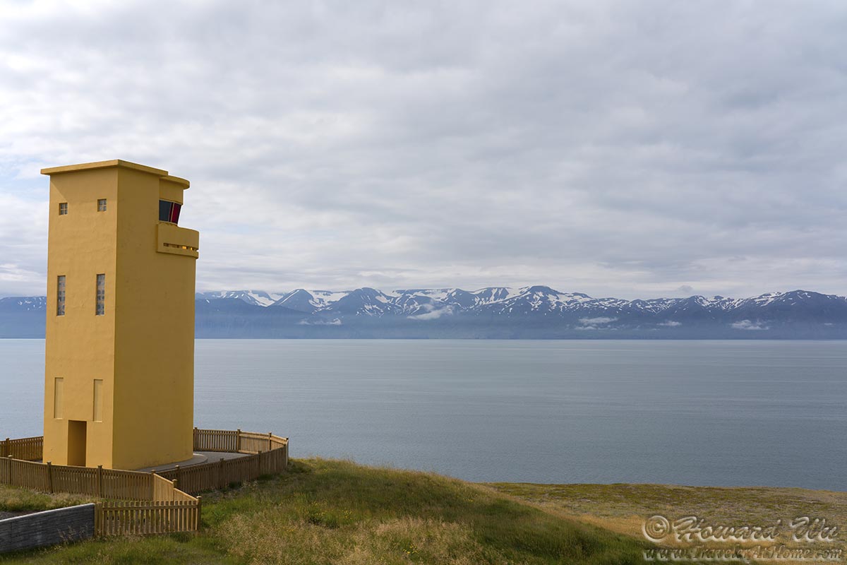
Húsavík Lighthouse
Our main destination for the day was Asbyrgi Canyon. This we reached in the afternoon, and as if on cue, a Common Redshank loudly greeted us just outside the visitor center.
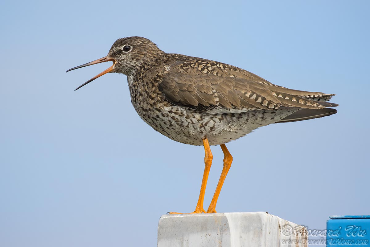
Common Redshank
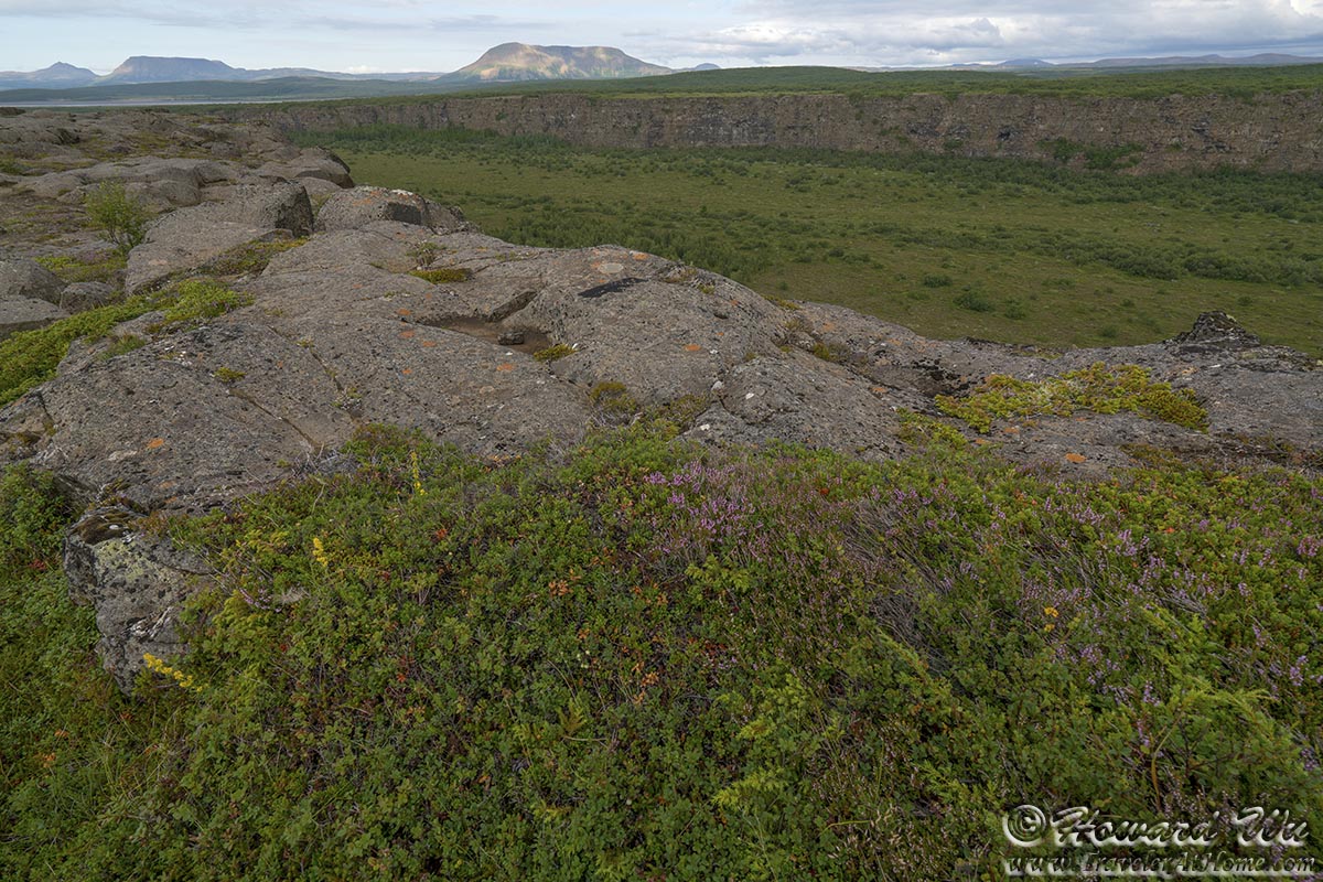
Asbyrgi is a horseshoe shaped canyon. At the "tip" of the horseshoe is a small limpid body of water, Botnstjorn Pond. We drove to the trailhead and hiked to the pond. Weather was not great at this time (too cloudy), but the canyon is lush with trees and other plants, a strong contrast to other part of Iceland which are spectacular but often austere. Surrounded by high basalt cliffs, the pond seems like a sanctuary.
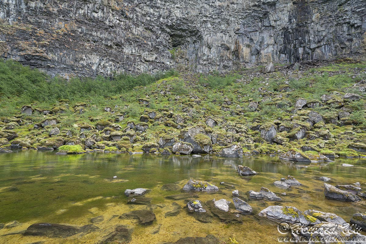
Botnstjorn Pond
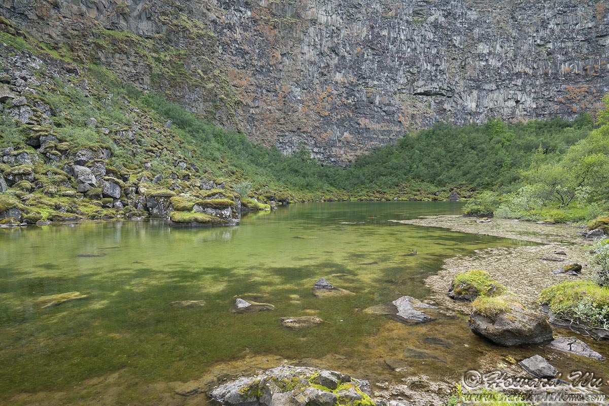
Botnstjorn Pond
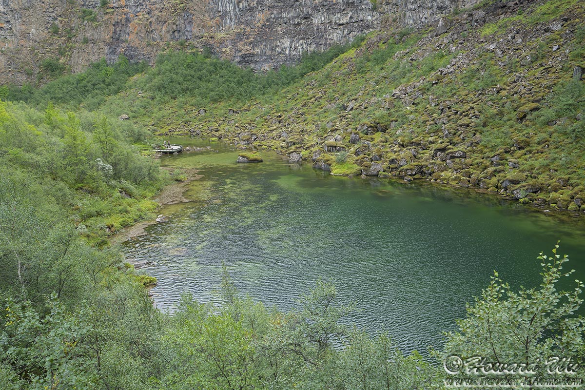
Botnstjorn Pond

Botnstjorn Pond
Indeed, there were several (Eurasian) Wigeons swimming in the pond, some are obviously this year's duckling.
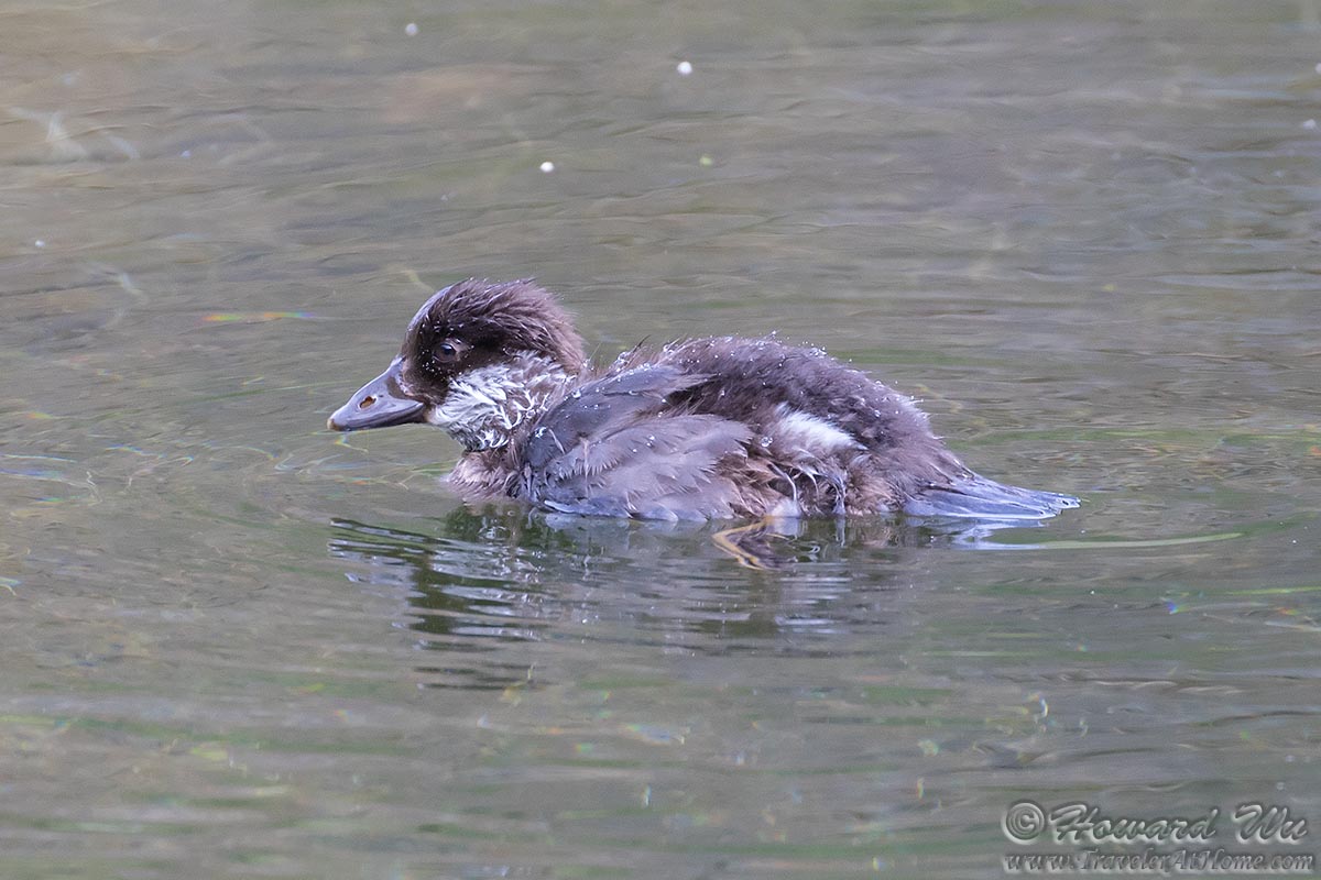
Wigeon
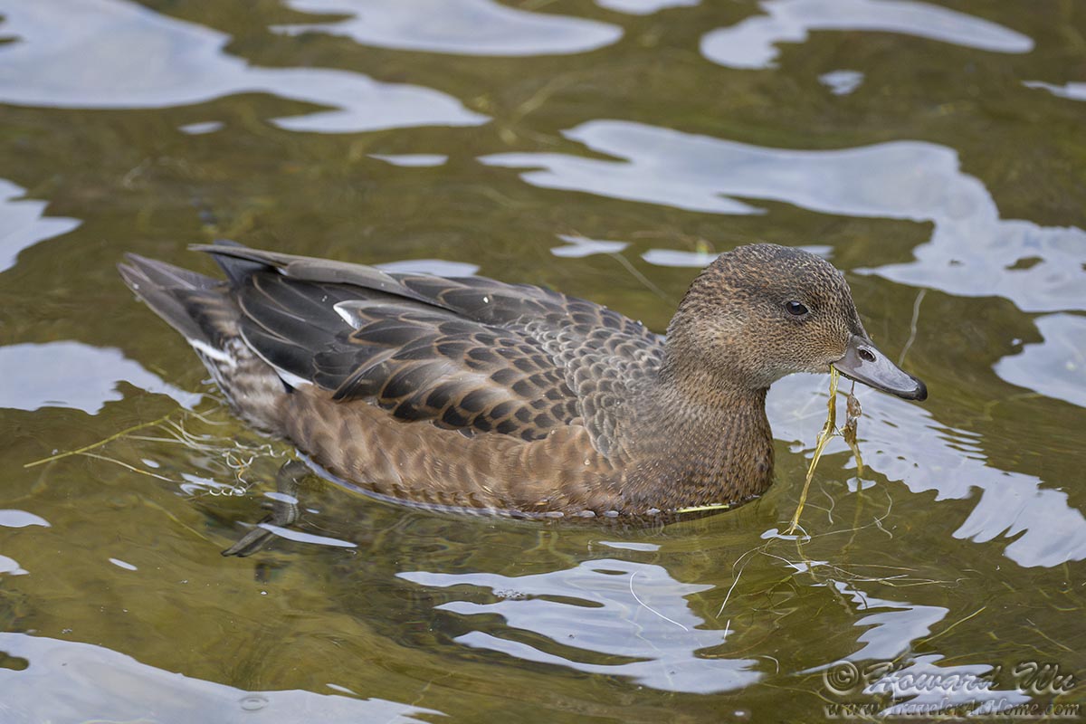
Wigeon
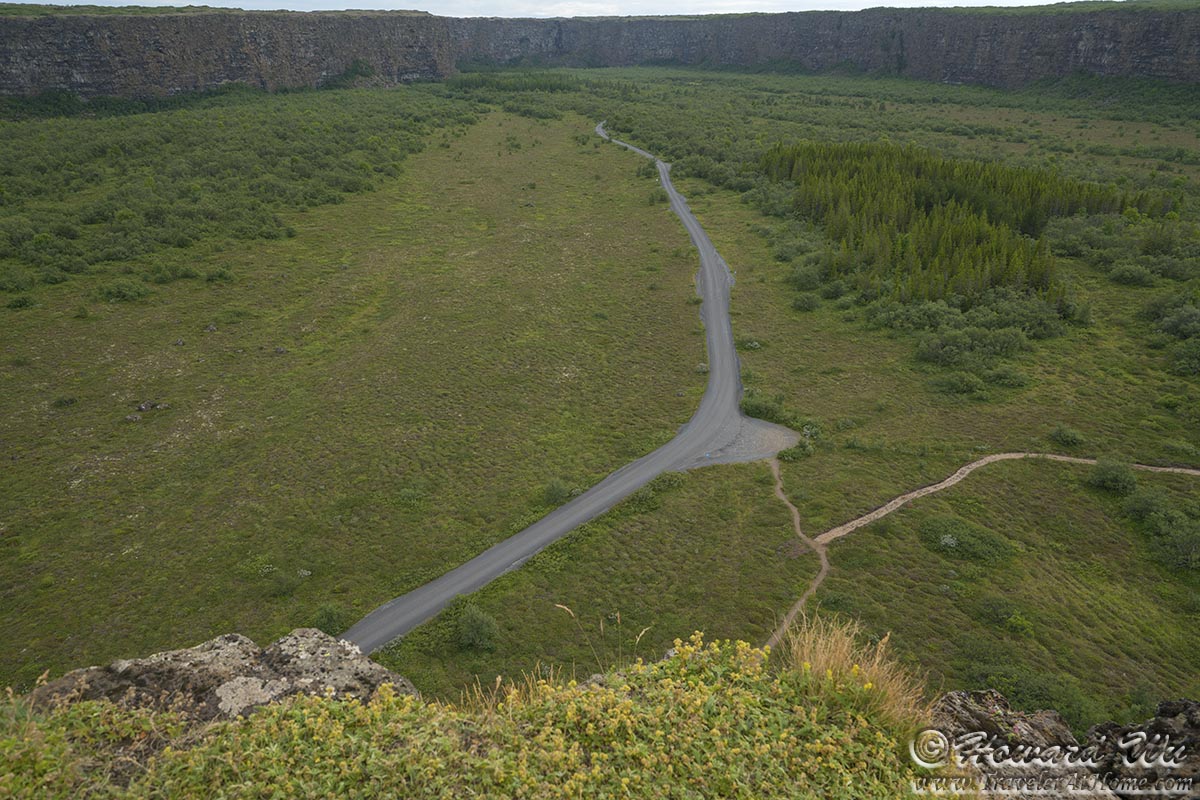
We then hiked to the rock formation Eyjan (island) that protrudes into the center of the canyon. At the end of the ridge, the view is panoramic. However, the cloudy weather was a little disappointing and did not show the canyon in its full glory, and this was one of the few times I wish I had a drone with which I could gain a bird's-eye view perspective to see the entire canyon from above (but I still hate drones).
Asbyrgi Canyon
Asbyrgi Canyon

Asbyrgi Canyon

Asbyrgi Canyon
The plant diversity on top of the rock formation is astonishing. The first flower below is the Mountain Avens, I believe, Iceland's national flower. There were a lot of blueberries too, but to our dismay they were not yet ripe and were tart and sour.
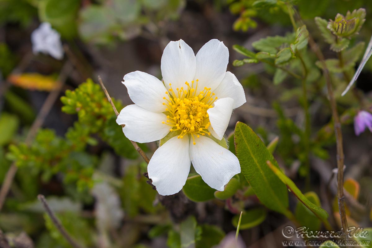
Mountain Avens
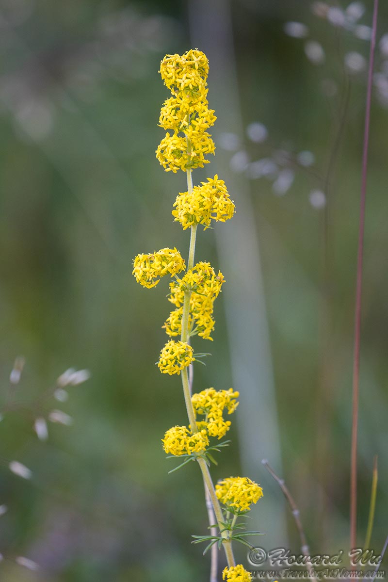
Lady's Bedstraw
Wildflower
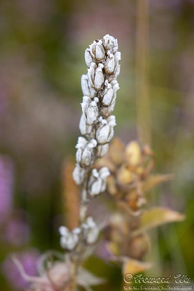
Wildflower
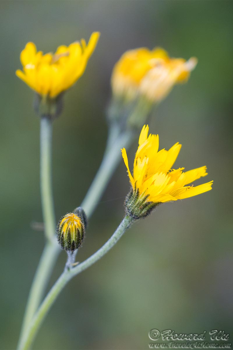
There were some nesting birds in the vegetation too, such as this European Golden Plover.
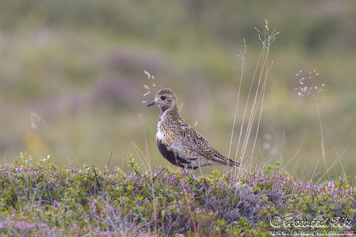
European Golden Plover
After our hike in Asbyrgi Canyon, we still had a long drive to our destination of the day, Egilsstadir. We had to zoom by Dettifoss, one of Europe's most powerful waterfalls, without stopping. We could afford to do so because we had seen it two years ago. We managed to make a stop at Rjukandafoss just before reaching Egilsstadir.
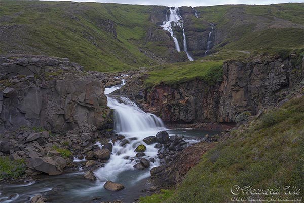
Rjukandafoss
Day 11 (August 3, 2021): Egilsstadir to Hofn (Day's driving distance: 401.8 km, Total trip distance: 2422.1 km)
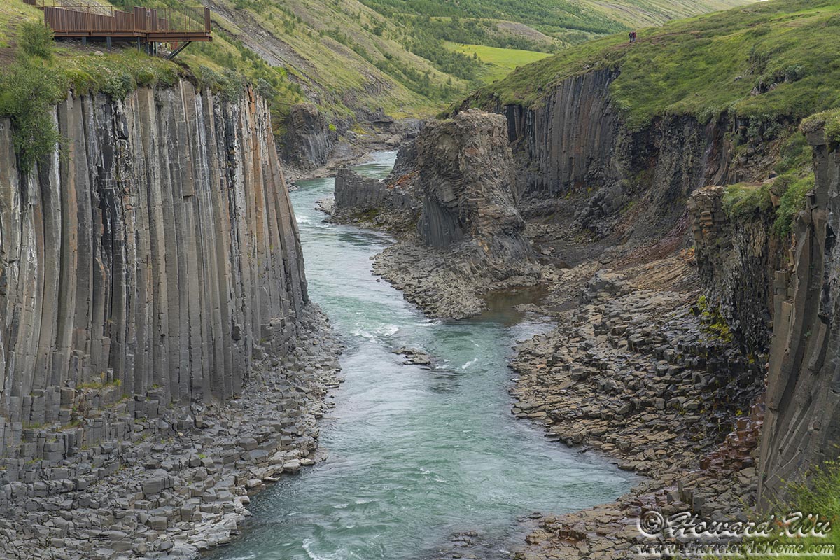
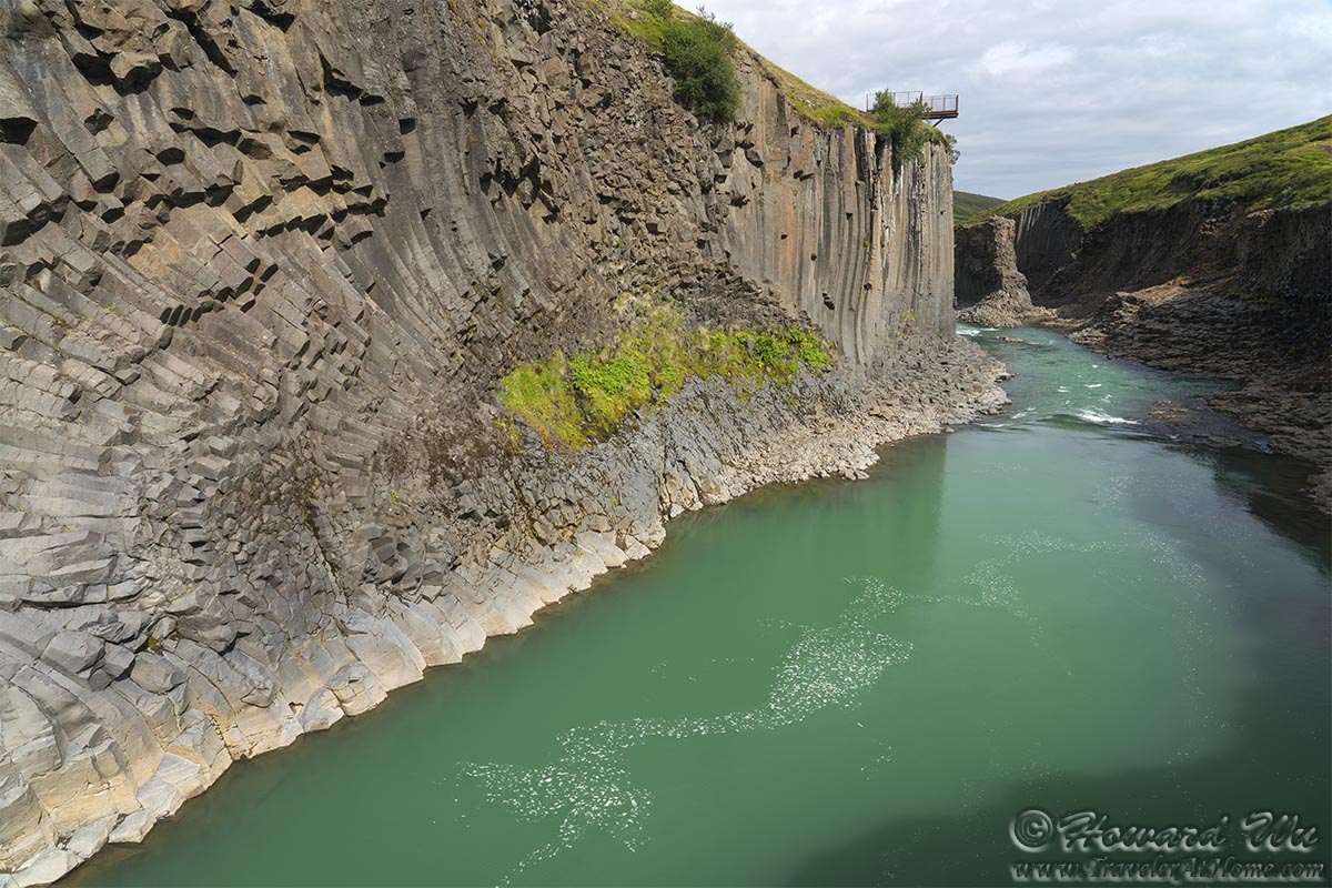
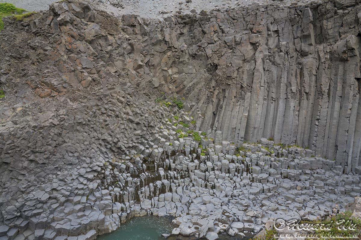
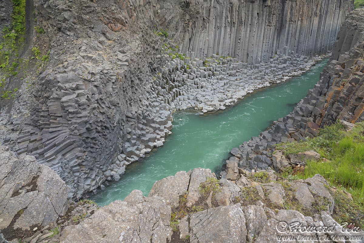
This was our last day in northern Iceland before veering south. This day's highlight was Stuðlagil Canyon, to which we had to backtrack our steps some ways to reach. The basalt columns lined canyon looked surreal, and it was somewhat difficult to get to (we had to drive on long sections of unpaved road). But it was well worth the effort.

Stuðlagil Canyon
Stuðlagil Canyon
Stuðlagil Canyon

Stuðlagil Canyon
Stuðlagil Canyon
Stuðlagil Canyon
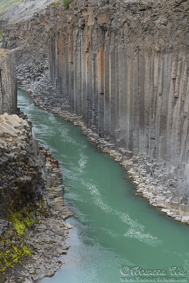
Stuðlagil Canyon

Stuðlagil Canyon
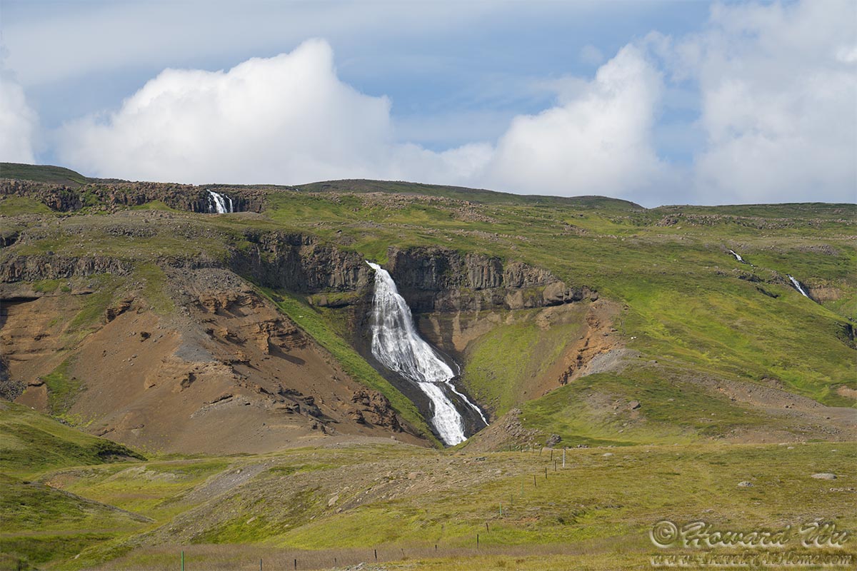
After Stuðlagil Canyon, before returning to Egilsstadir, we stopped at a road side waterfall. This is a waterfall with respectable size, and as you can see, the hollow that it carved out on the side of the mountain is actually heart shaped. In any other place this would be a famous waterfall, but we found no signs for it, and it does not show up on Google Maps. This underscores the ridiculous beauty of Iceland.
(After some research, I believe this waterfall is on the river of Garðá, the same river that runs through Stuðlagil Canyon, so it may be called "Garðáfoss".)
Heart-shaped Waterfall
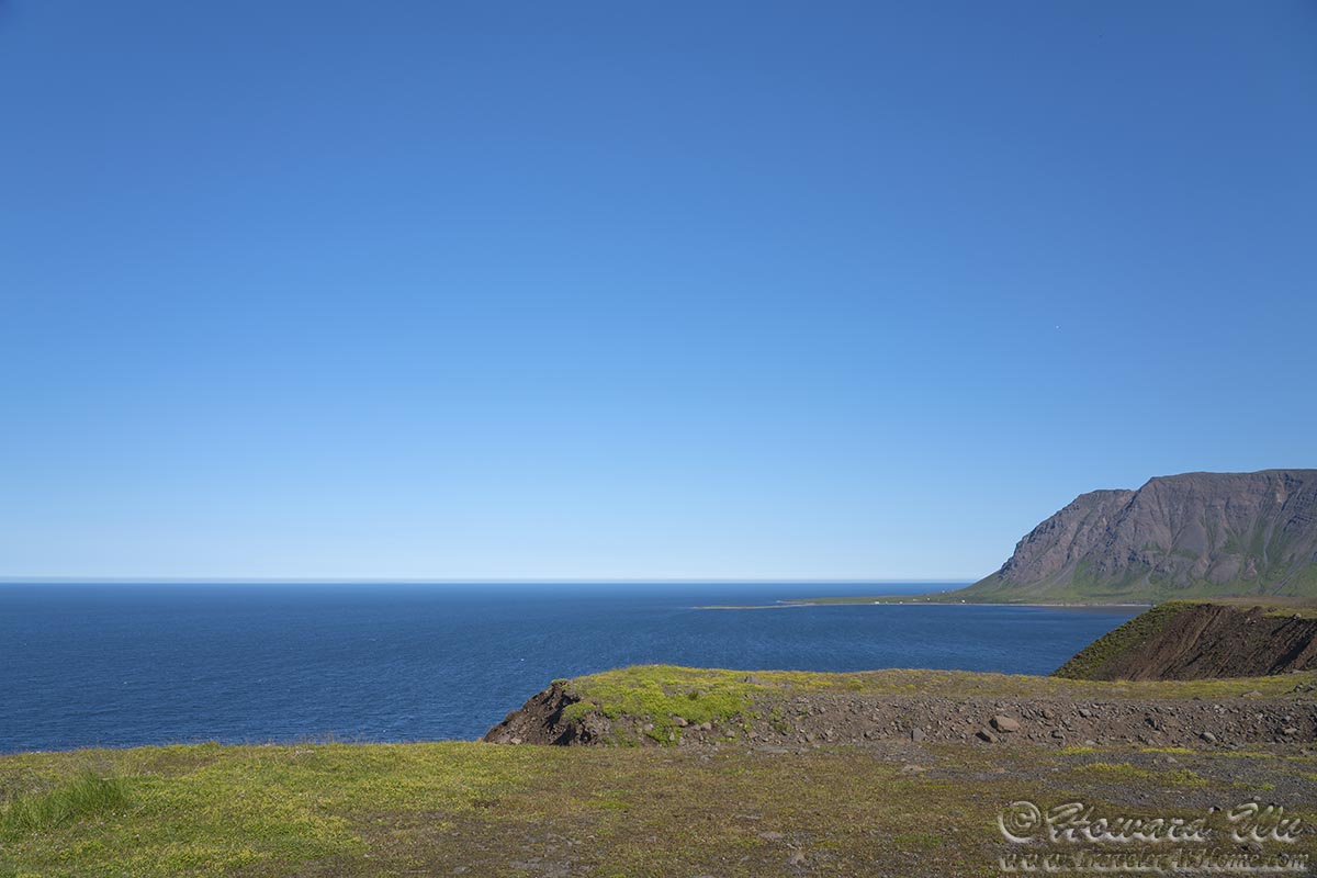
After this it was a long drive from north to south. Weather turned foggy and cloudy too. We made a few stops, but mostly we pretty mcuh skipped all of East Fjords, where we did spend significant time two years ago.
 Click the image below to return to the index page of 2021 trip to Iceland: