Day 7 (Wednesday, June 26, 2019): Lake Myvatn, geothermal areas and yet more waterfalls (from Lake Myvatn to Akureyri)
We woke up to a beautiful day in Lake Myvatn. We drove to Dimmuborgir and stopped to enjoy the view of the lake.
(Click on each image to see the high-resolution version)

Lake Myvatn

Lake Myvatn
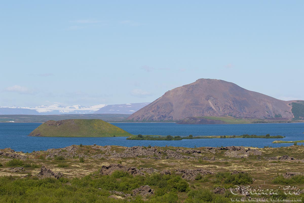
Lake Myvatn

Lake Myvatn
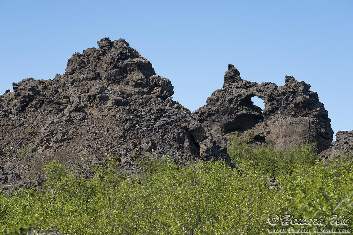
Dimmuborgir is a lava field with strangely (some say grotesquely) shaped rock formations. Some rocks have been eroded and formed grotos and arches. We hiked in the rock "forest" for a little bit.
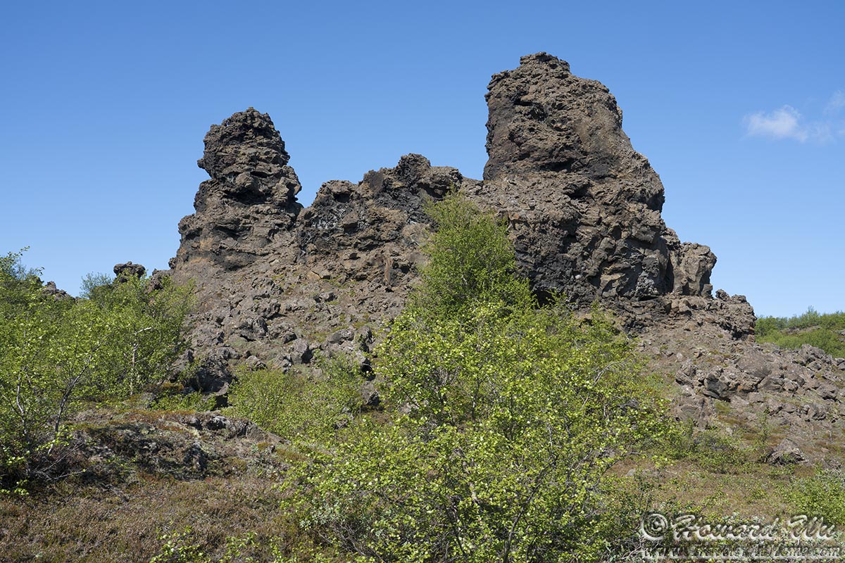
Rock formation
Rock formation
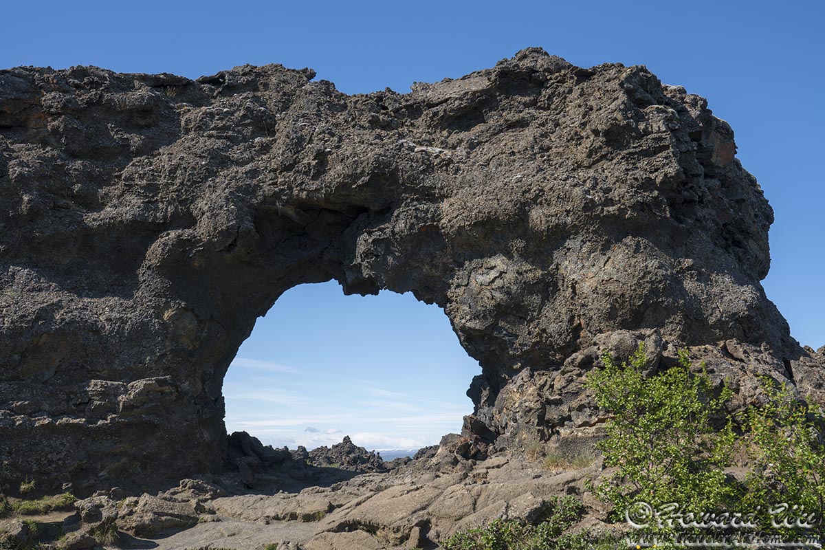
Rock arch
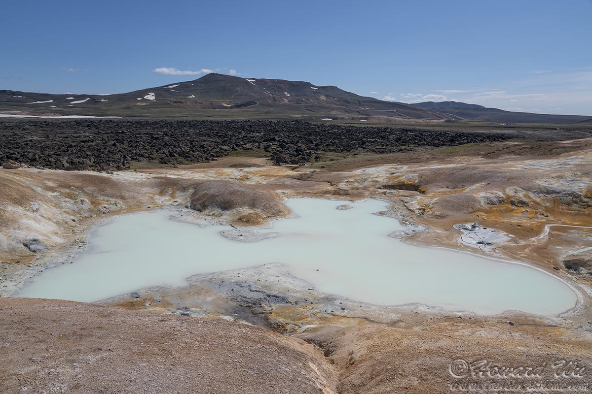
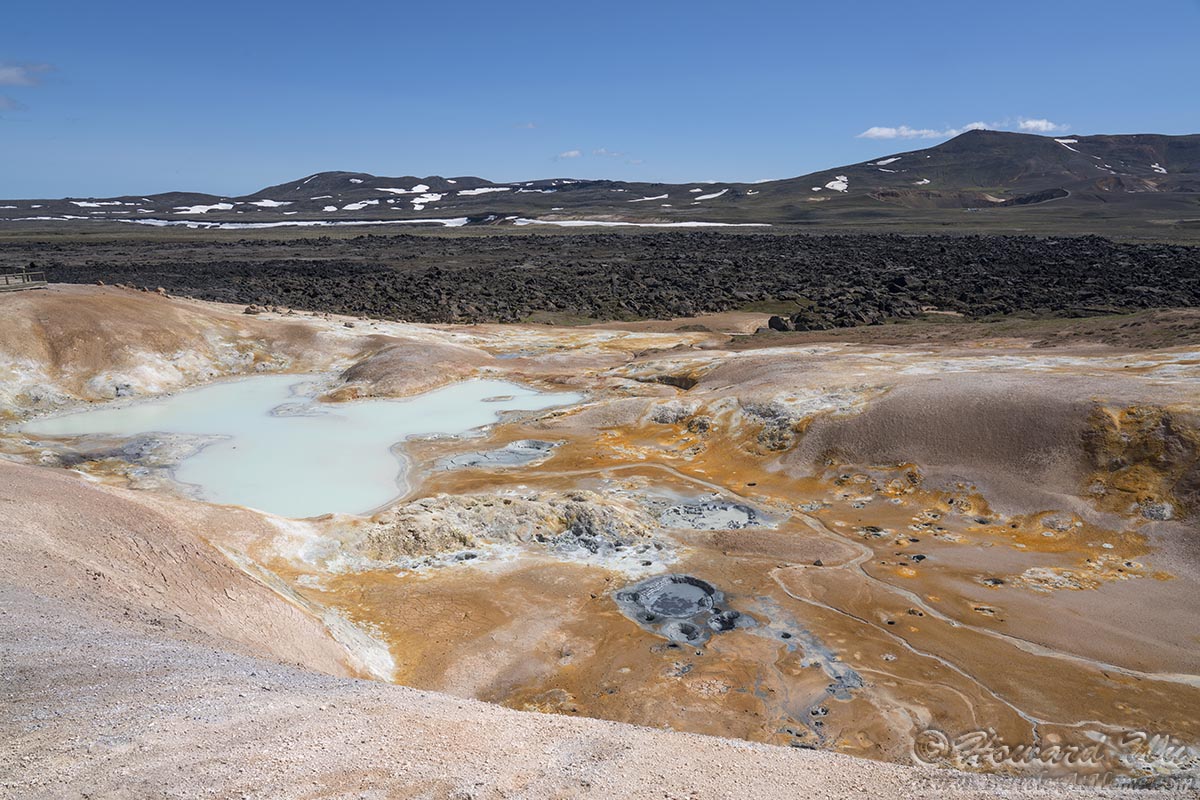
Our next stop was at Leirhnjukur, another, more active lava field. There are several colorful thermal pools along the trail.
Leirhnjukur
Leirhnjukur
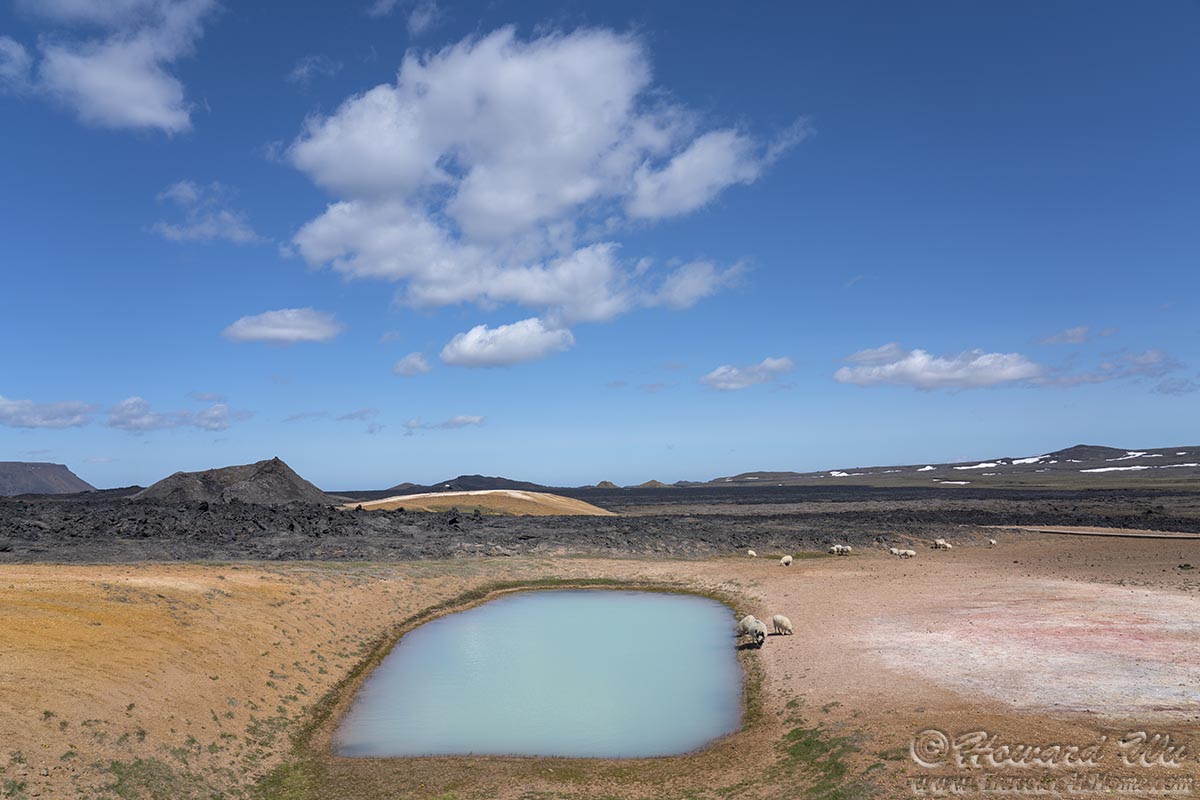
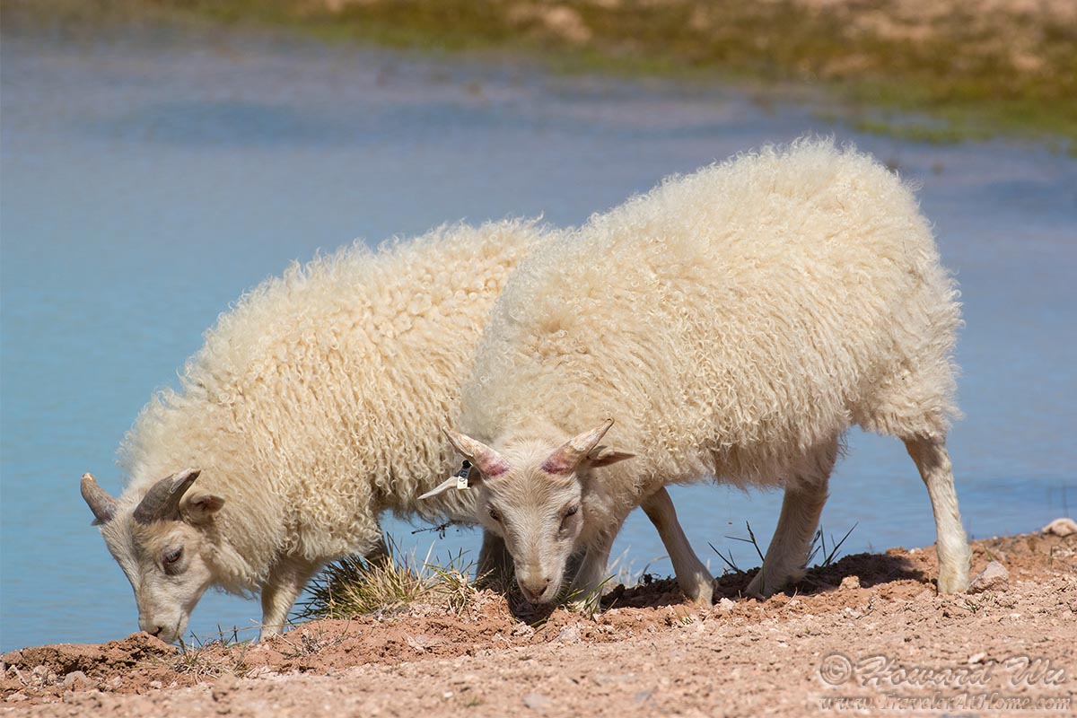
A small flock of sheep went by. This was a little surprising, as there was little vegetation in the field. It was even more shocking to see them drink in the pools; I though the water was toxic, but perhaps they have evolved to cope with the minerals in the water.
Sheep

Sheep
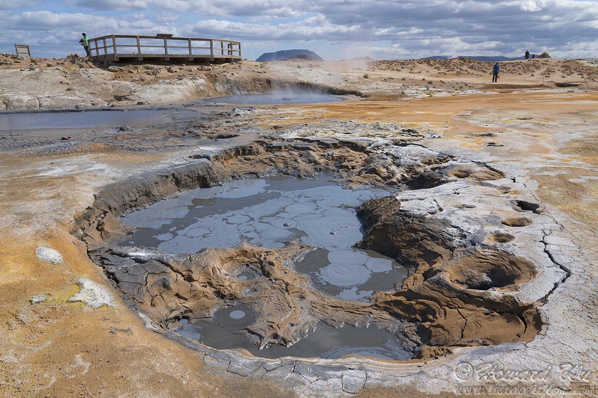
Other geological features at Leirhnjukur.
Leirhnjukur
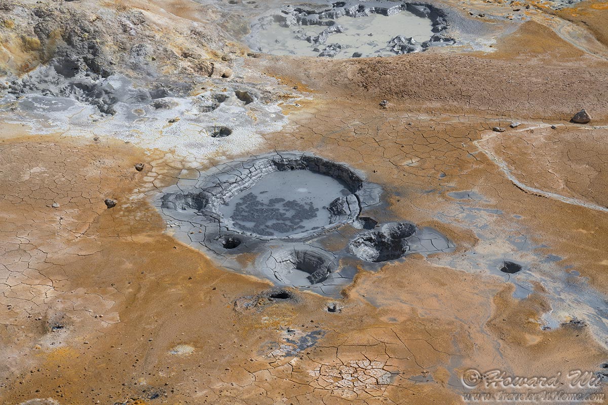
Mud pot
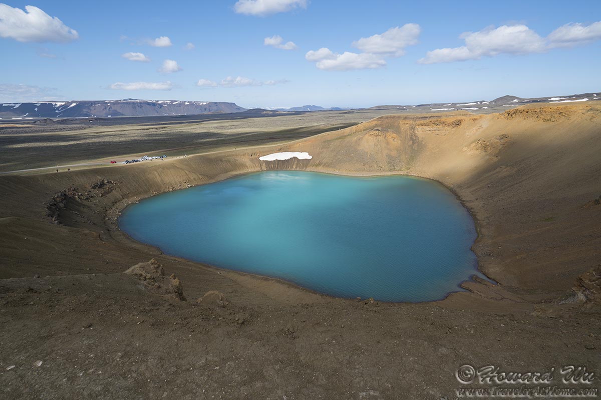
We then went to Viti, a small crater lake. The water is deep turquoise green under the sun, in sharp contrast to the brown and yellow volcanic landscape.
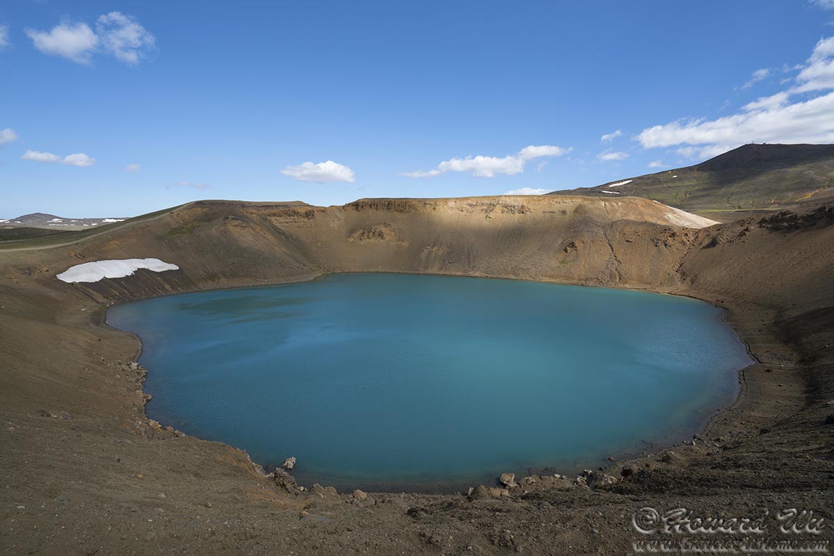
Viti
Viti

Viti
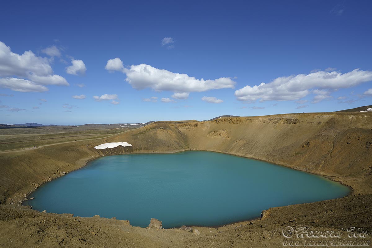
Viti
There is a smaller crater lake near Viti, this one has some bacteria growth and the water does not look so pure.
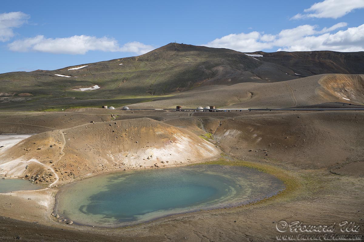
small crater lake next to Viti
Next, we went to admire the alien landscape at yet another lava field, Hverir. The similarity with Yellowstone's geyser basins is strong.
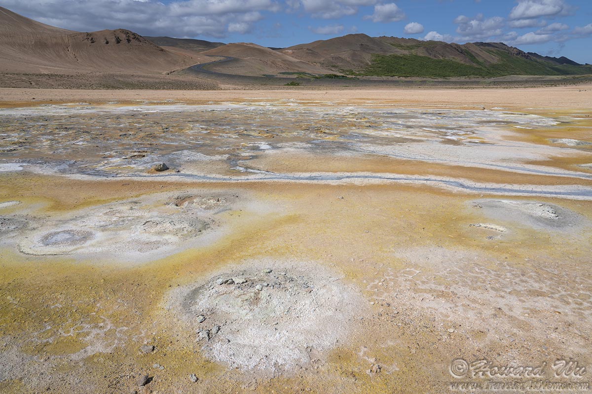
Hverir
Hverir

Hverir
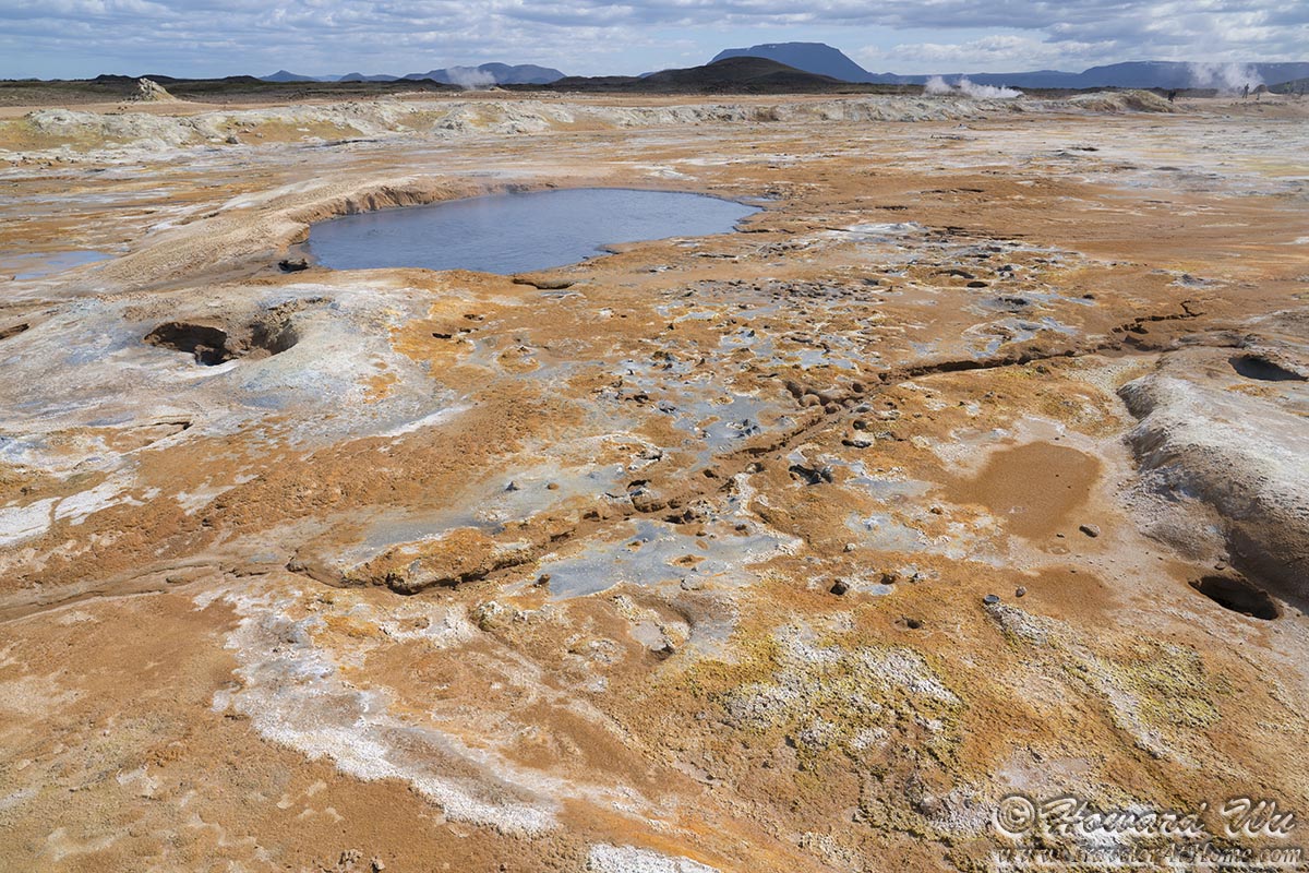
Hverir
But we had to leave Lake Myvatn. It is the traveler's curse: we go half way around the world to some fantastic place, only to be just a few hours or even minutes short, whereas sometimes we spend many idle hours at home with no better things to do. How I would trade those hours for one on the road! We did not even have time to drive around the entire Lake Myvatn.
We retracted and went to Dettifoss, said to be the most powerful waterfall in Europe. One can access the waterfall from either the east or west side. Because we went in the afternoon, I picked the west side when the sun would be behind us. This worked out beautifully -- a beautiful rainbow appeared over the thunderous waterfall.
By my measure, Dettifoss was where we went the farthest north on this trip -- the latitude should be around 65.81°N, within 1 degree of the Arctic Circle.
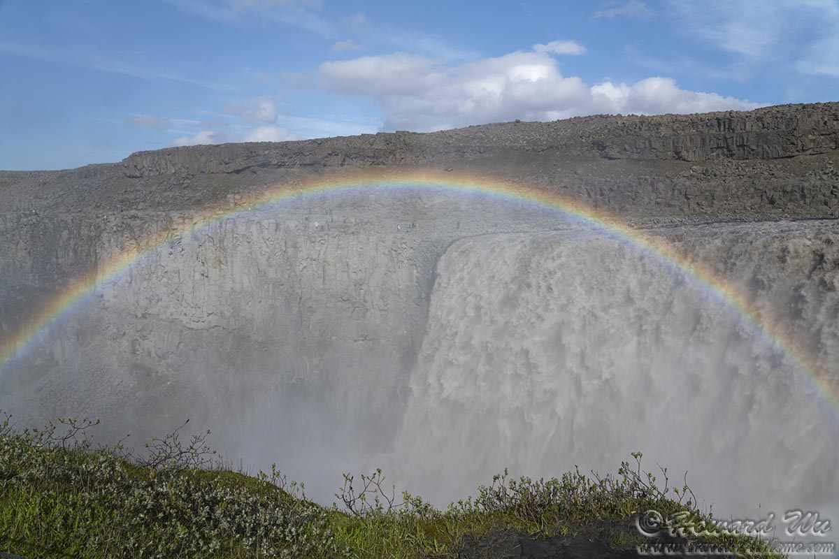
Dettifoss
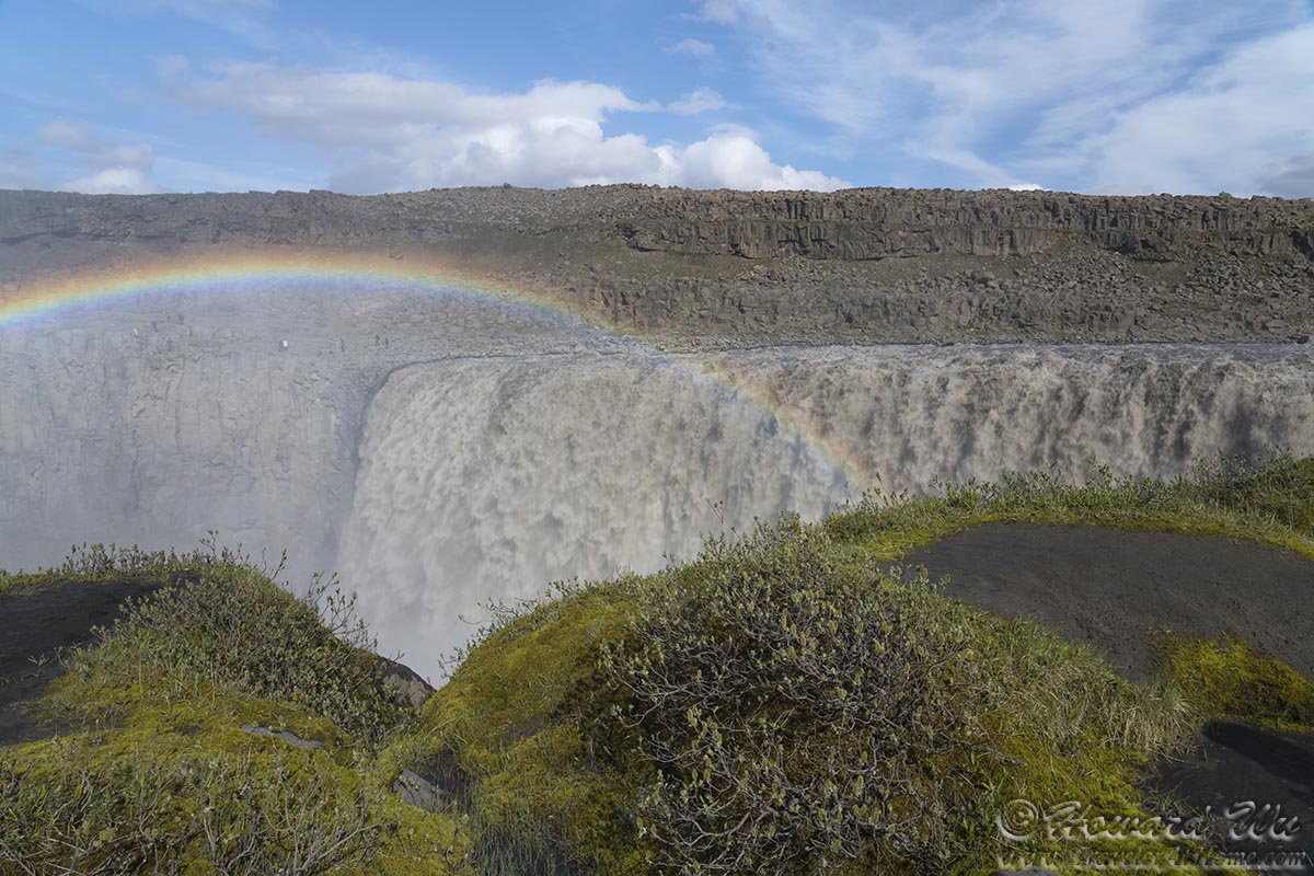
Dettifoss
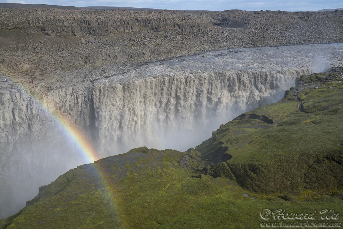
Dettifoss
We took the trail to another waterfall upstream, Selfoss. In any other place, it would be a spectacle in its own right, but in Iceland, Selfoss is almost an afterthought.

Selfoss
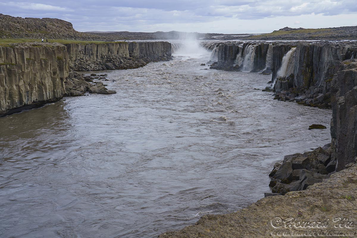
Selfoss
We had to push on to Akureyri. But we could not resist stopping at Godafoss. Not as powerful as some other waterfalls in Iceland, Godafoss is roughly symetrical, tumbling down a horseshoe-shaped cliff, and has a beauty of its own.
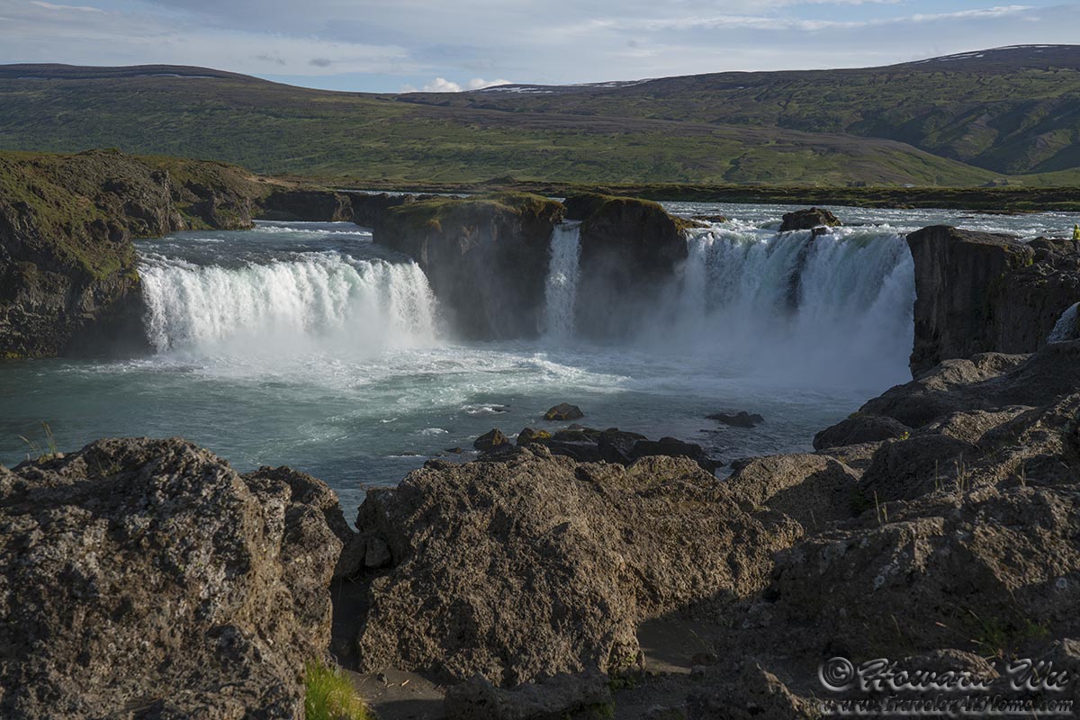
Godafoss
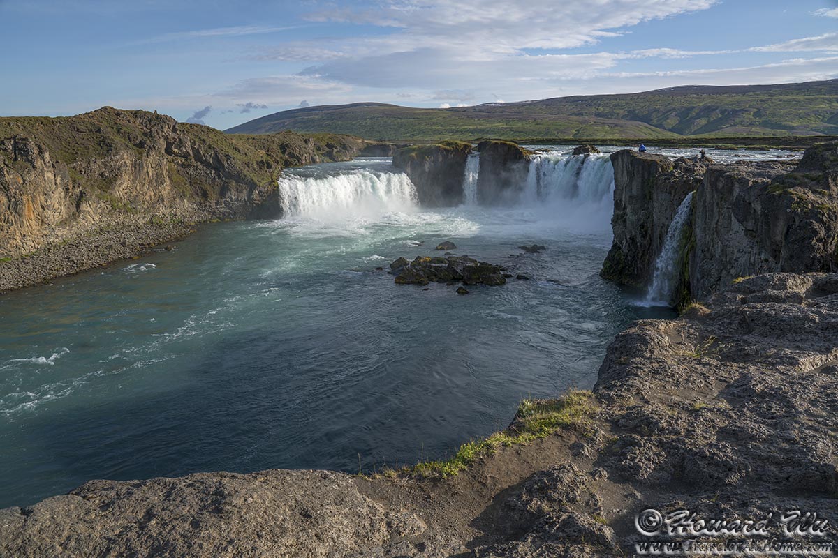
Godafoss
From the parking lot at Godafoss, we looked back at the pretty Icelandic houses on the hill across the highway.
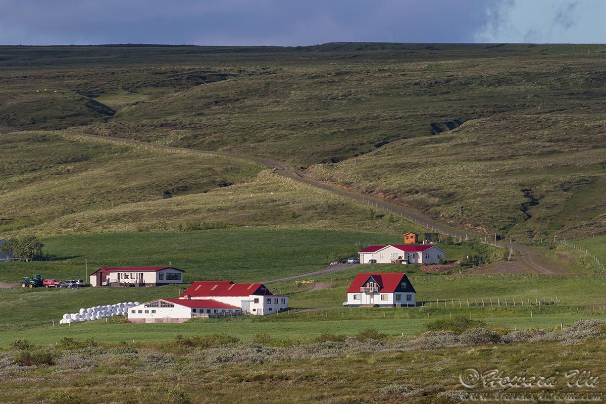
Houses
On we pushed. The long summer days are forgiving, and we had a lot of time on this road trip, but I think ideally, one needs 2 weeks to do the whole Ring Road at a more leisurely pace.
We arrived in Akureyri, the largest town outside of Reykjavik in Iceland. After checking into our guesthouse, we went to town for dinner and a walk. This mural was one of the things that caught our attention.
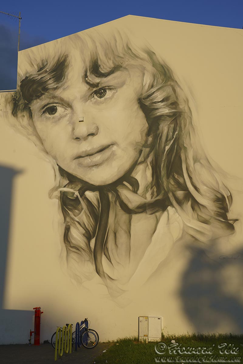
Mural
We walked by Akureyrarkirkja, or the Church of Akureyri. Not a very big church, the architicture still has an Icelandic simplicity and elegance.

Akureyrarkirkja
We walked down the streets of Akureyri in the forgiving Arctic summer sun, passing by Gotubarinn (the name means "Street Bar"), one of the cutest houses I've seen in Iceland.
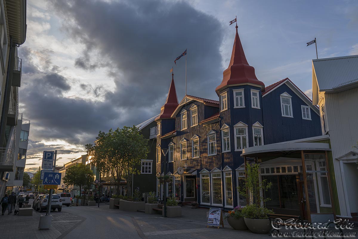
Akureyri stree scene
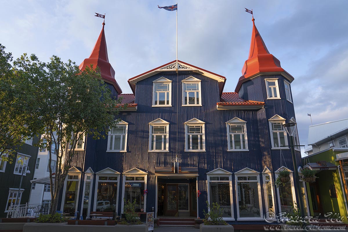
Gotubarinn
Click the image below to return to the index page of 2019 trip to Iceland: