Day 9: Fundy National Park and the Fundy Coast
Driving distance for the day: 72 Miles
Cumulative distance: 1563.2 Miles
(Click on each image to see the high-resolution version)
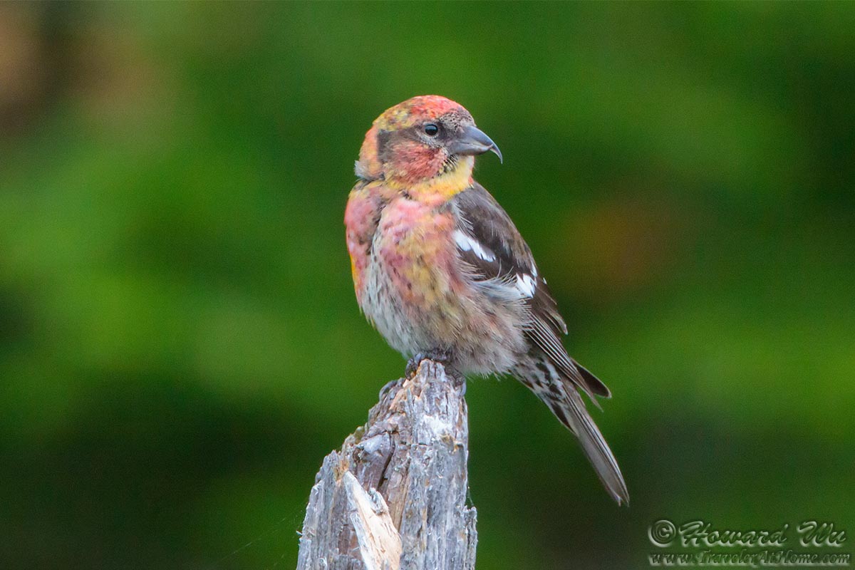
In the morning we took the Caribou Plains hike inside Fundy National Park. Here we encountered the first northern bird — a flock of White-winged Crossbills. These birds spend the summer as far north as inside the Arctic circle, and it was a delight to catch a glimpse of them here.
Another short hike to Dickson Falls allowed us to pass some time before high tide.
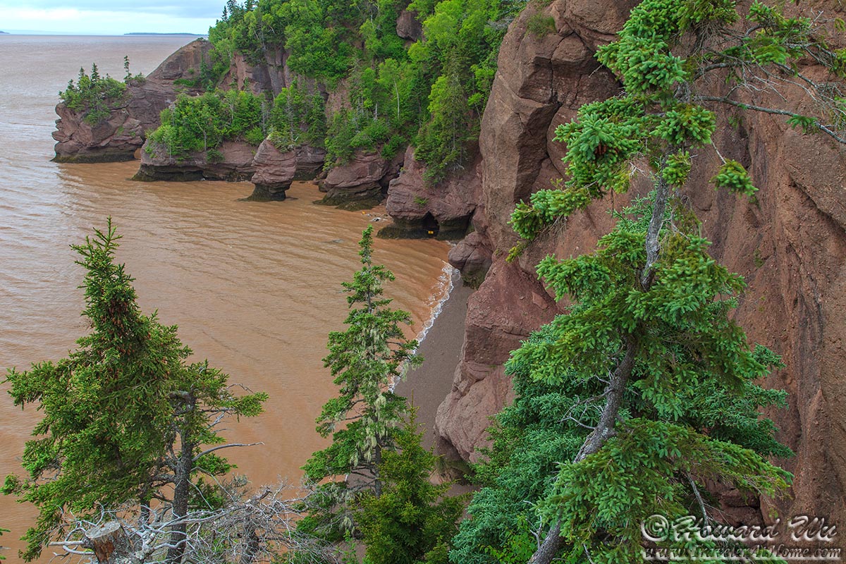
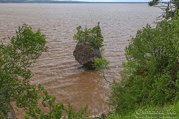
We timed our arrive at the Fundy Coast Hopewell Rocks to be just before high tide, this way we could see the dramatic effects of the famous Tides of the Bay of Fundy.
The following pictures were taken at Hopewell Rocks at high and low tides (to best see the tidal effects, move the mouse over each image to see another one taken at low tide, then click on the links below it to see a high-resolution image of each).
When the tide recedes, on some of the rock formations we could see seaweeds exposed to the air.
Border Crossing
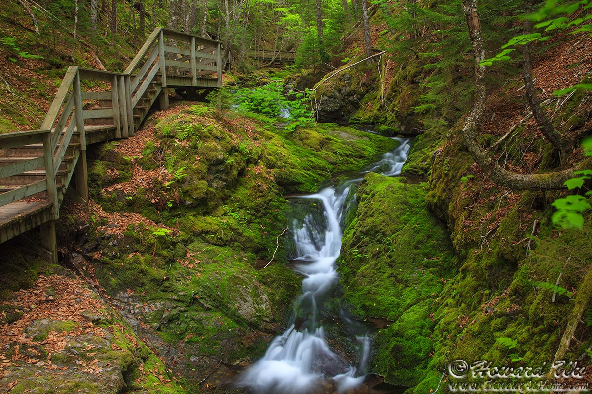
Dickson Falls
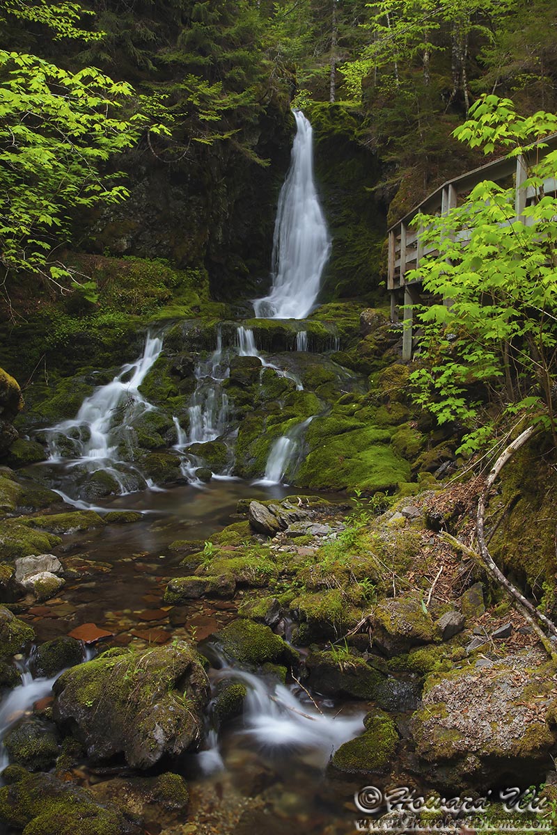
Dickson Falls
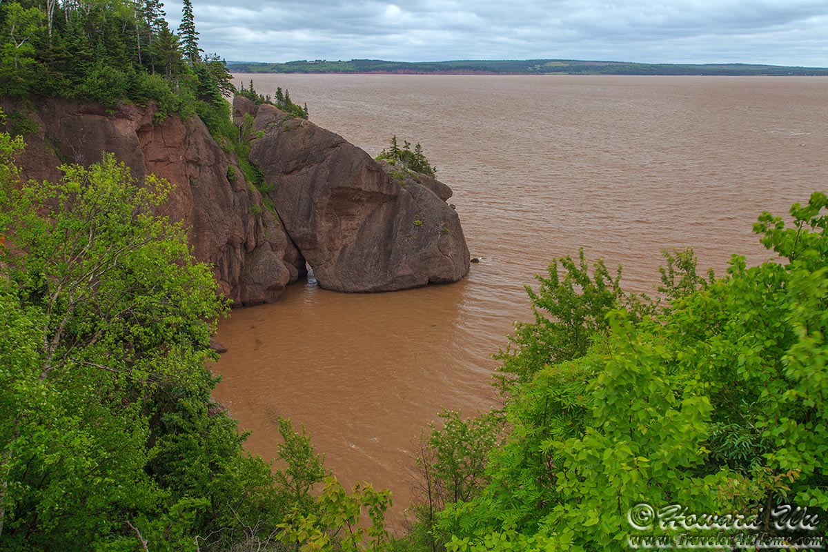
Bay of Fundy
Bay of Fundy
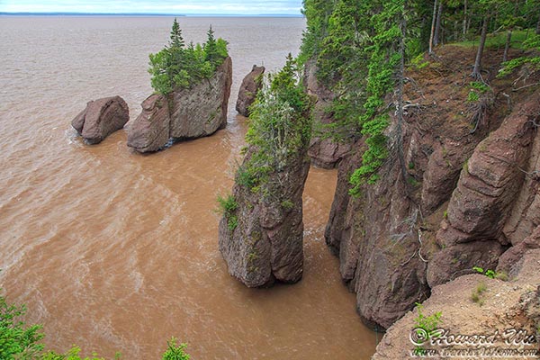
Hopewell Rocks (High Tide Low Tide)
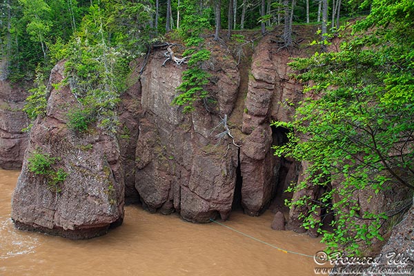
Hopewell Rocks (High Tide Low Tide)
Hopewell Rocks (High Tide Low Tide)
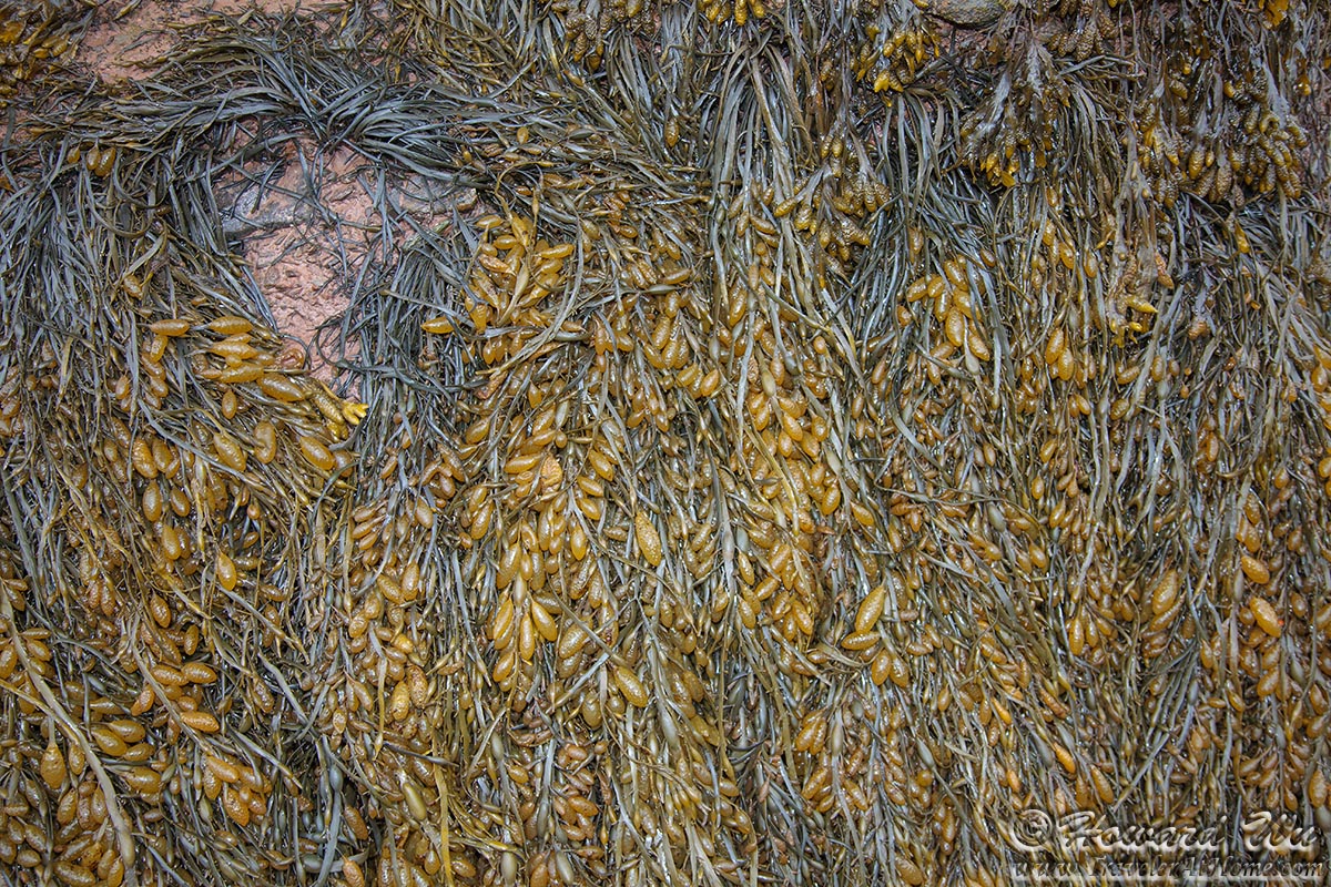
Seaweed
Click the image below to return to the index page of Summer 2012 Road Trip: