2017 Portland: Portland
On this trip, we stayed in Portland for 12 days. Except for 2 day trips to the coast, we pretty much stayed in downtown Portland the entire time. This was the longest time we spent in the city -- with so many things to do in the surrounding areas, from the Pacific Coast to the Columbia River Gorge, to the Painted Hills, we are usually drawn away from the city. This time, we would finally get to know the city itself more intimately.
(Click on each image to see the high-resolution version)
I walked in the city everyday I was there, usually short walks during lunch break and after work. But I also took two pretty long walks.
First long walk (~ 8 miles):
starting from downtown Portland
-> crossing the Willamette River on Burnside Bridge
-> walking south along the east side waterfront to OMSI (Oregon Museum of Science and Industry)
-> crossing the Willamette on Tilikum Crossing
-> walking up to the OHSU campus and the Portland Aerial Tram Upper Terminal
-> taking the tram down to the waterfront
-> walking through PSU campus back to downtown
Somewhat unwittingly, I walked by a few of Portland's famous fountains en route. The first one I encountered was the Skidmore Fountain before I crossed the Burnside Bridge.
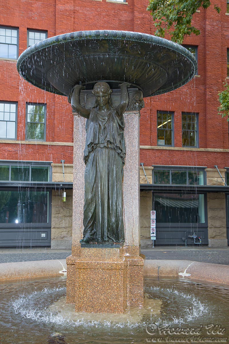
Skidmore Fountain
Fittingly, a sign of our time was displayed on the Burnside Bridge.

A sign of our time
At the other (east) end of Burnside Bridge, this colorful building stands prominently. I would later find out that this is the nearly completed Fair-Haired Dumbbell, read the story here.
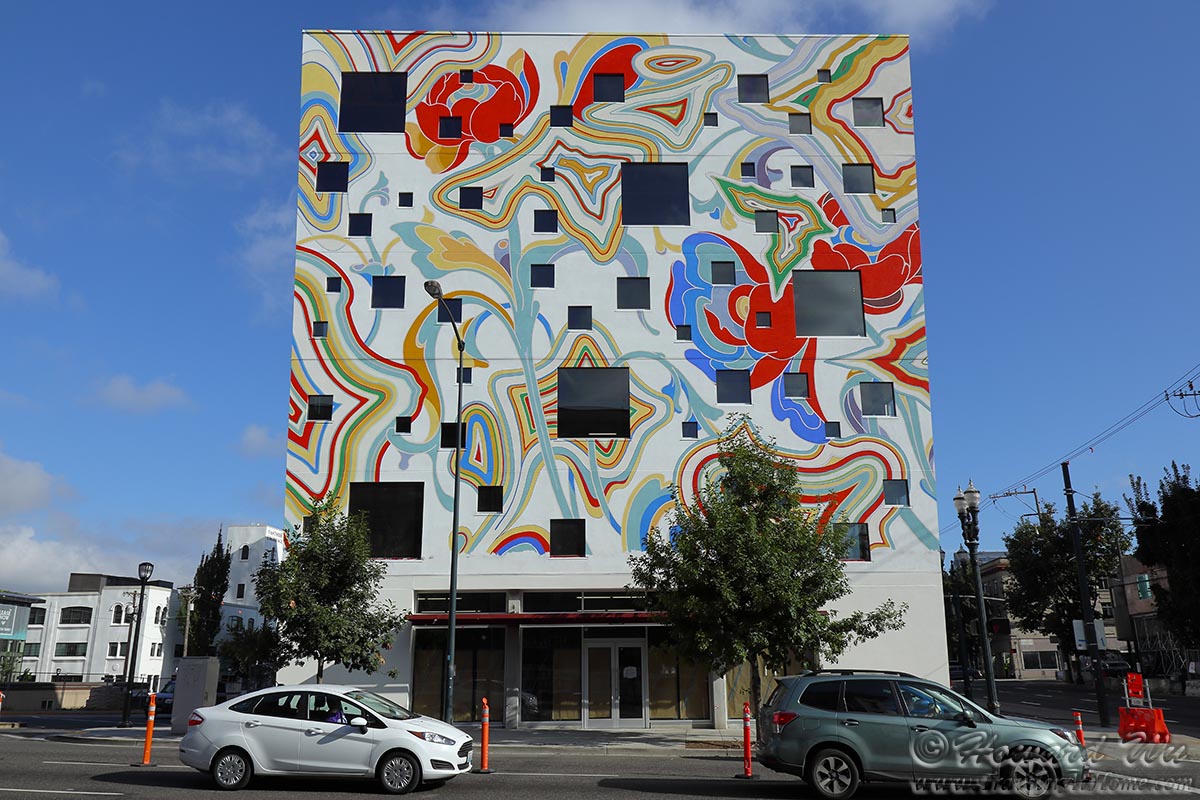
Colorful Building
After reaching the east side waterfront, I stopped at Water Avenue Coffee for coffee. This is one of the better coffee foam art I have seen.
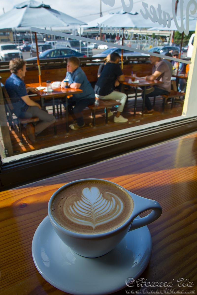
Water Avenue Coffee
Mornings are the best time to see the Portland downtown skyline from the east side.

Portland Skyline
They also make a good time to see the gulls in the river. I believe this one is an "Olympic Gull", a hybrid between Glaucous-winged and Western Gulls.

Gull
A dredging barge was working hard to clear the navigation channel.
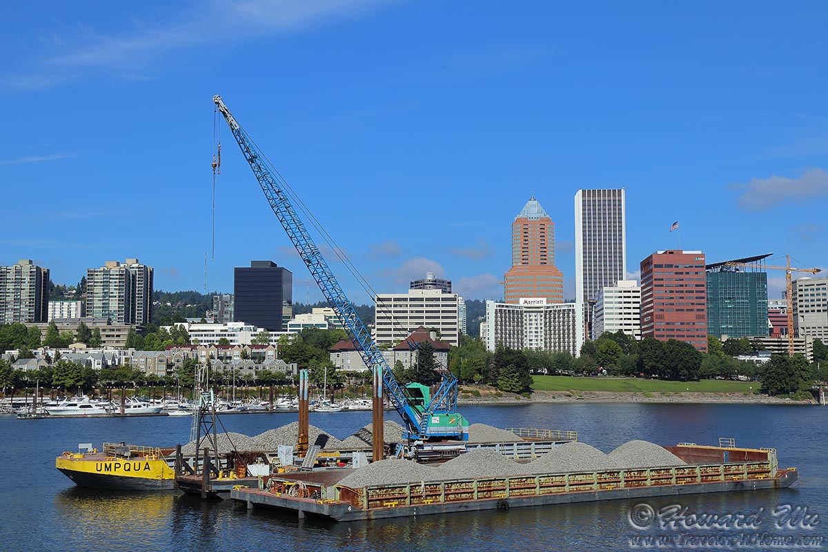
Barge
Marquam Bridge is one of the several bridges spanning the river.
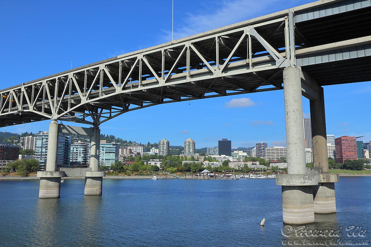
Marquam Bridge
I went to the river level to take a closer look at the OMSI Submarine (USS Blueback).
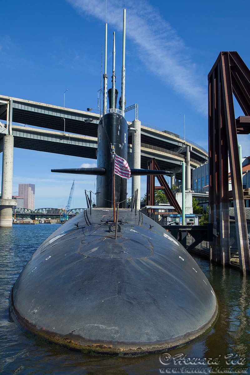
Submarine
It was here, in the shrubs along the river near OMSI, I saw this California Scrub-jay exhibiting some interesting behavior -- it picked up a cigarette butt from the ground and was making excited calls. This is one form of the bird behavior known as anting, possibly the pugent smell of the cigarette butt attracted the jay to rub it against its feathers to rid itself of parasites (though the function of anting is not entirely understood).
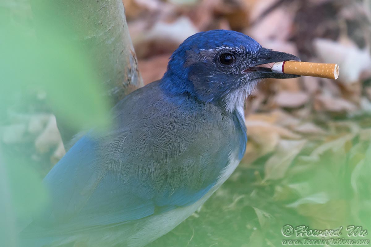
California Scrub-jay
I would eventually cross back on the beautiful pedestrian, bicycle and public transit only Tilikum Crossing (the second one was taken on a later day, from the west side).
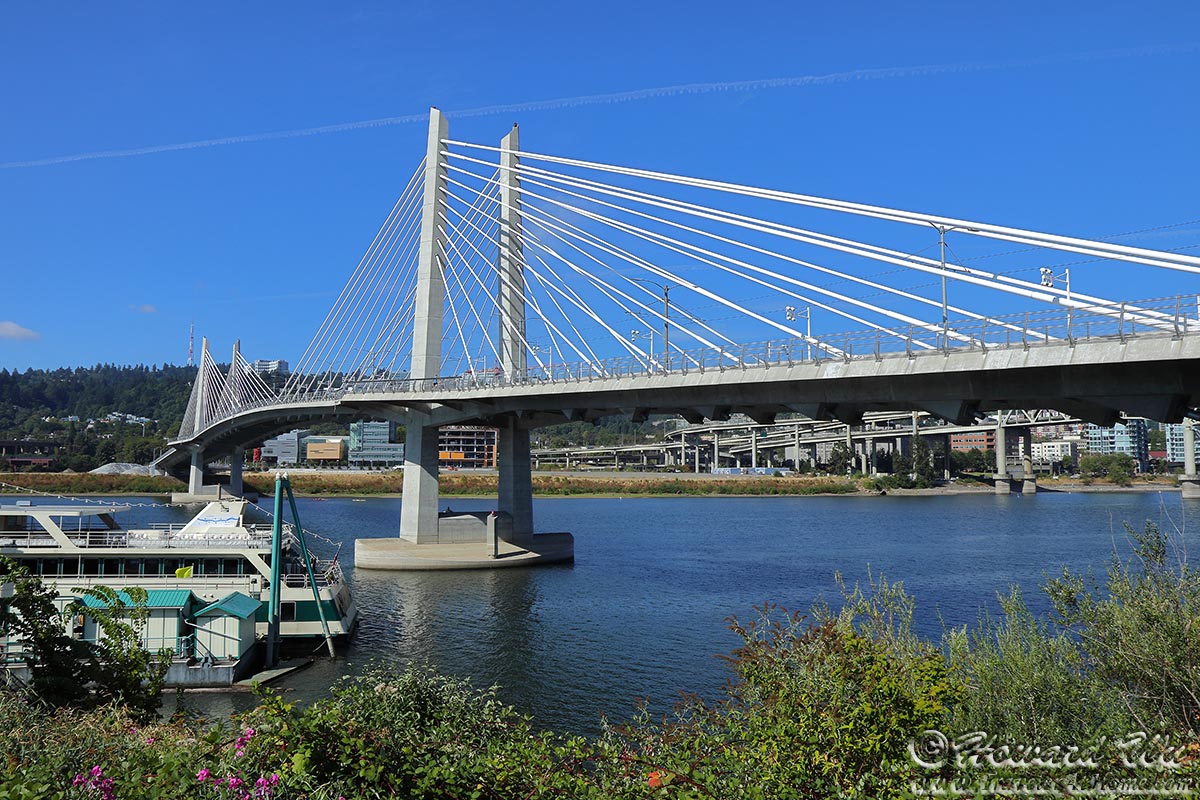
Tilikum Corssing

Tilikum Corssing
I would then walk across the Gibbs Street Pedestrian Bridge into the Corbett-Terwilliger-Lair Hill neighborhood, one of my favorite in Portland.

Gibbs Street Pedestrian Bridge
From here, it was a good walk uphill to the Portland Aerial Tram Station on the OHSU campus, a trip I took the year before.
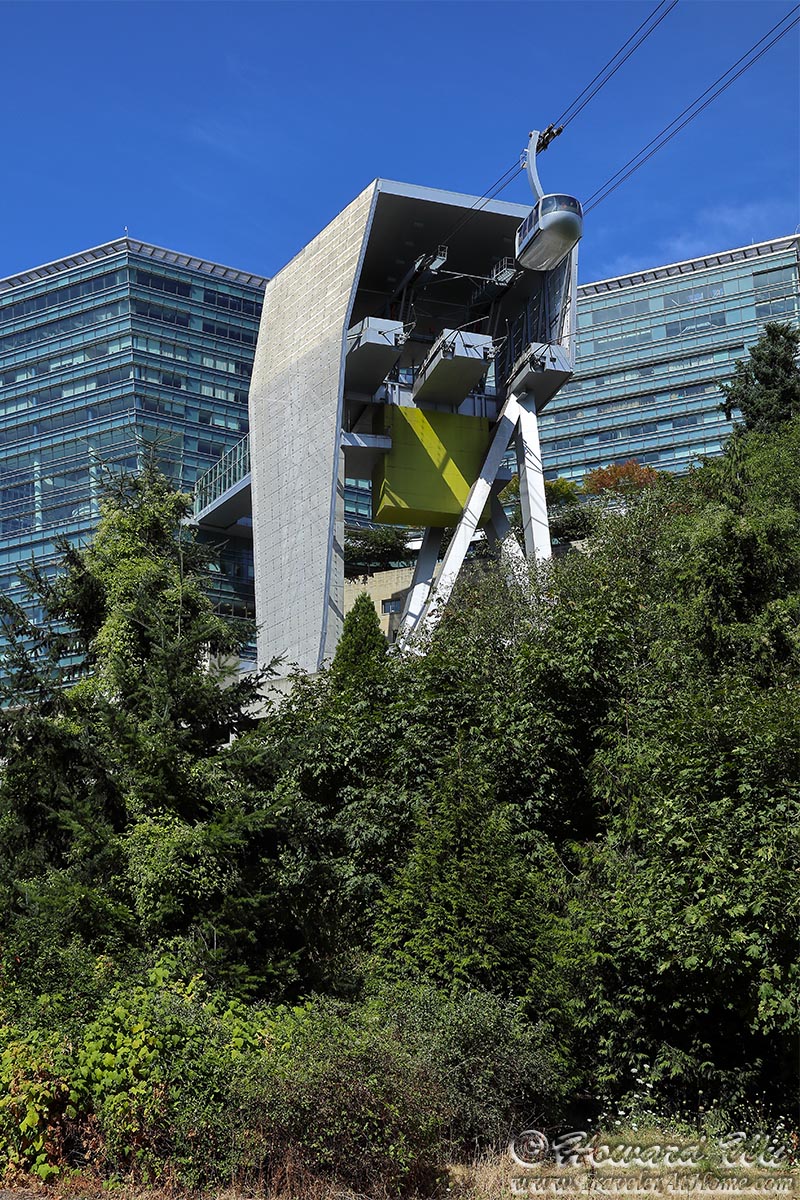
Portland Aerial Tram Upper Terminal
The view from the Upper Terminal is one of the best -- with the snow-capped peaks of Mt. Hood, Mt. St. Helens, etc. in the distance and the south waterfront of Portland and the Willamette River just below. However, at this hour (near noon), the direction of light wasn's the best.
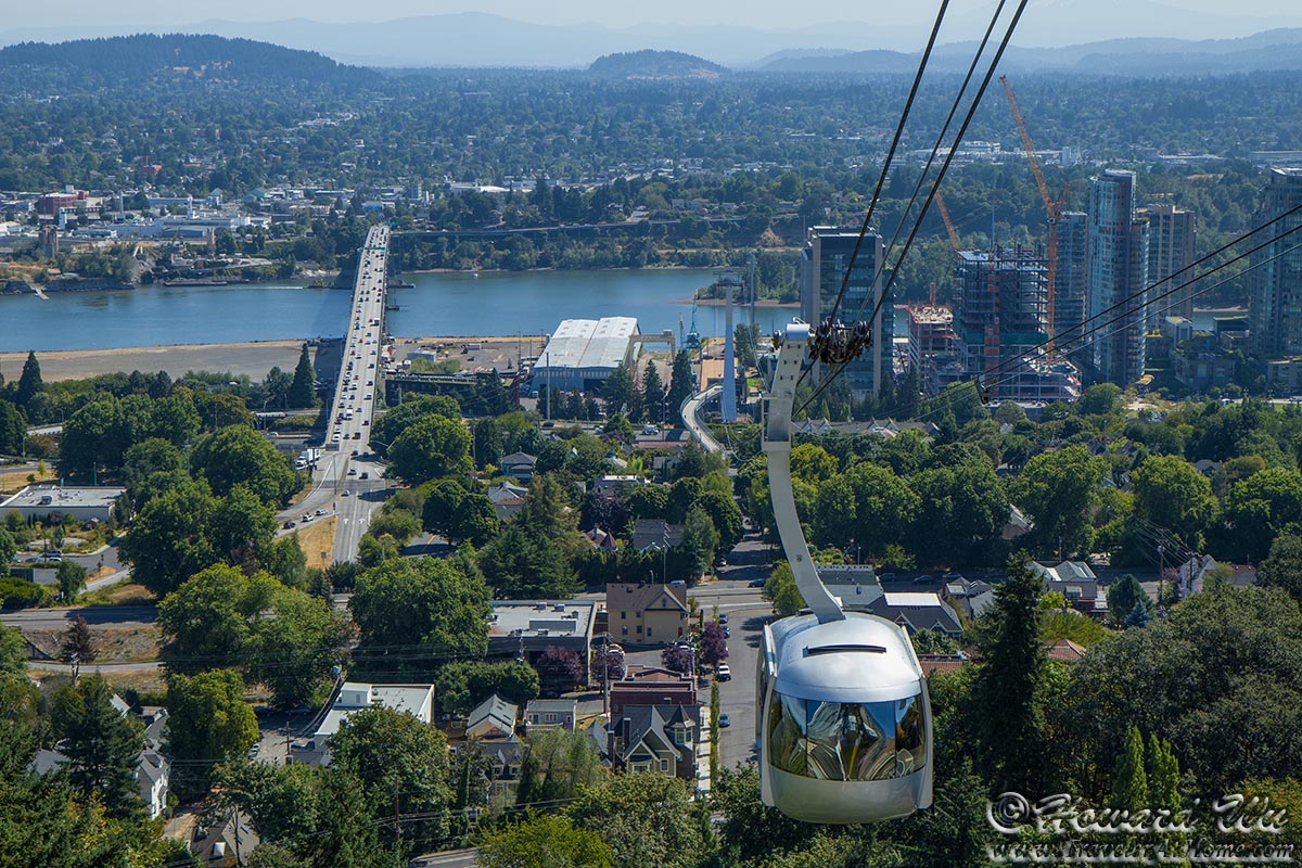
Portland Aerial Tram
I arrived at the same place a couple of days later, this time in the afternoon. Light was much better, and the view was superb (also compare with a picture I took the year before, also in the afternoon).

Willamette River seen from the Aerial Tram Upper Terminal
(with Tilikum Crossing on the left and Ross Island Bridge on the right)
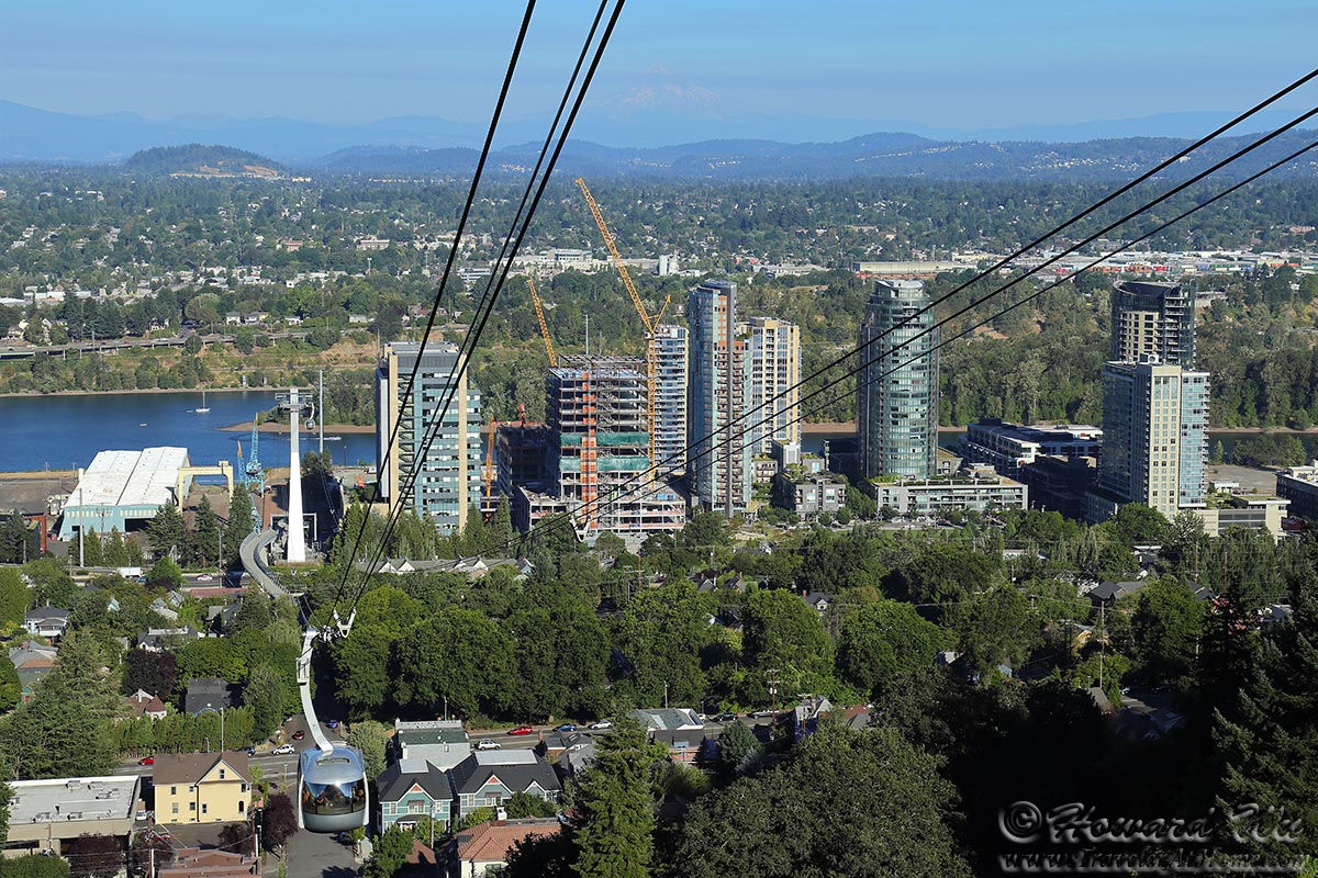
Portland Aerial Tram
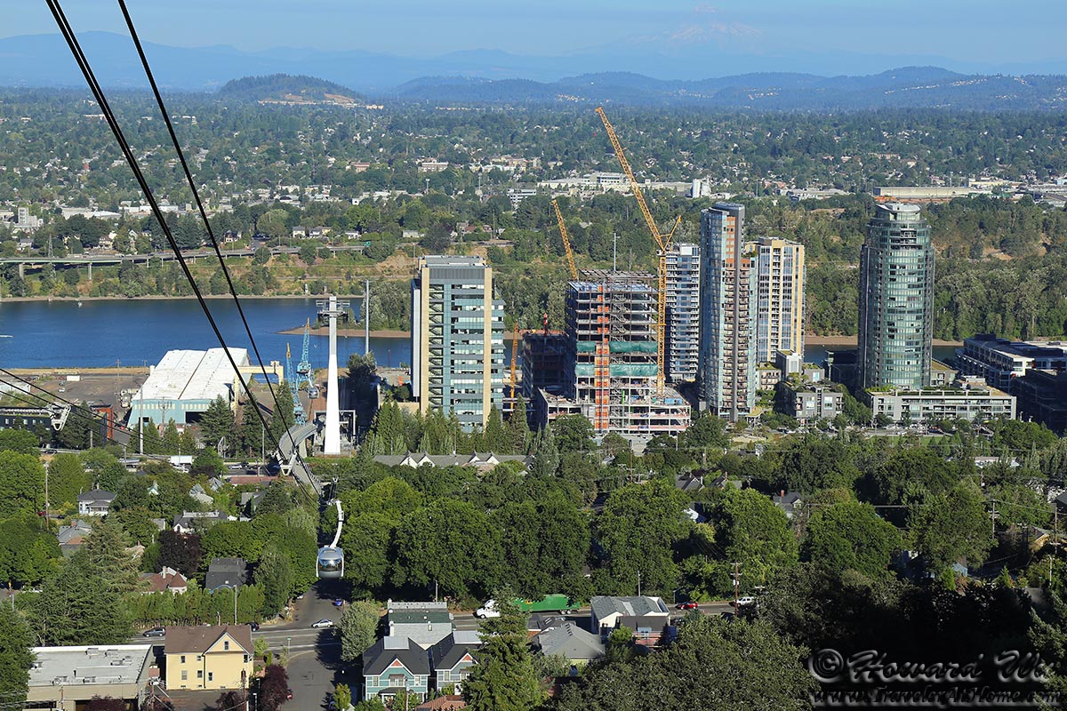
Portland Aerial Tram
I would take the tram down to the waterfront (the ride down is free). I then walked toward downtown. I went through Lovejoy Fountain Park, really a small park surrounded by office buildings, but it would be the second fountain I photographed on this day.
Lovejoy Fountain
Lunch was from one of the food trucks at the southern end of the OSU campus.

Food Truck
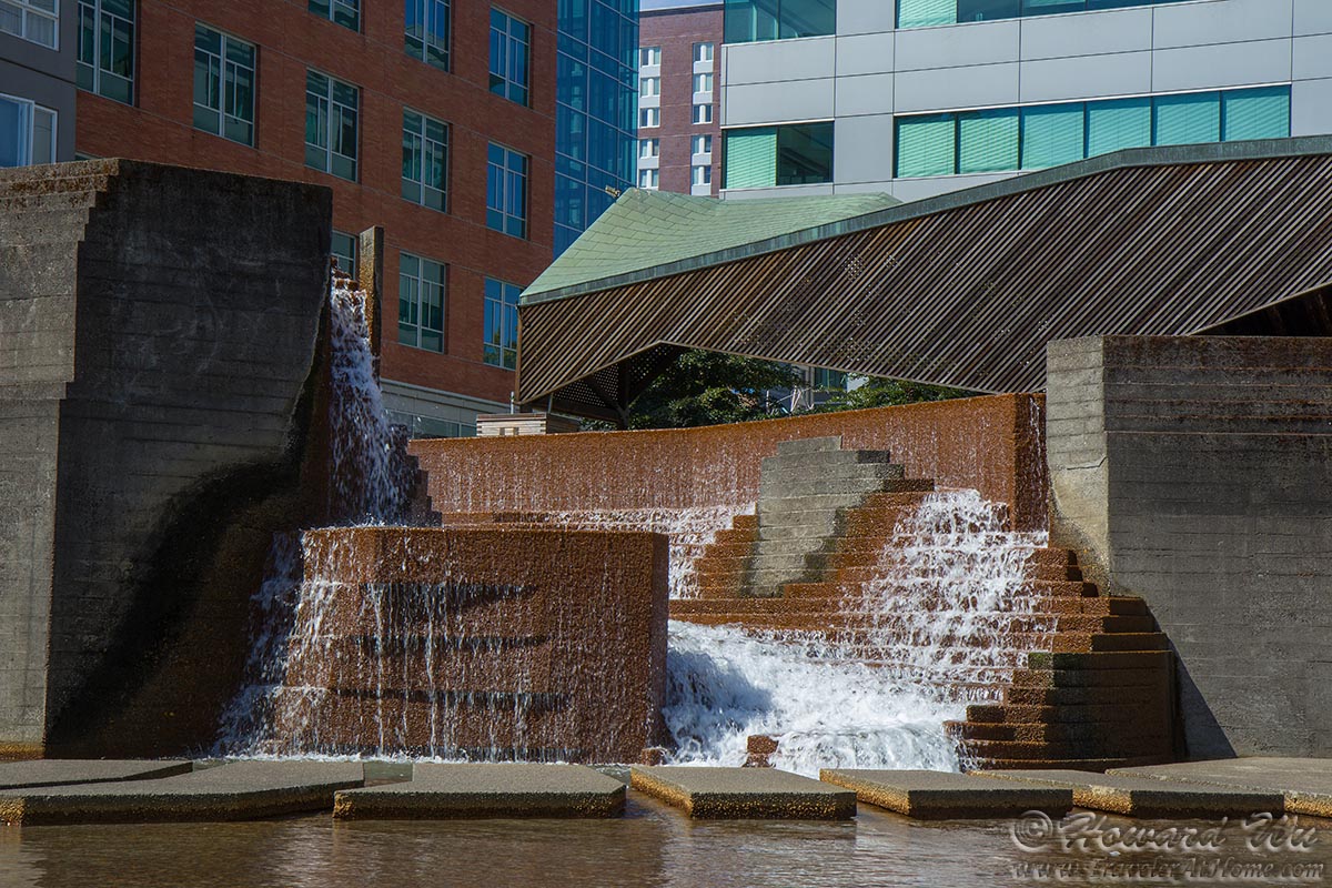
I then passed the third and last of the founds on this walk -- Kelly Fountain, the most impressive of them.

Kelly Fountain
Finally, I swung by Portlandia before returning to my hotel.
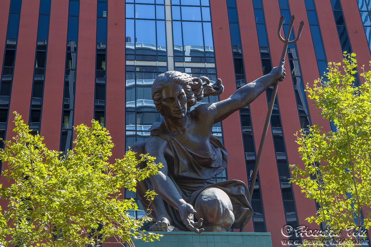
Portlandia
My second long walk was even longer than the first, with more elevation change (~ 600 feet at least).
Second long walk (~ 10 miles):
starting from Audubon Society of Portland's Nature Sanctuary (and hiking for about an hour there)
-> walking down to Stone House at Macleay Park
-> walking all the way up to the Pittock Mansion
-> walking through Hoyt Arboretum and Washington Park, skirting Portland Japanese Garden, and down to Burnside Street
-> walking back to downtown via Burnside Street, Morrison Street, etc.
I arrived at the Audubon Nature Sanctuary rather early, just after sunrise, and walked the trails in the sanctuary.
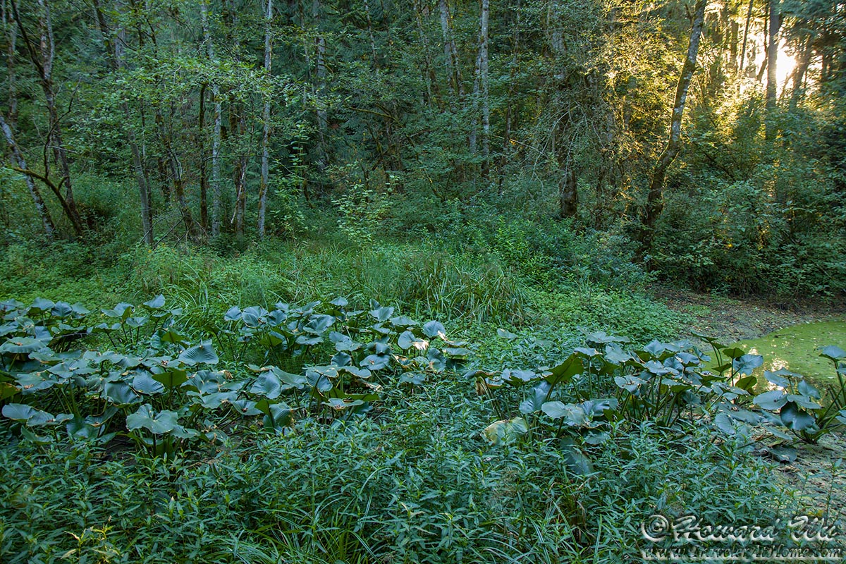
Pond at the Nature Sanctuary
I was a little disappointed with the number of birds I saw there, which was not many. In fact, this would be my first trip to the West Coast without seeing any new bird at all. This is understandable as I take more and more trips to the West Coast and have checked off some common birds already. I took picture of this Pacific Wren in the underbrush -- with the dim light under the forest canopy, I had to use very high ISO (16000) to get this picture which is why it is so grainy. The Pacific Wren would have been a new bird for me had I not seen it the year before, but I did, so it was not.
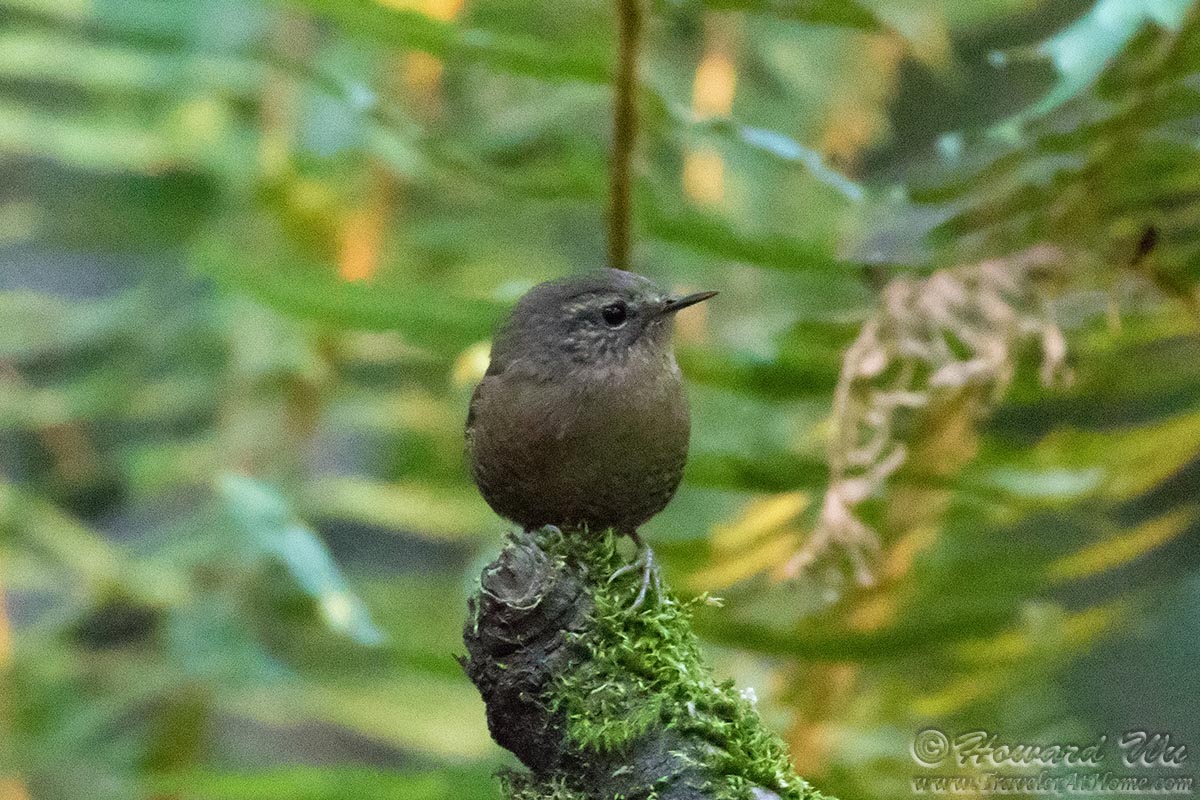
Pacific Wren
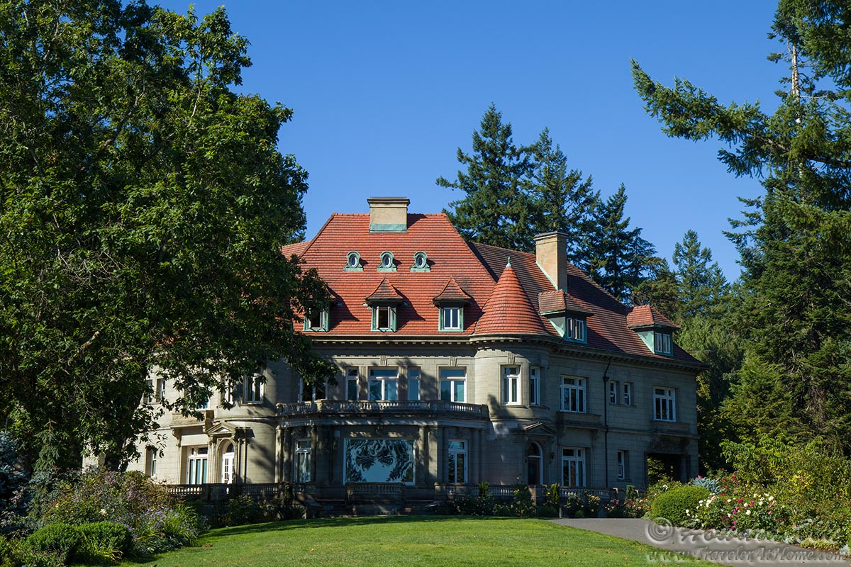
Nicknamed "Witch's Castle", the Stone House at Macleay Park is an interesting and a little spooky place at the low point of a ravine. From here, it was all the way up to Pittock Mansion, an elevation gain of more than 500 feet -- a fantastic hike within the city limit.

Stone House
I would thus arrive at Pittock Mansion, still in the early morning.
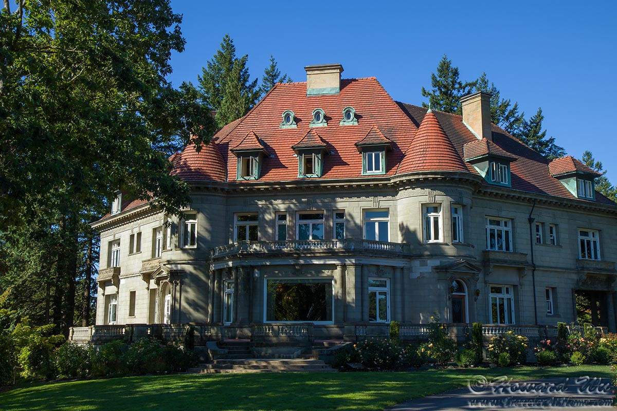
Pittock Mansion
Pittock Mansion
Here I would photograph a couple of birds: first a friendy Song Sparrow, then a perching hummingbird, surely Anna's (it was harshly side-lit, but I had to work with what I had).
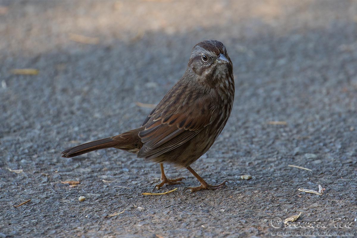
Song Sparrow
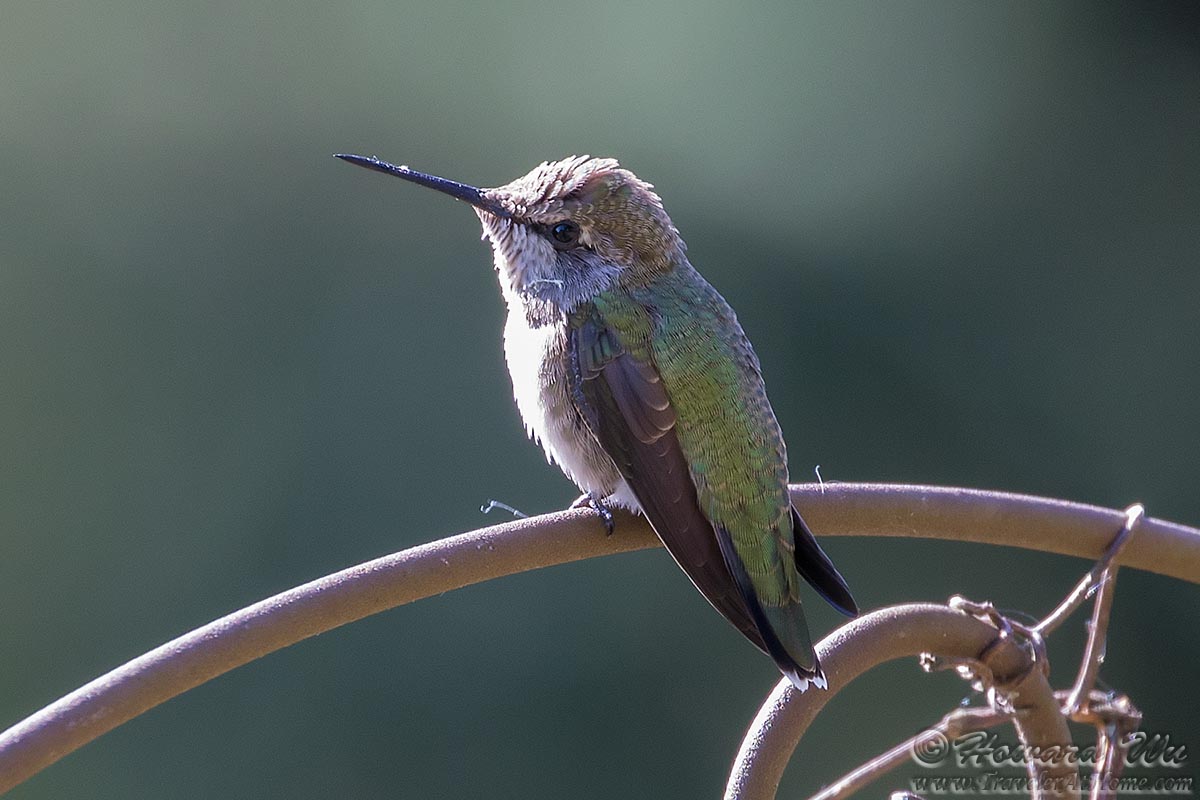
Anna's Hummingbird
At that hour, the view from Pittock Mansion wasn't very great (I was looking into ths sun). We would return a couple of days later in the afternoon to get much better views. As a general rule of thumb, because the river and mountains are all in the east, views of them are better in the afternoon. As to where the view is the best, I think it is a toss-up between the Pittock Mansion and the Aerial Tram Upper Terminal at OHSU; if pressed, I think I will pick the latter for its closer proximity to the river.
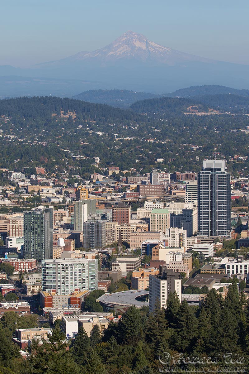
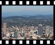
Mt. Hood (seen from Pittock Mansion)
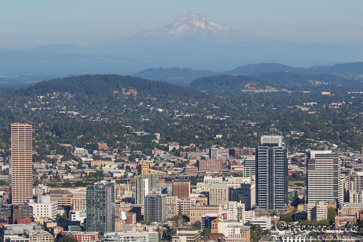
Mt. Hood (seen from Pittock Mansion)
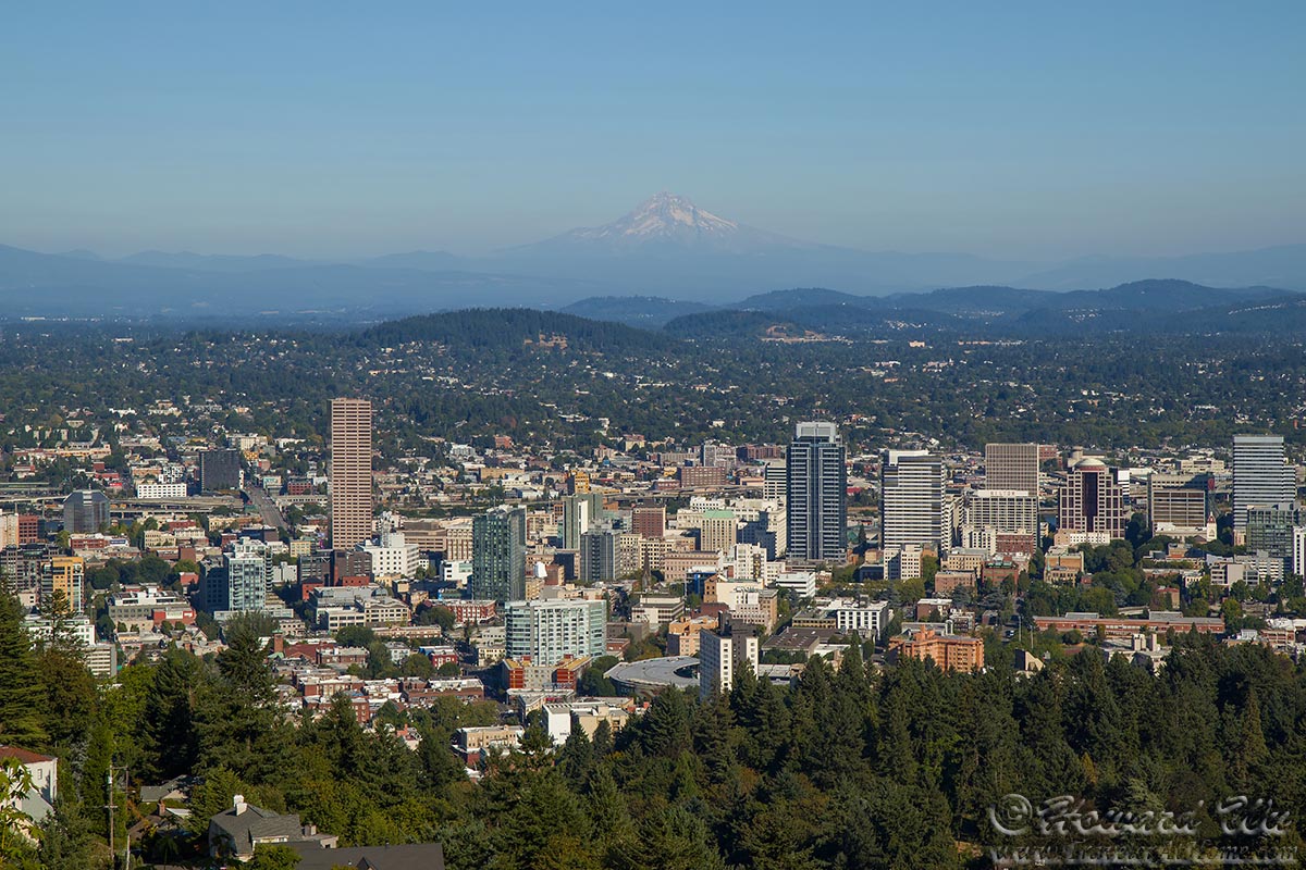
Mt. Hood (seen from Pittock Mansion)
In fact, that later day when we came back to take in the view of the mountains was the last day in a while such clear views were possible -- wildfires were raging in the northwest in part due to the hot and dry weather (and in part due to irresponsible human behavior). In fact, on that day we saw what appeared to be the ominous start of the Eagle Creek Fire (started by some tenegars with illegal fireworks).
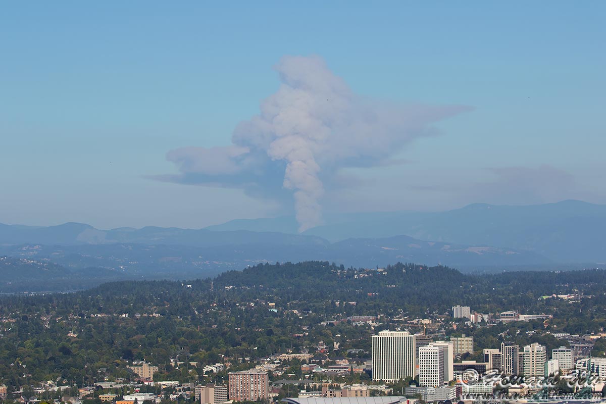
Wildfire