Day 4 (Sunday, June 23, 2019): Westman Islands and waterfalls (from Hveragerdi to Vik)
Another perfect day on the southern coast! In the morning we walked to a small hill behind the hotel where a small church stands. It is an iconic landmark in town, which we saw driving in the day before.
(Click on each image to see the high-resolution version)
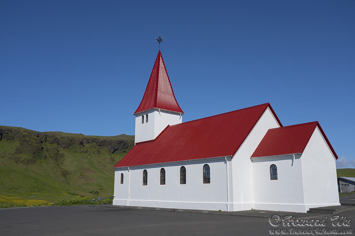
Church in Vik
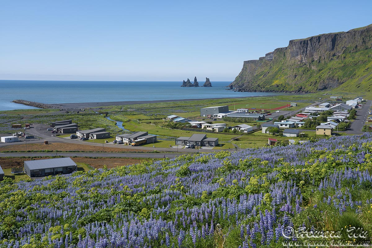
From the hill, the view is breathtaking in all directions.
Vik (looking toward the coast)
Vik (looking toward the coast)
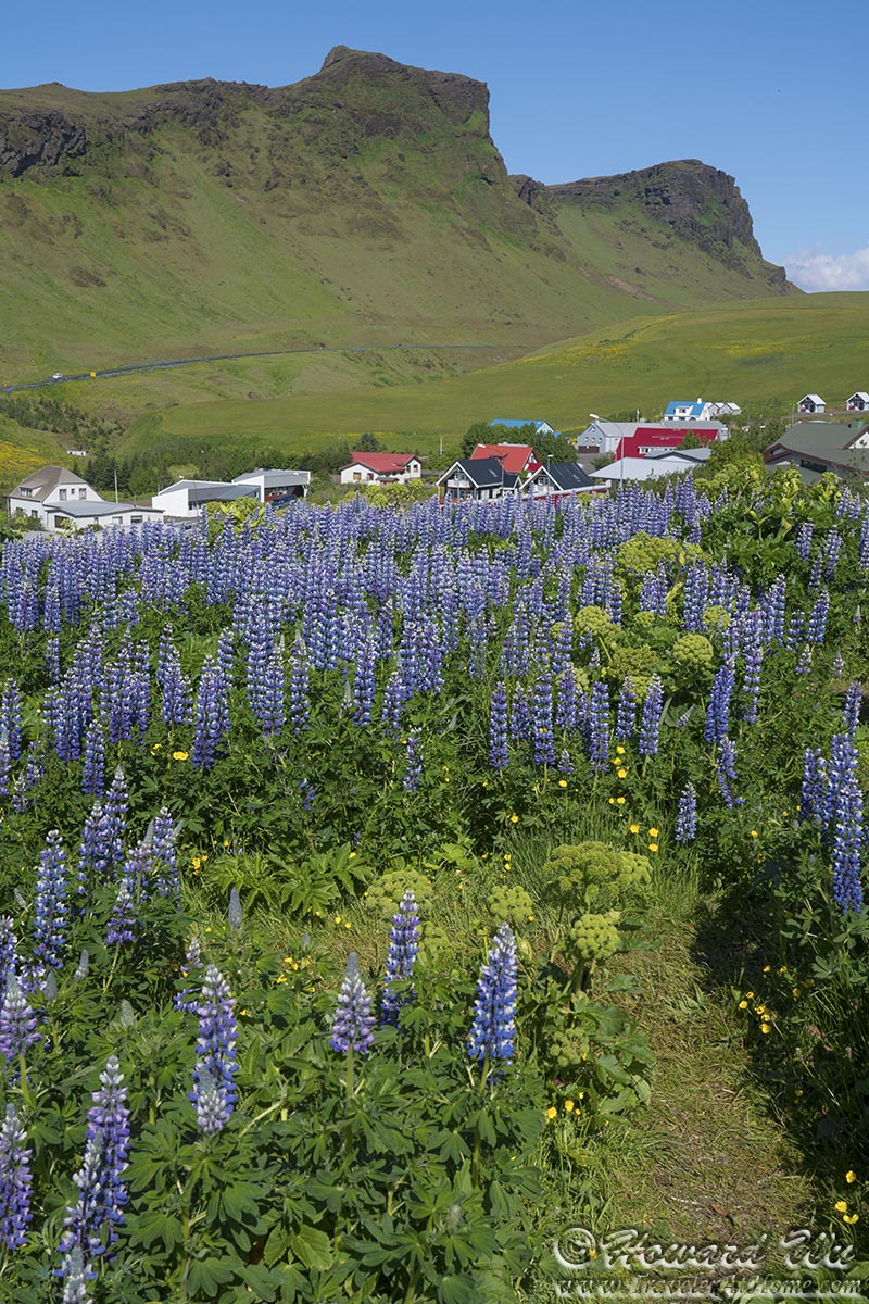
Vik (looking toward the mountains)
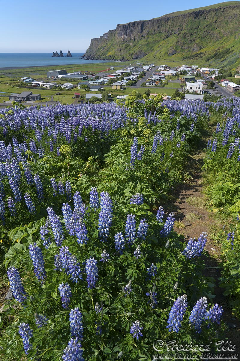
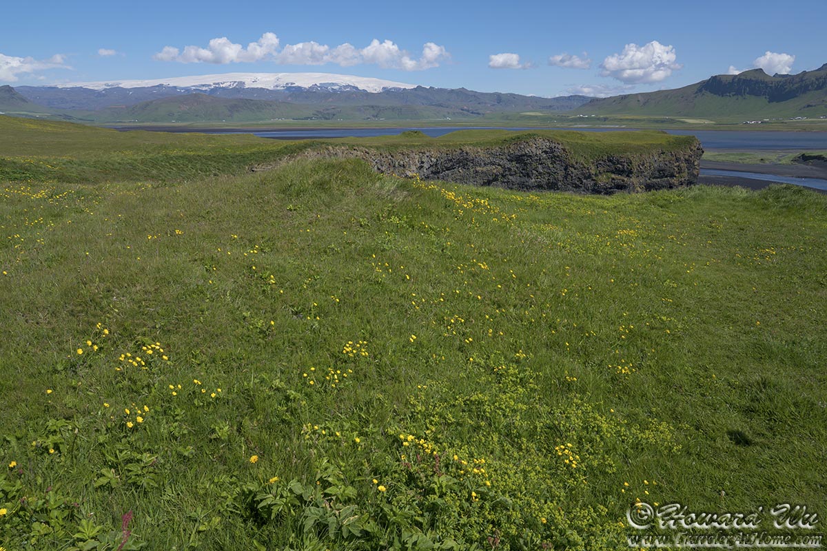
The hills are carpeted with lupine, but the native angelica still clings on to a foothold (for a list of plants in Iceland, see this page).
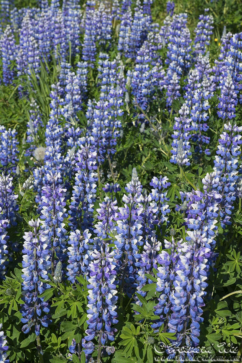
Lupine
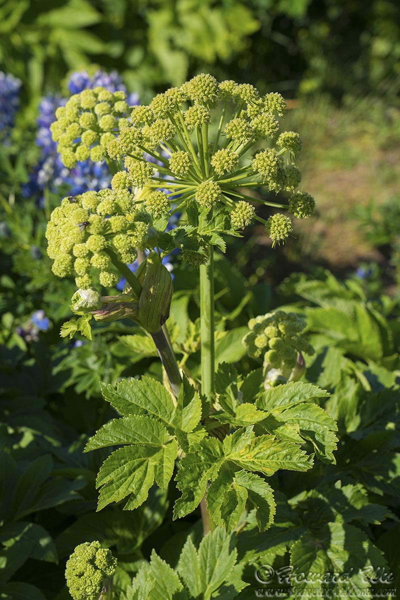
Agelica
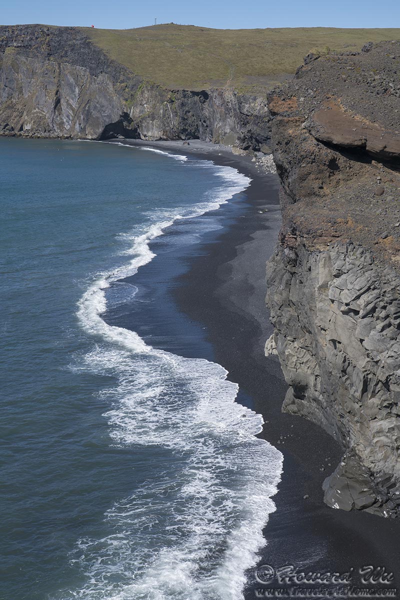
We retraced our steps back to Dyrholaey. Dyrholaey is a massive sea arch (it literally means "door-hole"). The view from the headland is panoramic and breathtaking, and somehow it reminded me of Lagos in southern Portugal (though with different types and colors of rocks) -- on one side, Arnardrangur, or the Eagle Rock, can be seen; on the other, the Dyrholaey sea arch itself.
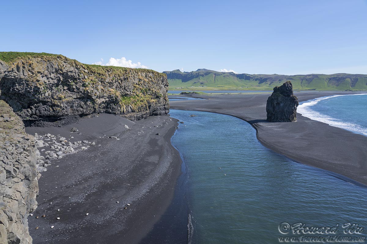
Dyrholaey (with Arnardrangur in the picture)
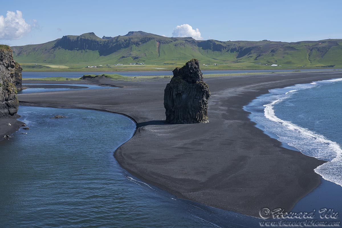
Dyrholaey (with Arnardrangur in the picture)
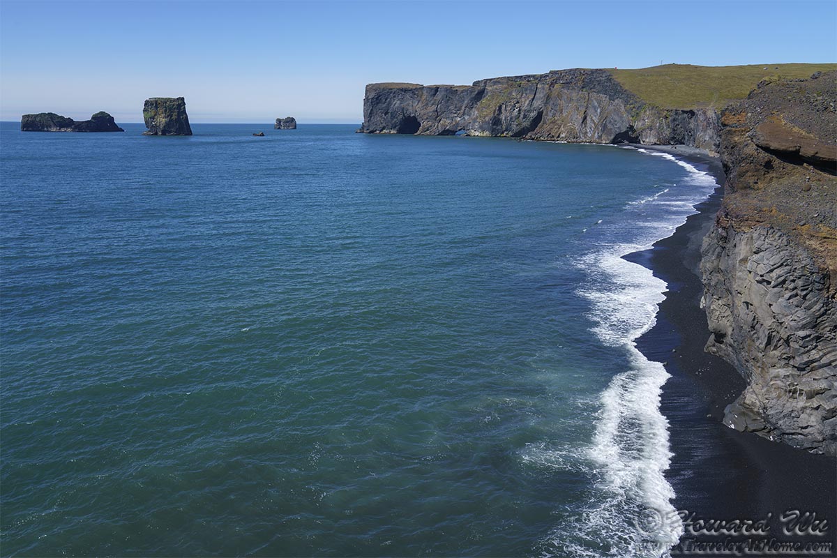
Dyrholaey
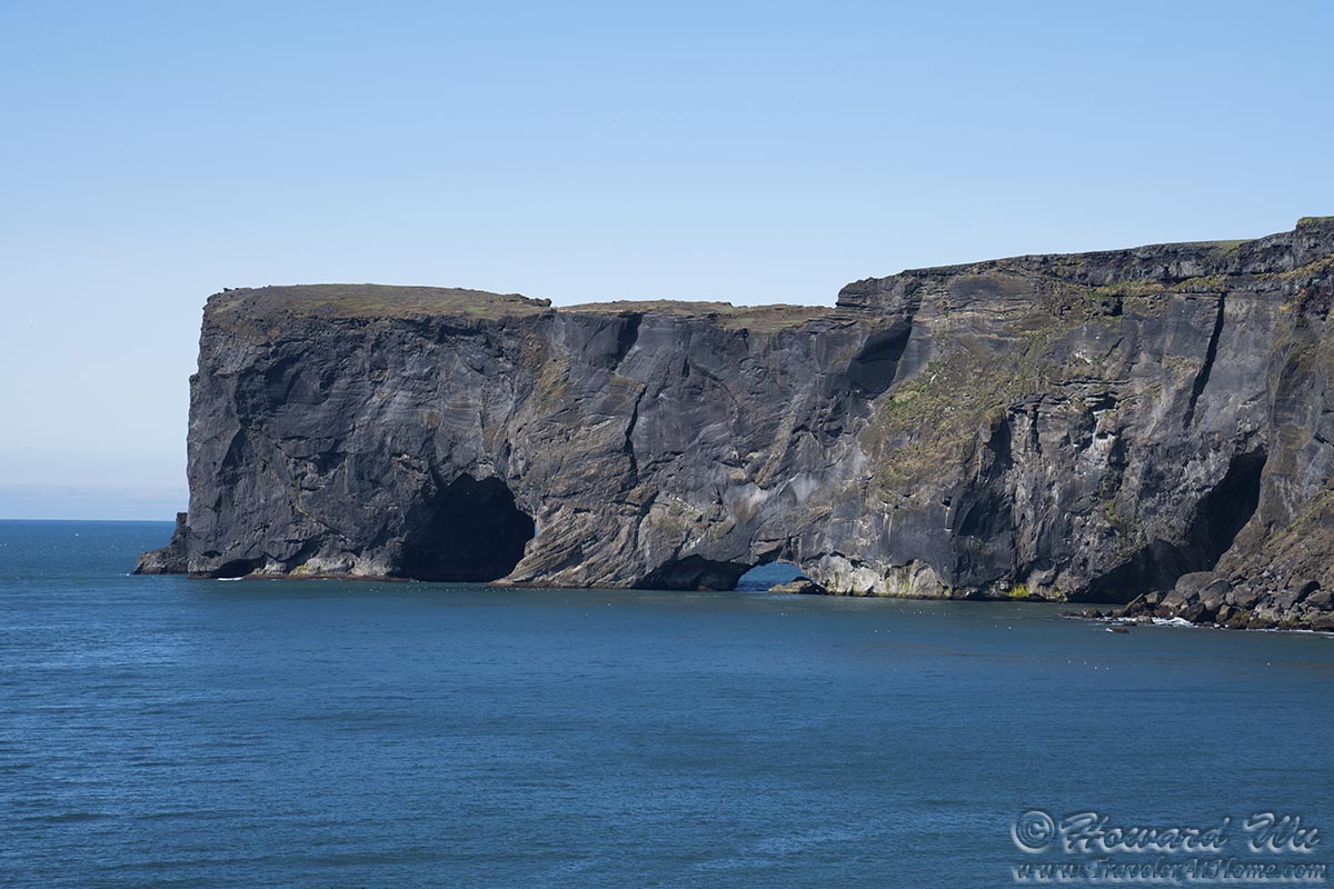
Dyrholaey
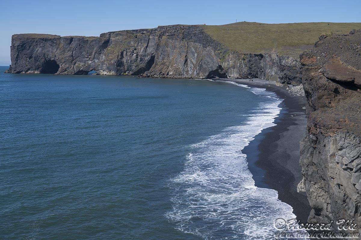
Dyrholaey
Dyrholaey
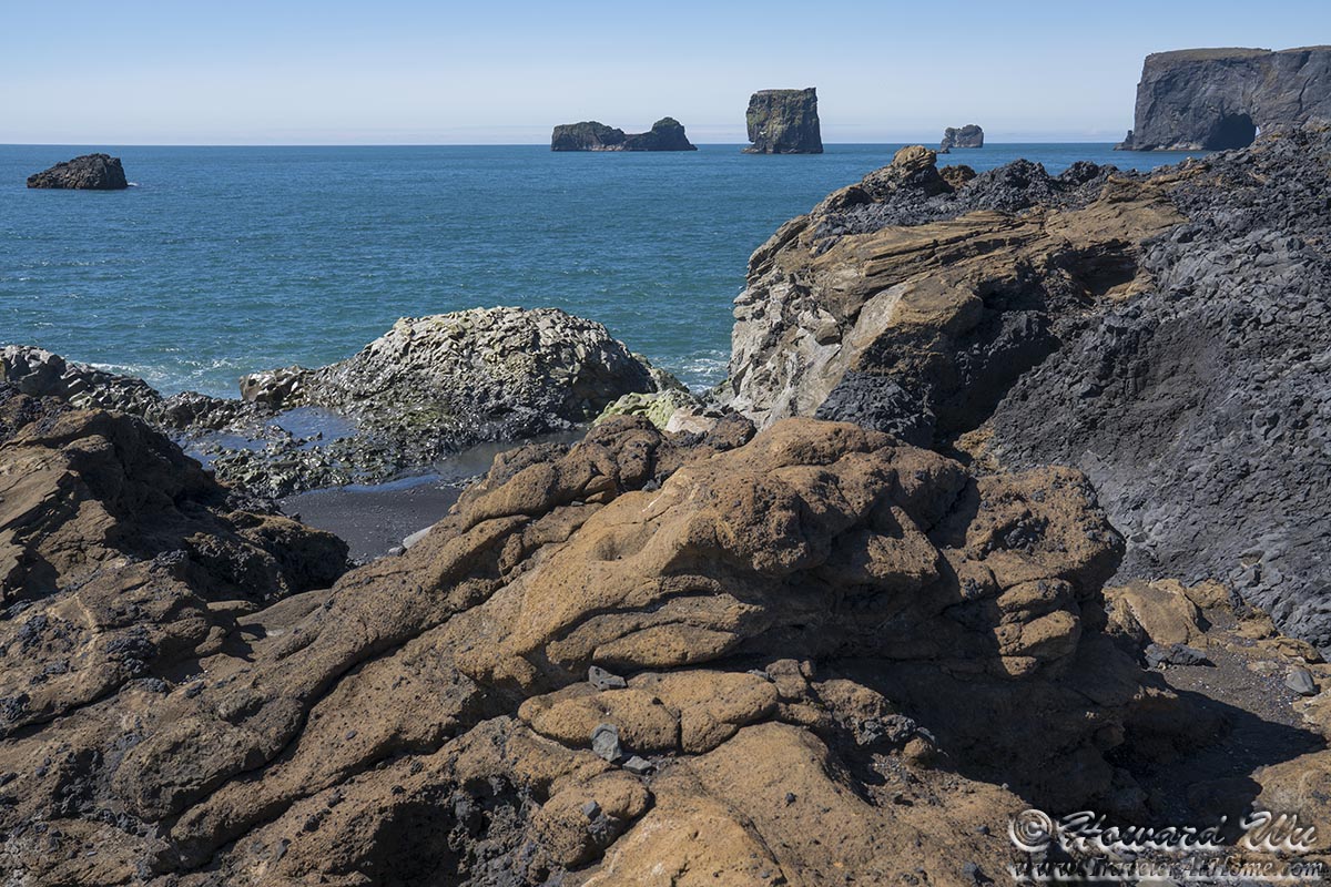
Dyrholaey
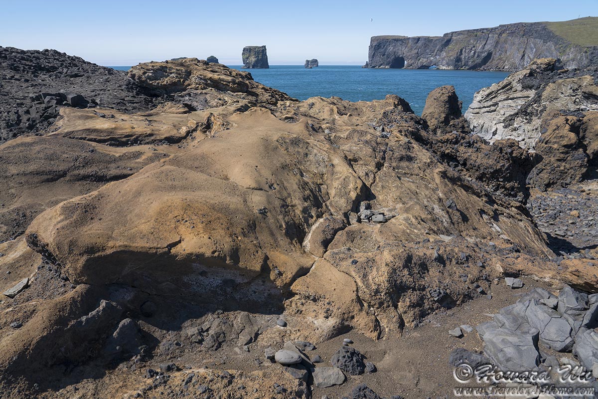
Dyrholaey
From Dyrholaey, there is also a good view of the Myrdalsjokull Glacier, Iceland's southernmost glacier.
Myrdalsjokull
There were a few Atlantic Puffins nesting on the cliffs. This was one of my first close photograph of one (much closer than on Heimaey the day before).
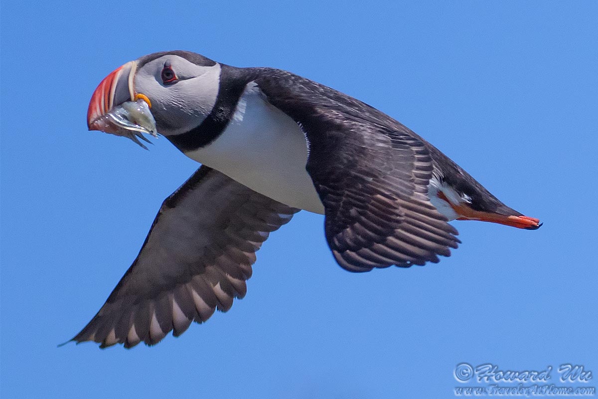
Atlantic Puffin
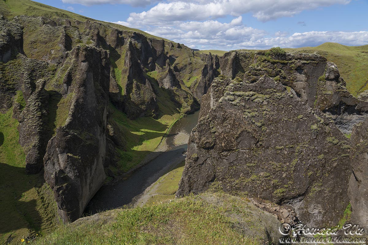
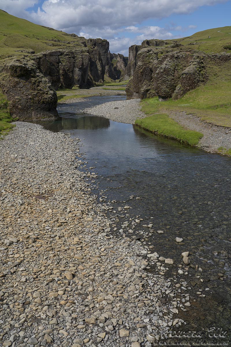
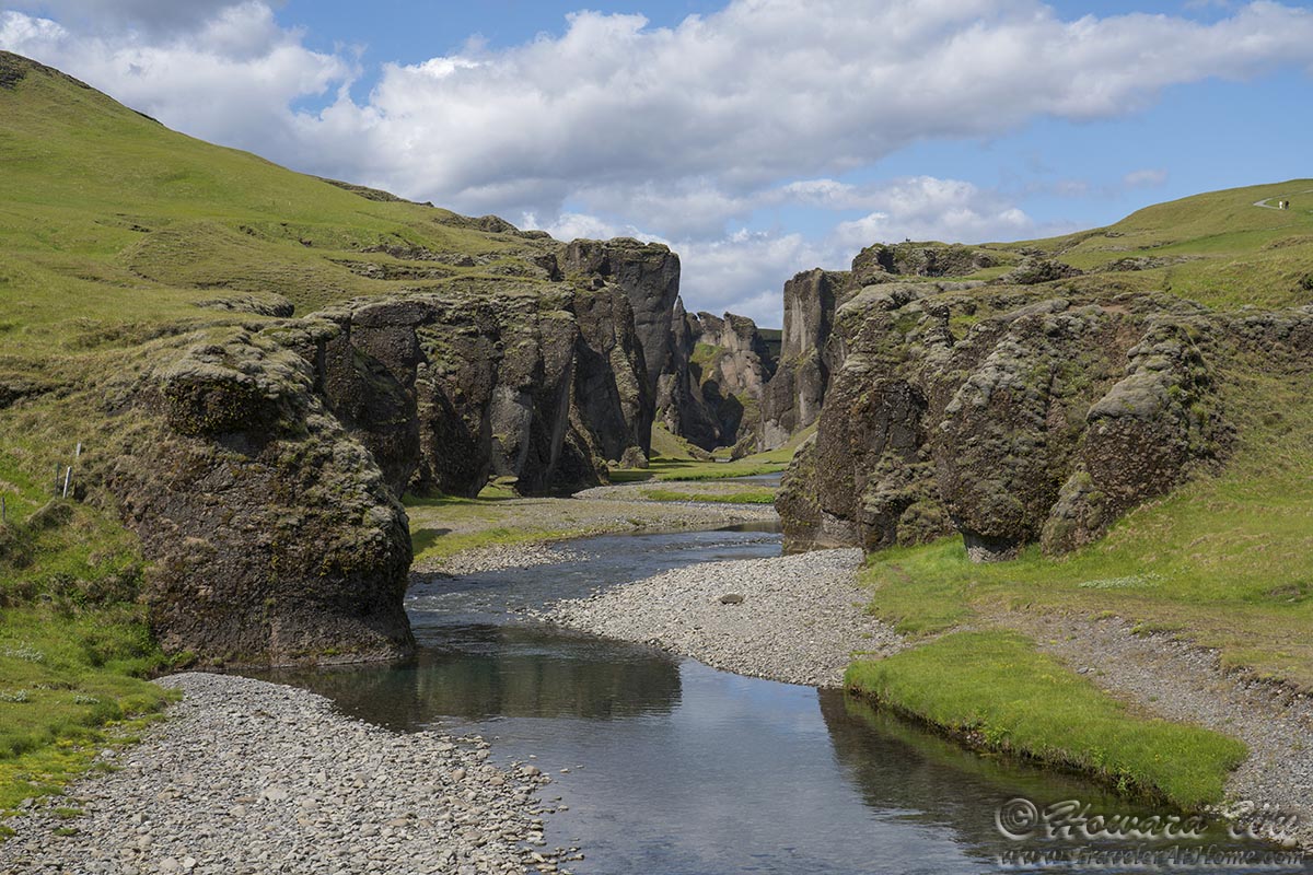
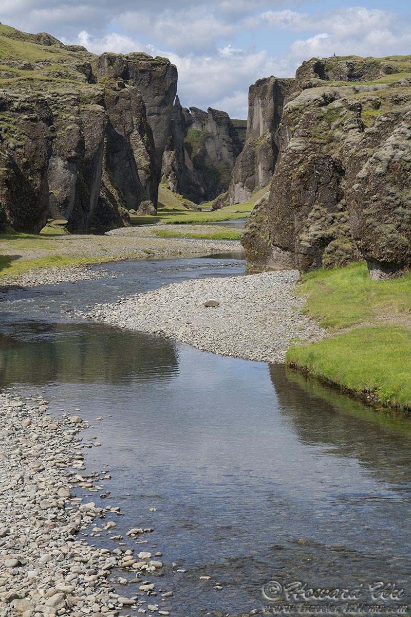
Our next stop was at Fjadrargljufur, a sheer black rock canyon. The canyon's made extremely popular by a Justin Bieber video which in turn leads to great damages to its environment. This prompted authorities to close it for most of the year. We were fortunately to visit when it was open and took a short hike to a few overlooks peering into the canyon.
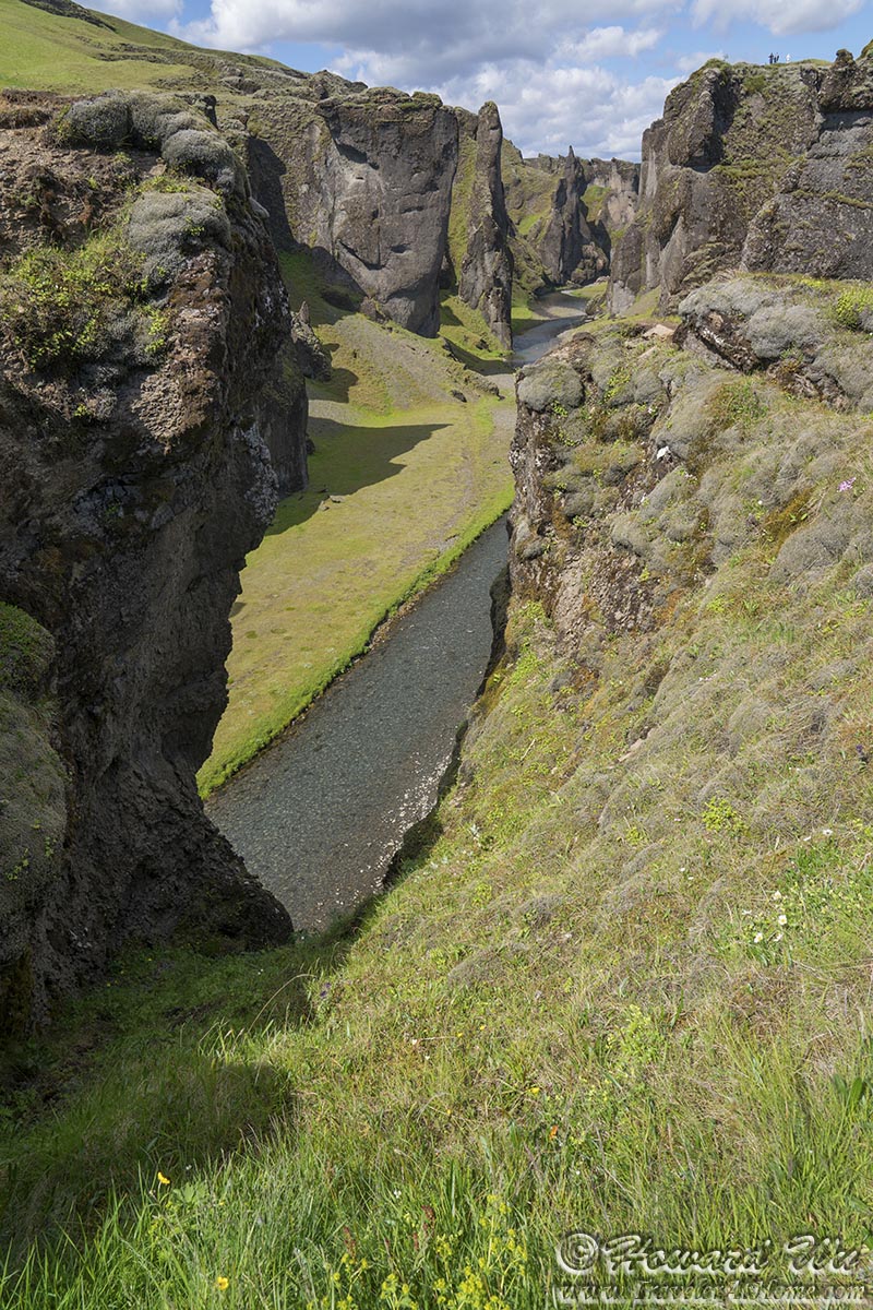
Fjadrargljufur Canyon
Fjadrargljufur Canyon
Fjadrargljufur Canyon
Fjadrargljufur Canyon
Fjadrargljufur Canyon
We continued on the Ring Road. The sky became increasingly dusty -- this area is in the flood plain of the glaciers, when weather is dry, wind whips up sands from the plain, creating a blanketing dust.
We arrived at the Skeidara Bridge Menument, the remnants of a bridge that was destroyed in a massive flood after the eruption of the Vatnajokull volcano in 1996. The Skeidararjokull glacier, whose melt caused the flood, can be seen through the dust not far from this spot.

Skeidara Bridge
Shortly we entered Skaftafell National Park. Unlike most other places we visited in Iceland, this national park has wooded areas, a lovely respite from the beautiful but austere landscape. We took the trail through the "forest" toward the famous black waterfall, Svartifoss.
Before long we could see the waterfall running down the sheer basalt column lined cliff.
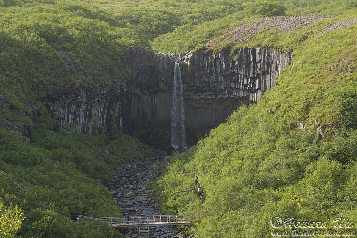
Svartifoss
We hiked to the base of the waterfall. Lighting was not in the right direction at this time (the waterfall was in the dark shadow), but the waterfall was still impressive.
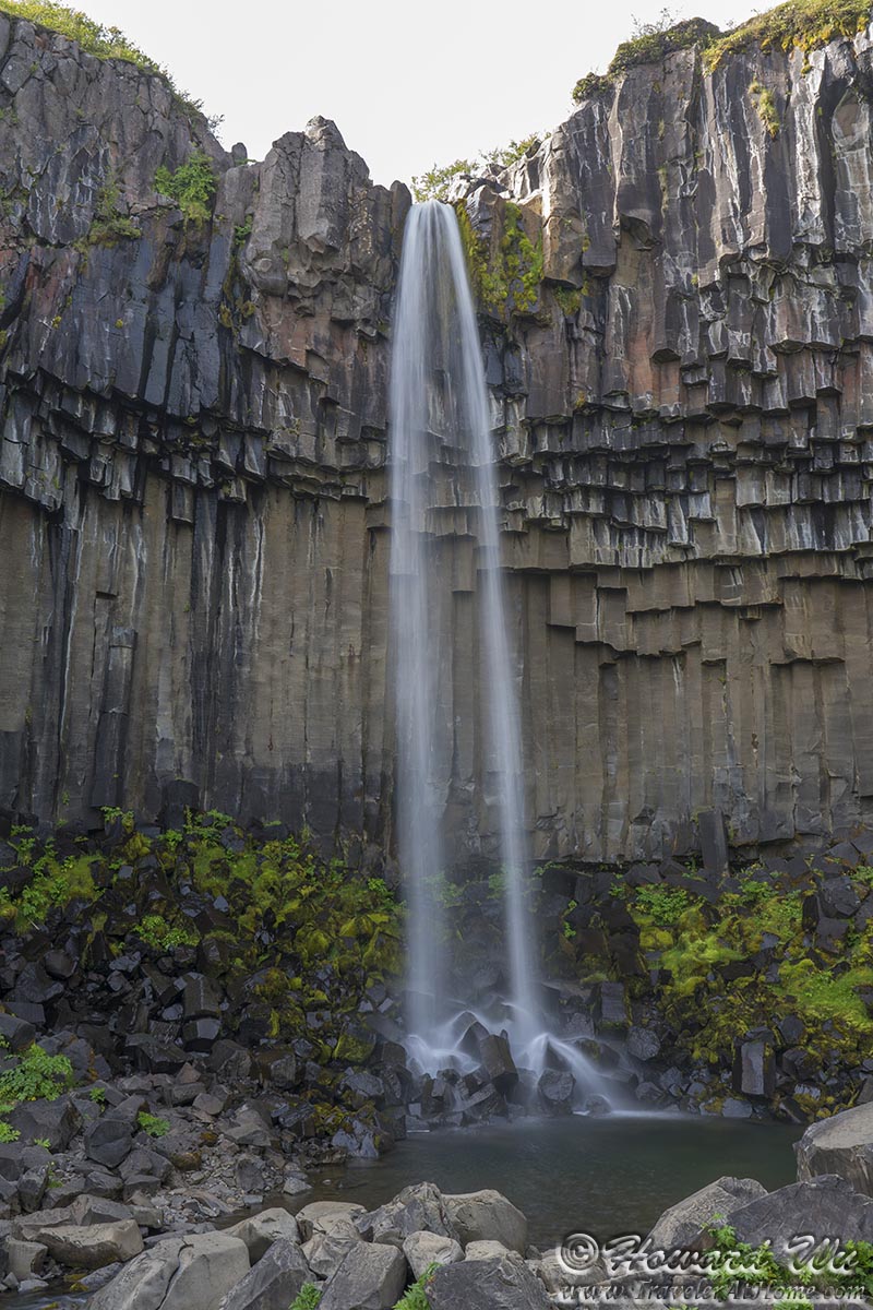
Svartifoss
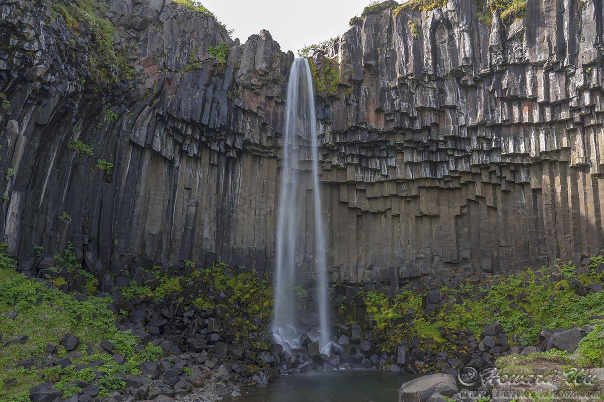
Svartifoss
The basalt columns are most fascinating too.
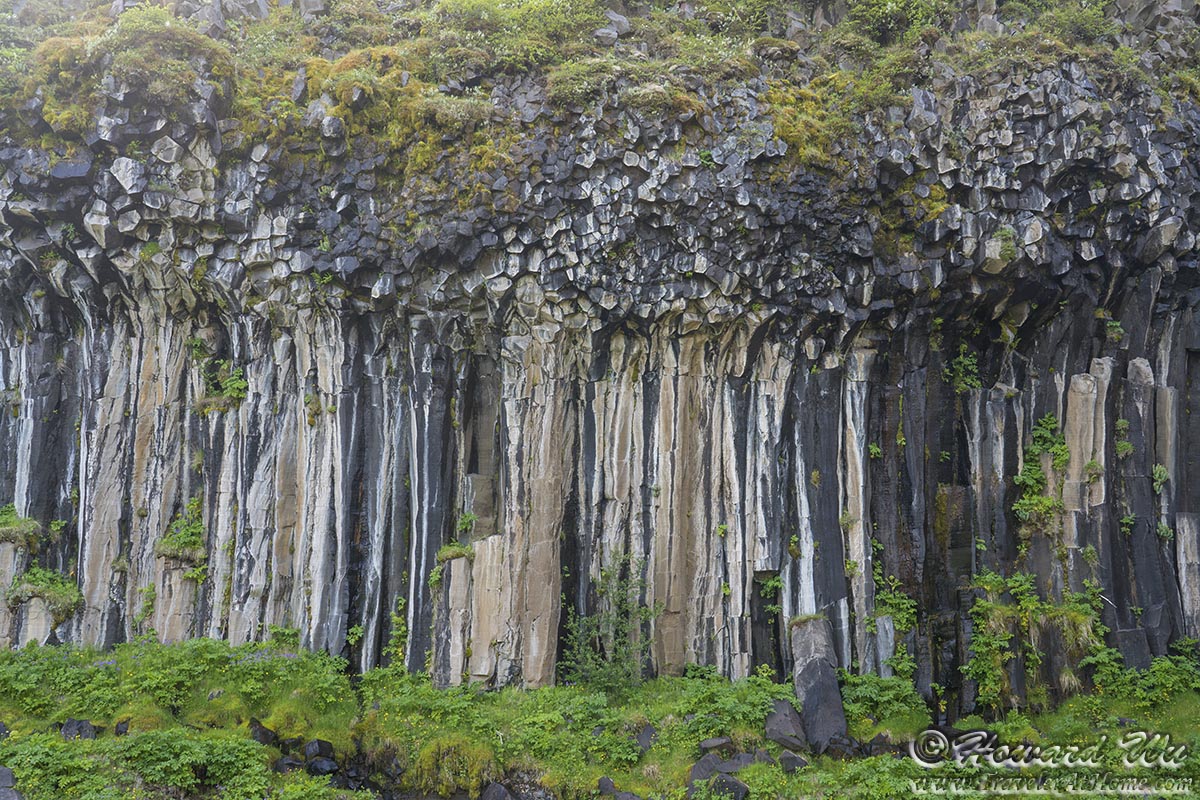
Basalt Columns
The hike to Svartifoss was one of the longest hikes we did in Iceland (though not too long, about 3 KM round trip) and once we finished it was getting late in the day. We arrived at Diamond Beach late in the afternoon. Because of time of the year (summer) and probably direction of the tide, there were few "diamonds" (ice chunks) on the beach.
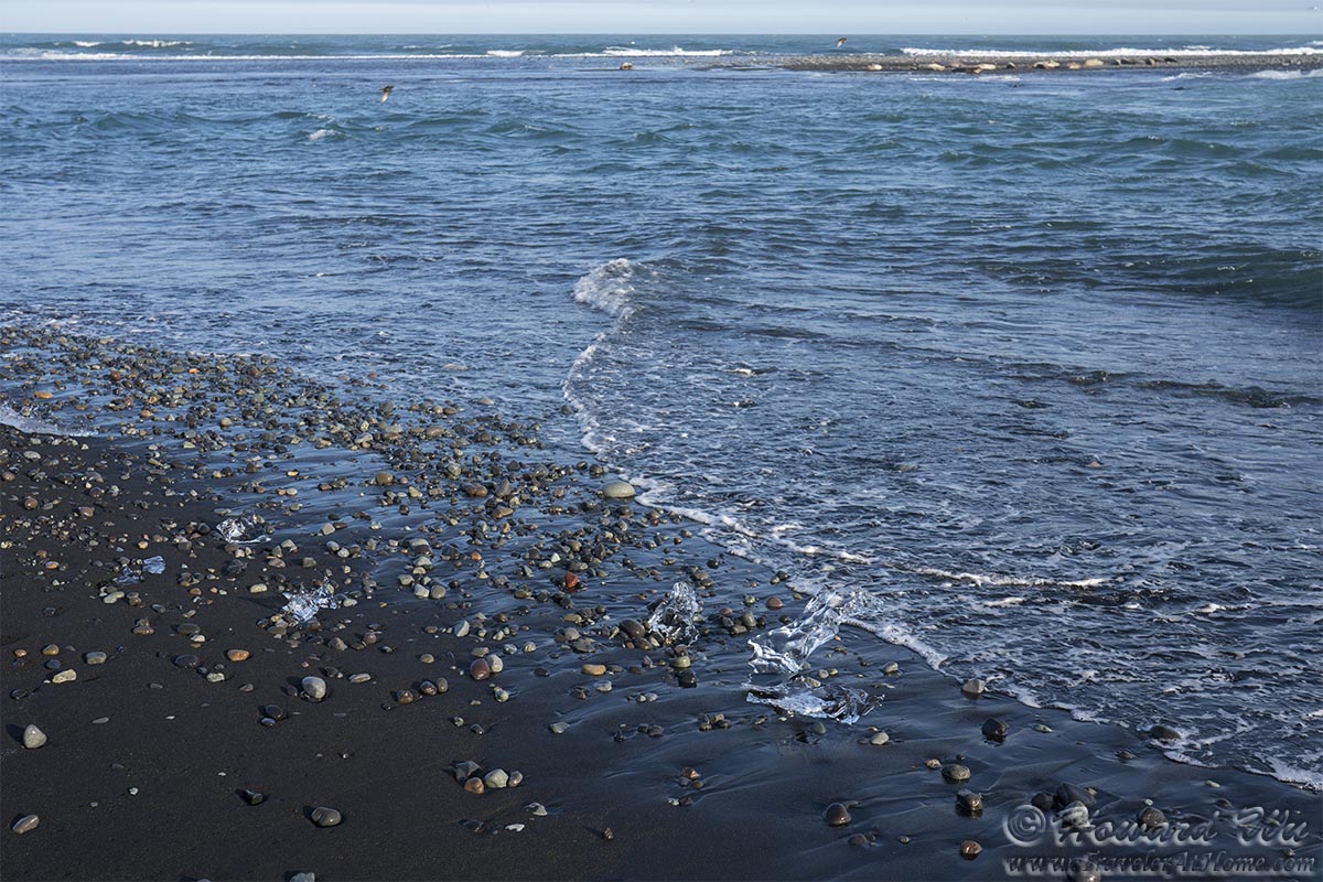
Diamond Beach
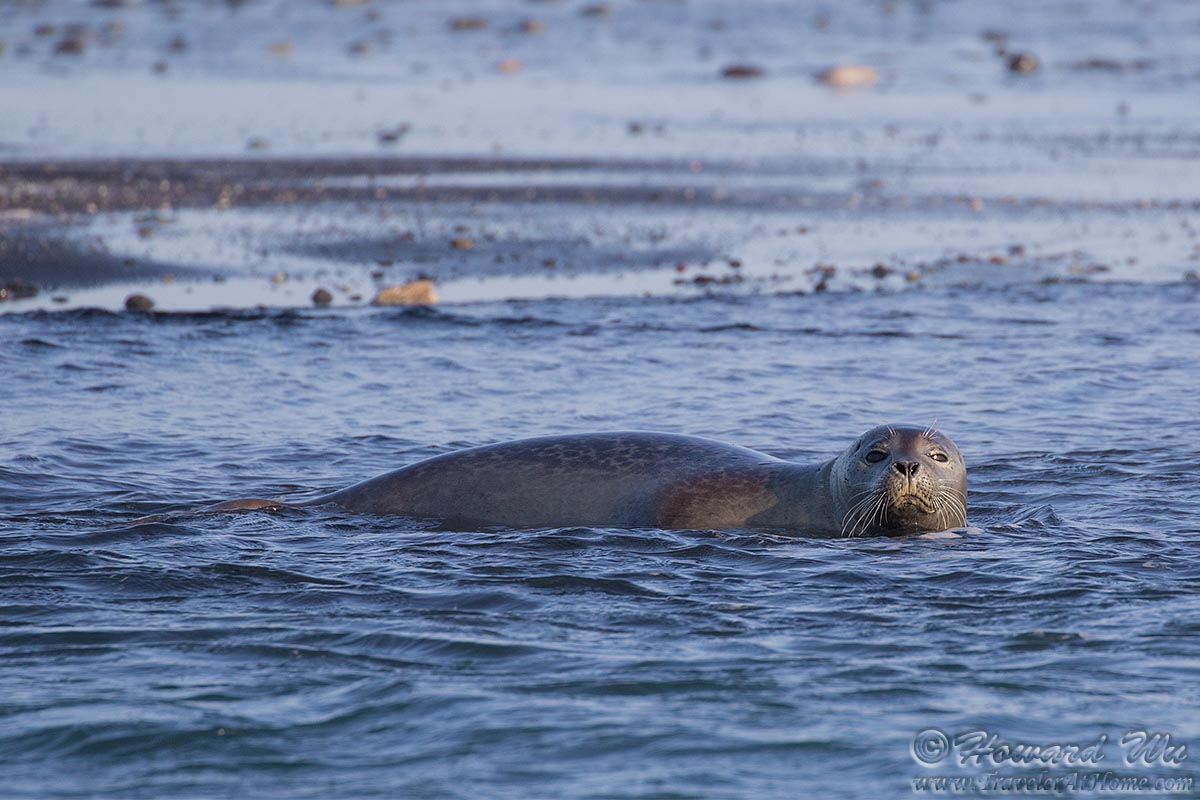
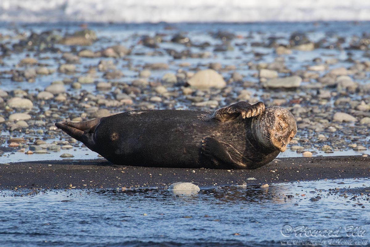
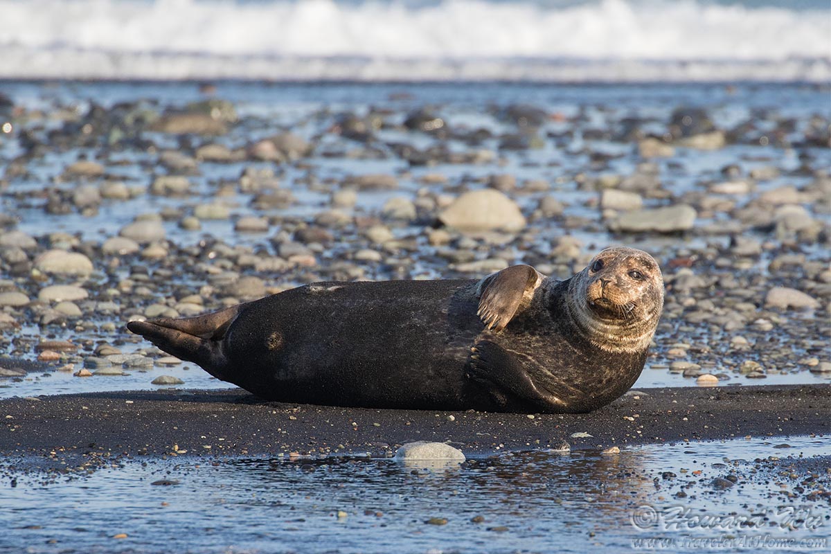
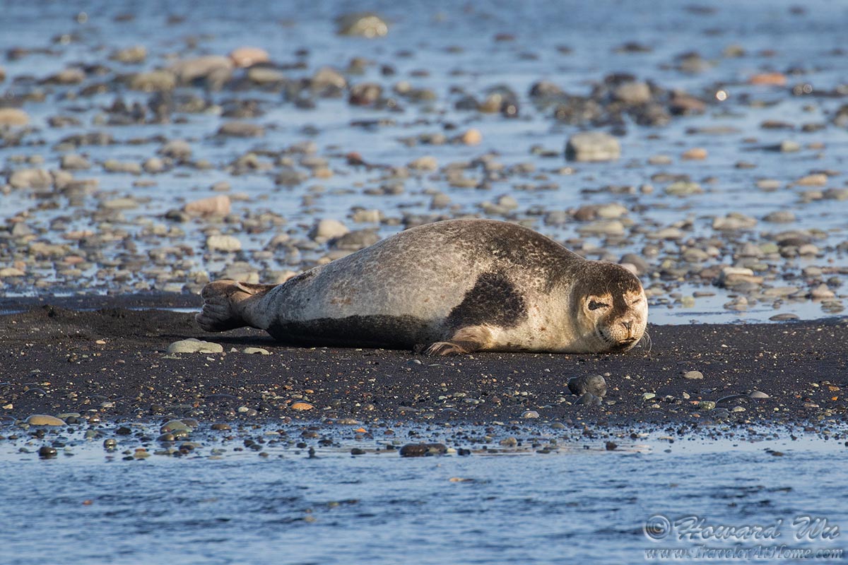
However, what we lost in diamonds was more than made up for in wildlife! Just off shore, a few Harbor Seals were swimming or resting on a sandbar, offering excellent viewing opportunities. This was the only time we saw wild mammals on this trip.
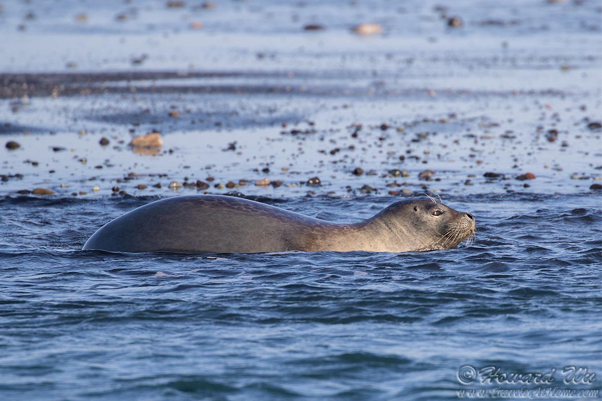
Harbor Seal
Harbor Seal
Harbor Seal
Harbor Seal
Harbor Seal
There were also a flock of sea birds -- mostly Arctic Terns, but also including other species such as this Parasitic Jaeger (Arctic Skua) -- in a feeding frenzy not far from shore. This was the best wildlife viewing we had up to that point.
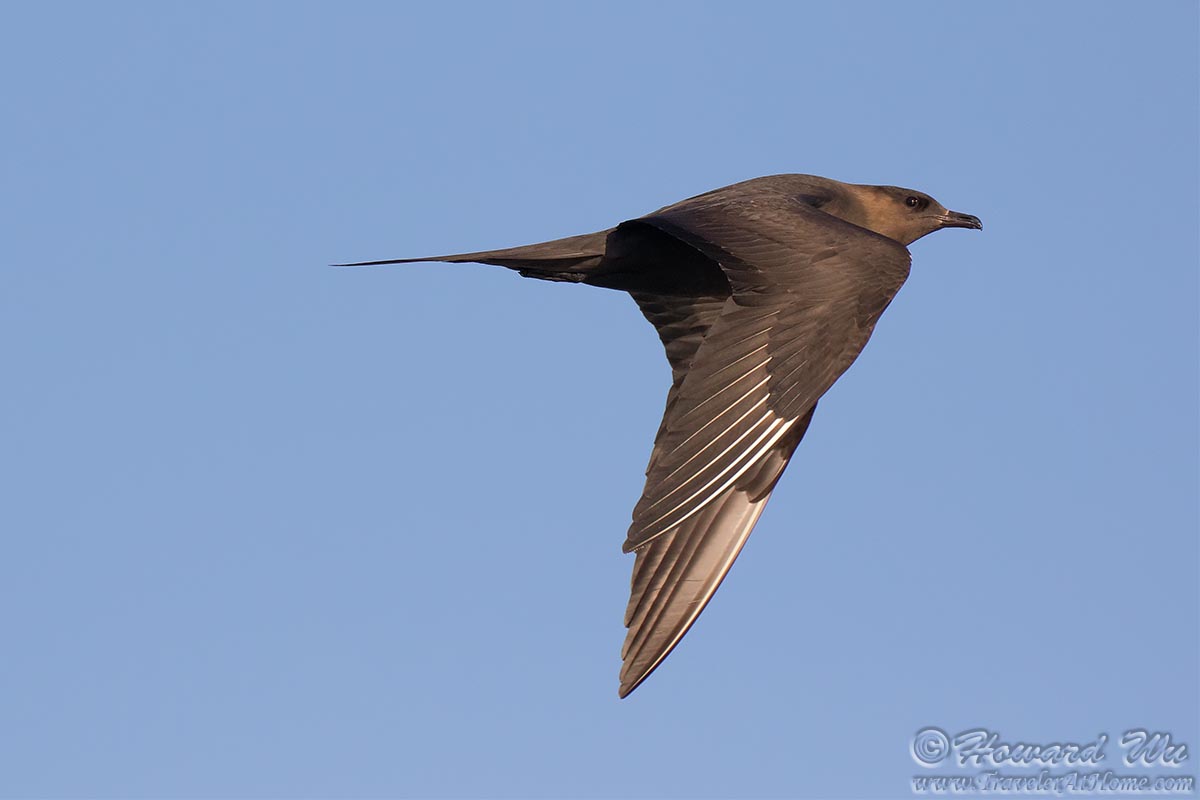
Parasitic Jaeger
We walked over to the other side of the Ring Road, where the Jokulsarlon Glacier Lagoon lies. With numerous icebergs were floating in the lagoon, Jokulsarlon is considered one of the natural wonders in Iceland.
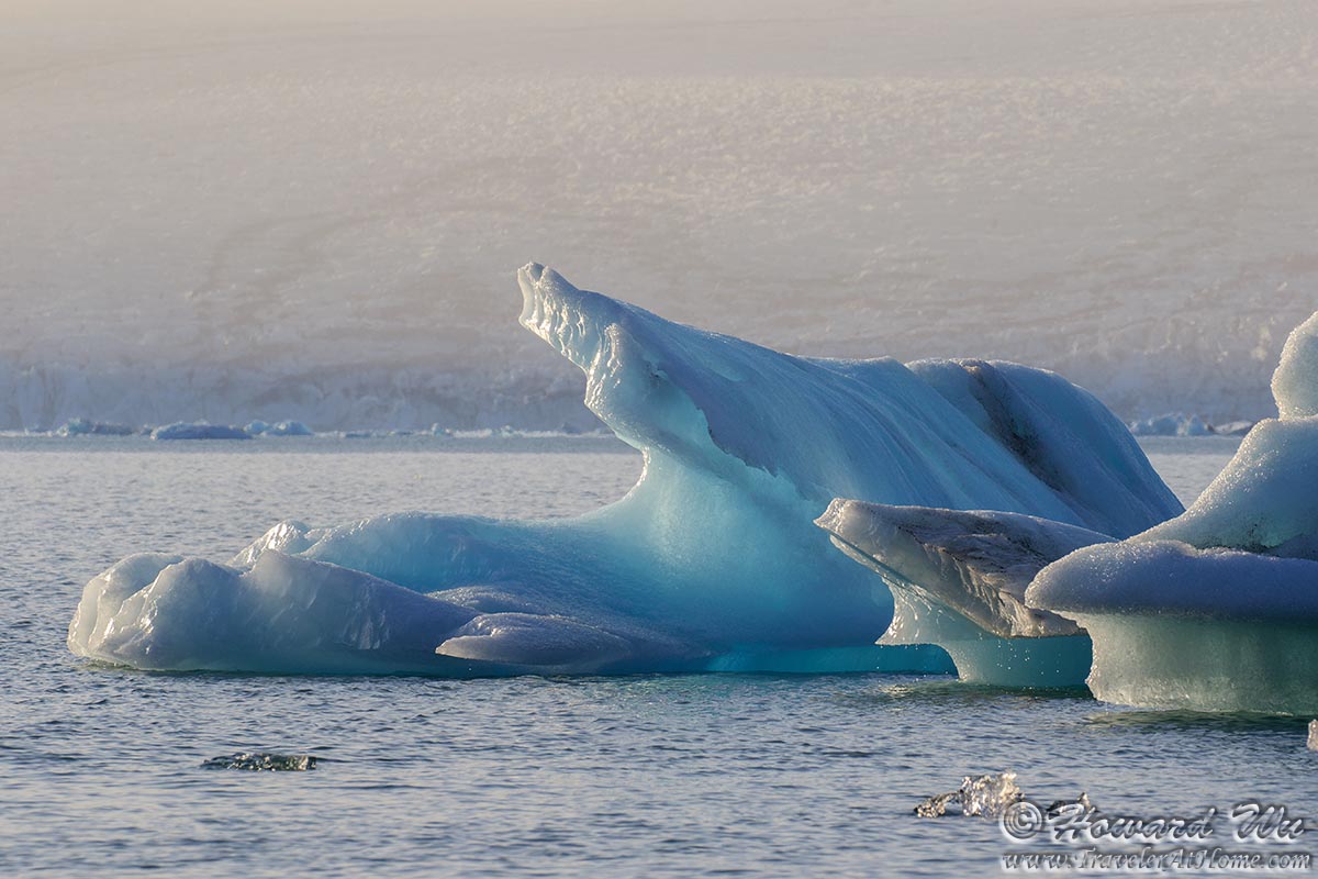
Glacier Lagoon
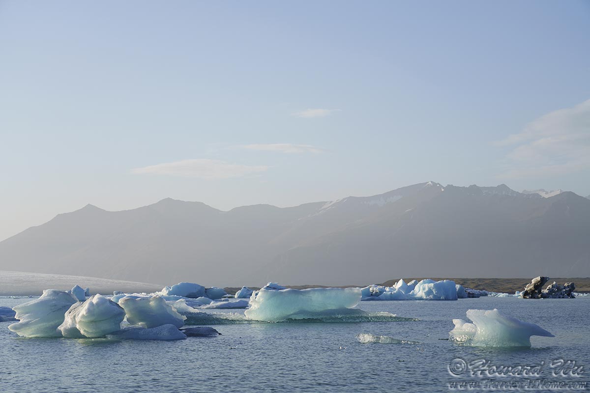
Glacier Lagoon

Glacier Lagoon
It was here that a few Snow Buntings flew by, one posed for me at close range. This is a bird I had seen before, but only in the winter in North America, where they wore their more muted winter plumage. Here, their black-and-white summer breeding plumage looked stunning.
We ran so late on this day that we arrived at our destination of the day, Hofn, at almost 10PM (but in bright "day" light). All the restaurants were closed, even the kitchen at the gas station was closed. We bought the last remaining hot dogs for dinner.
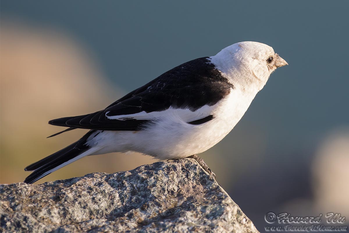
Snow Bunting
Click the image below to return to the index page of 2019 trip to Iceland: