Day 3 (Saturday, June 22, 2019): Westman Islands and waterfalls (from Hveragerdi to Vik)
We left Hveragerdi in the morning and drove east on the Ring Road. We made a stop at Seljalandsfoss first, but the direction of light was not right -- the waterfall was in the shadow. In any case, we had to Landeyjahofn to catch the ferry to Vestmannaeyjar or the Westman Islands. This would be our only excursion outside of main (is)land of Iceland.
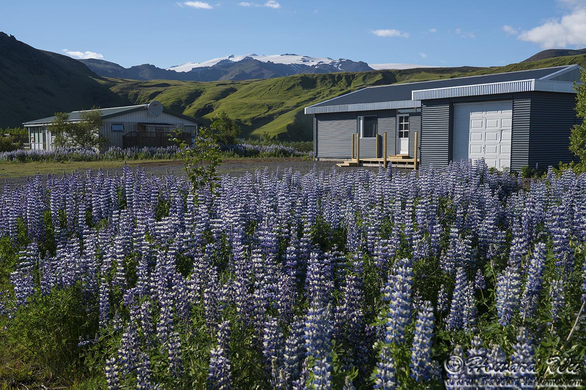
We boarded the ferry shortly. From the deck of the ferry, looking back toward the mainland, we had a nice view of the lupine-covered field and distant glacier-covered mountains. I believe the high peak in the distance is Hekla, one of Iceland's most active volcanoes.
(Click on each image to see the high-resolution version)
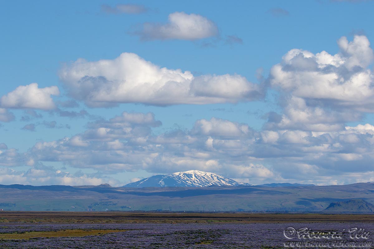
Hekla
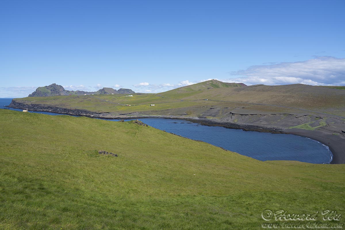
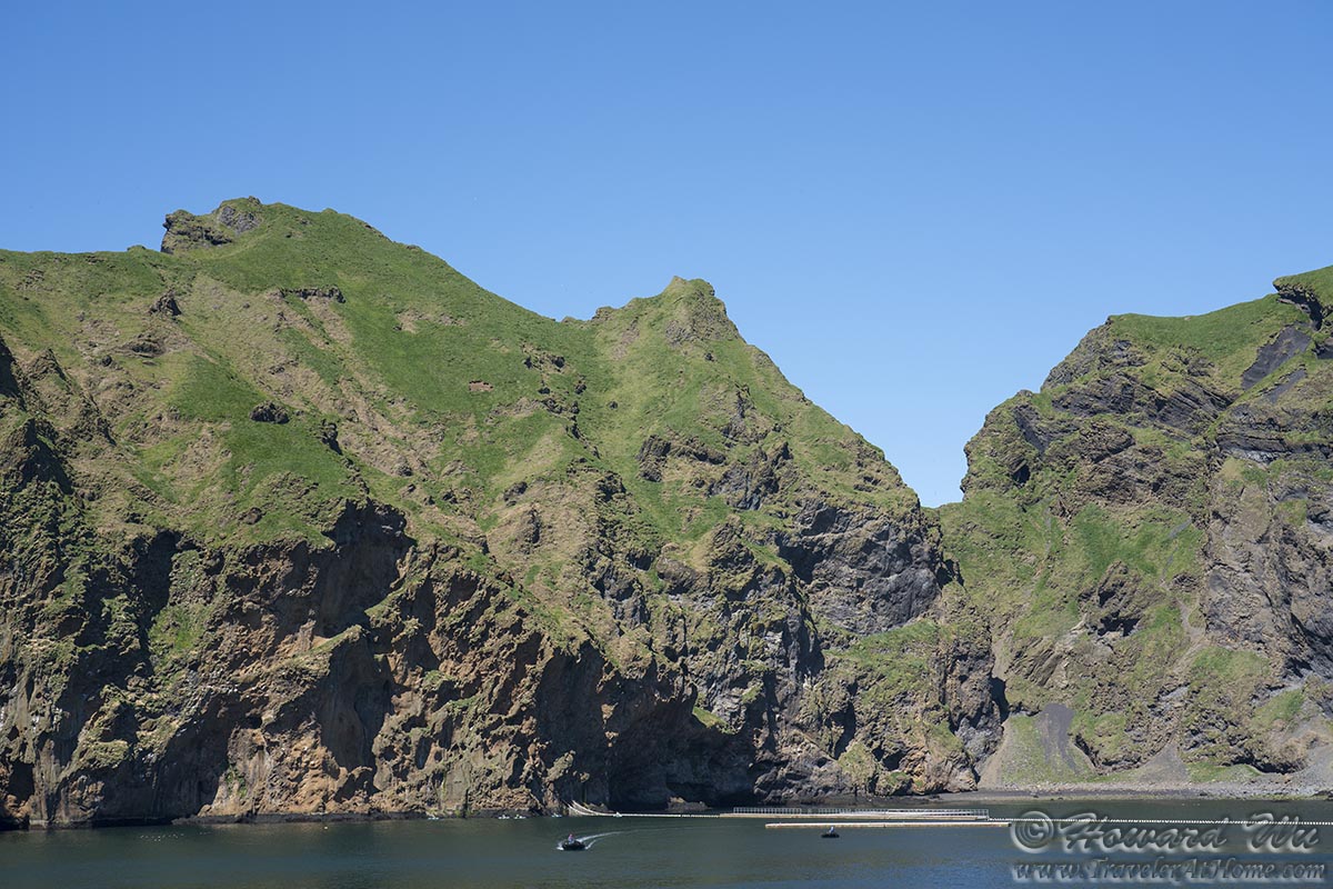
It was a fairly short ferry ride. As the boat pulled closer to Heimaey, our destination and the only populated island in the Vestmannaeyjar, it offered a great opportunity to study the rocky cliffs of Heimaey and its outlying islands.
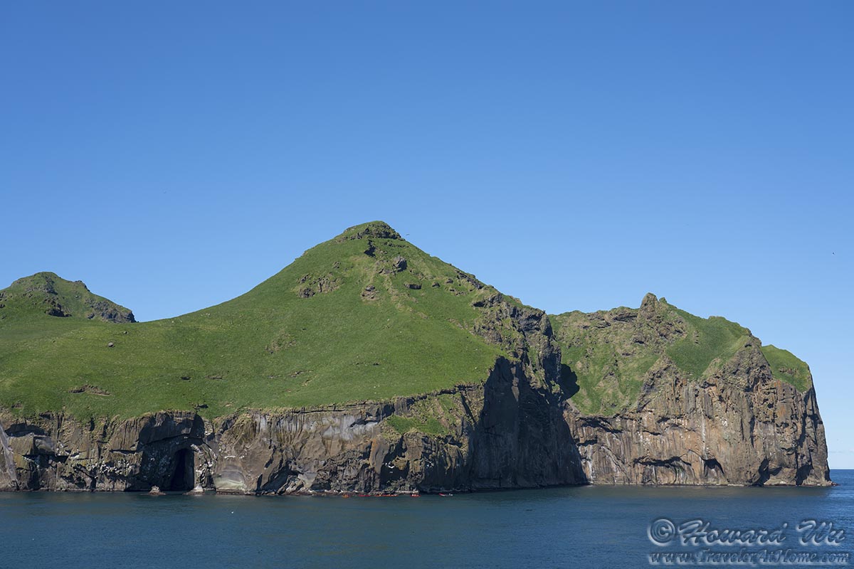
Heimaey
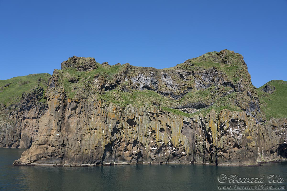
Heimaey
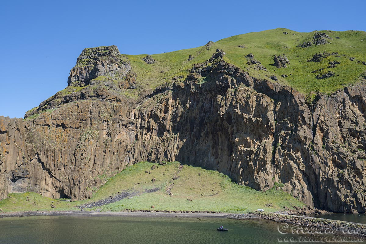
Heimaey
Heimaey
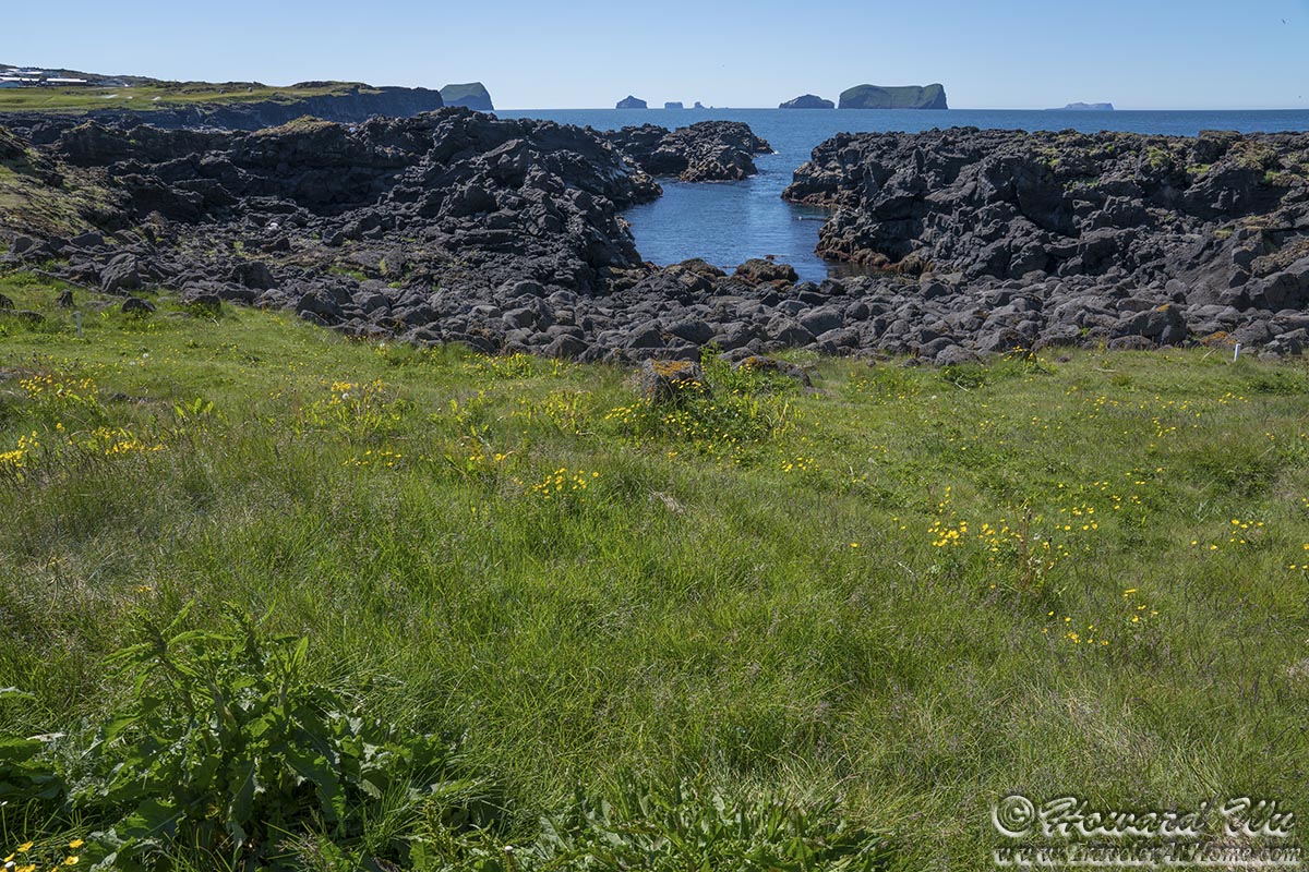
Because we made the decision to not bring our car with us, we had to rely on a tour company to take us to places on the island. This was the only time we took a tour in Iceland, and I found it generally unsatisfactory (see my review here). We were rounded up and taken to various spots on the island. Our first stop was at this cove near a golf course. Several outlying Westman Islands can be seen off shore, including the recently formed and much studied Surtsey Island in the distance (I was reading a book about it on this trip).
Heimaey
We were taken to a place high on the rocky slope where Atlantic Puffins nest. We had fine views of the coast and the black volcanic sand beaches below.
Heimaey
Heimaey

Heimaey
Of puffins we would be rather disappointed -- we did see a few of them, but only from a distance, and either when they were flying to and from their nests or bobbing on the water far below.
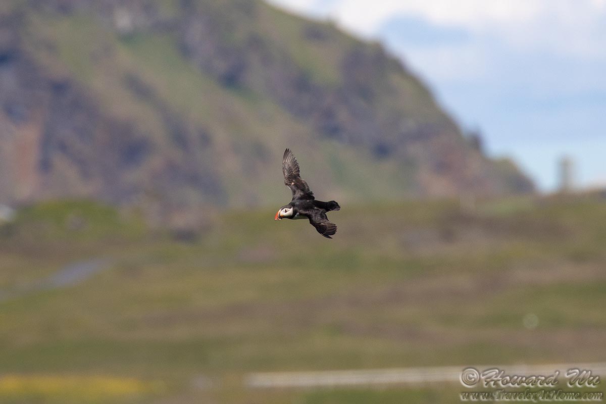
Atlantic Puffin
We did have close encounter with some sheep though. Here, as elsewhere in Iceland, Icelandic sheep are ubiquitous.
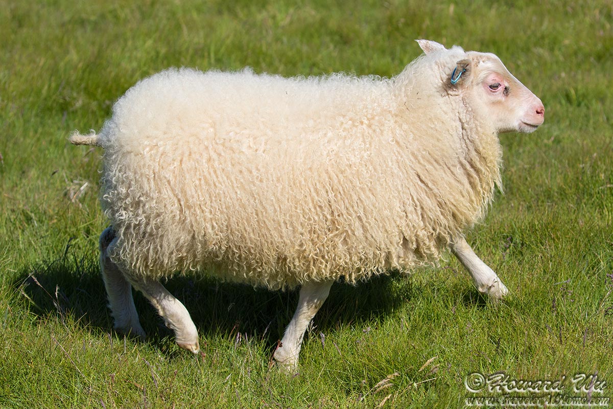
Sheep
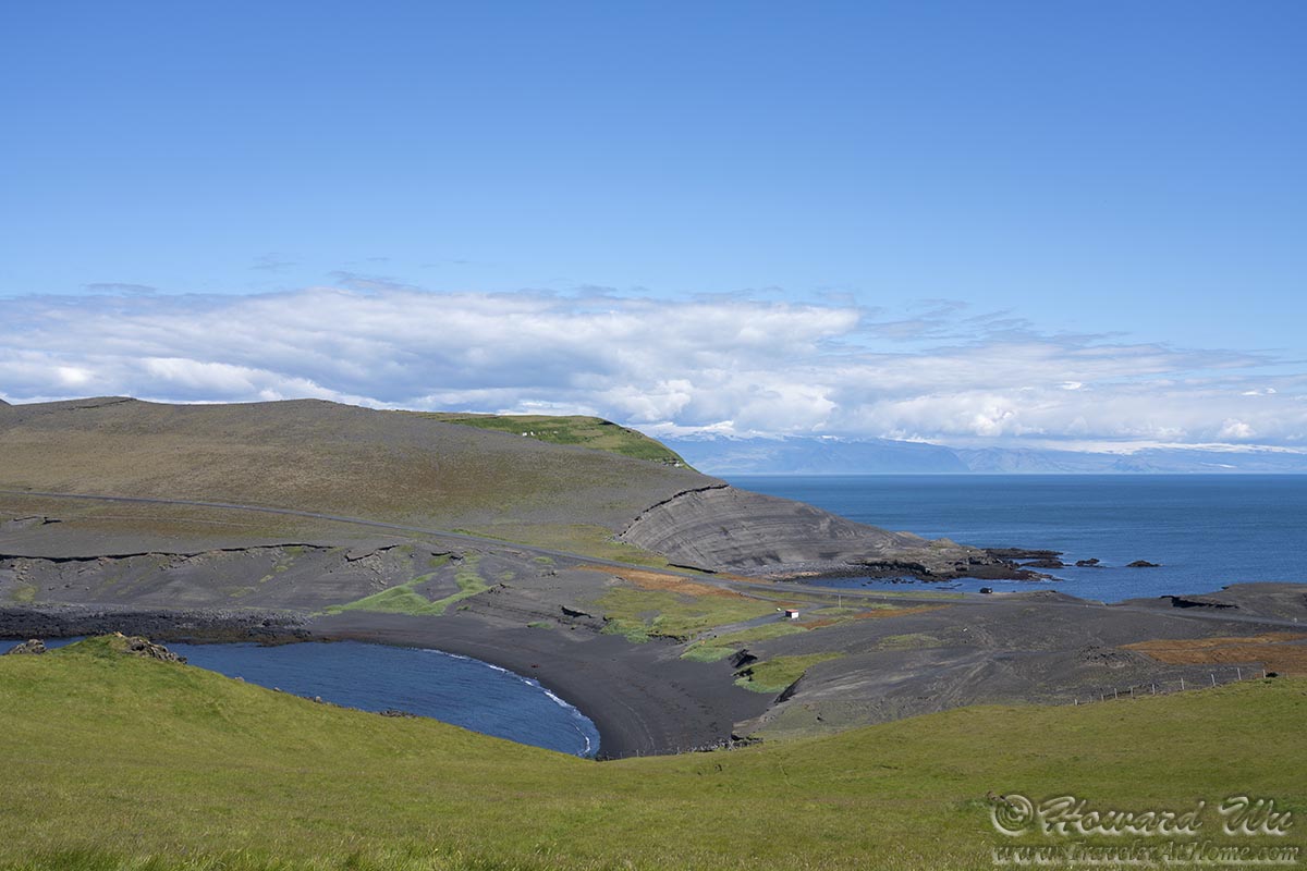
We were then taken to the spot where Volcano Eldfell erupted in 1973 and caused the evacuation of the whole island population. After several decades, the landscape still looks raw with exposed tephra and volcanic rocks, but nature's healing was under way too.
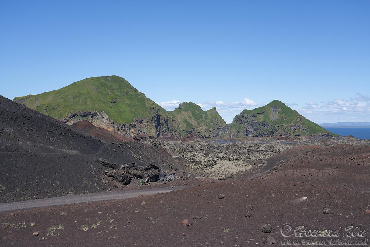
Heimaey
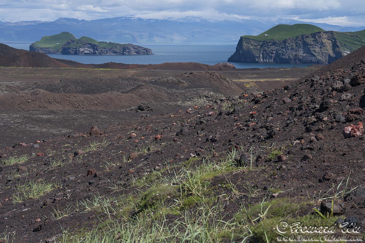
Heimaey
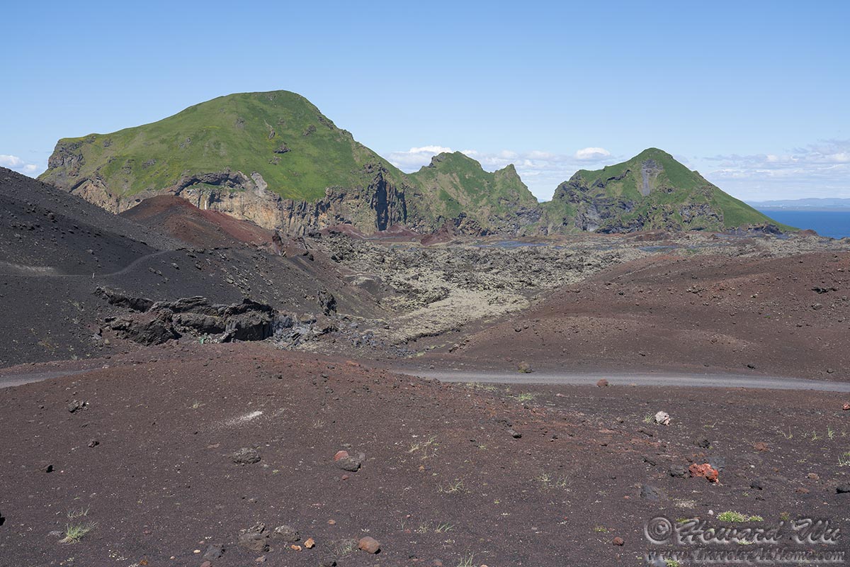
Heimaey
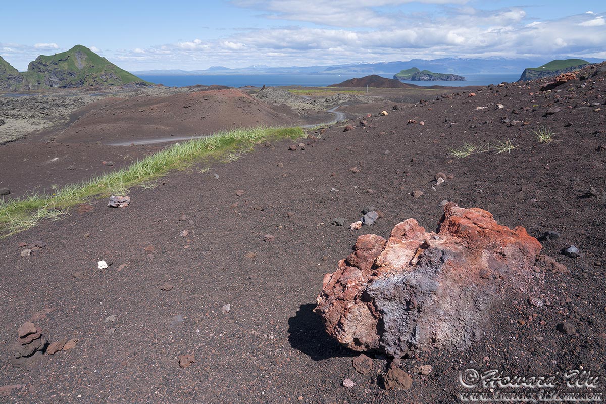
Heimaey
Before long we were back at the harbor. We lingered around before our ferry ride back to the mainland. Actually, finally we did have a close encounter with a puffin on Heimaey! Well, it was a statue.

Heimaey
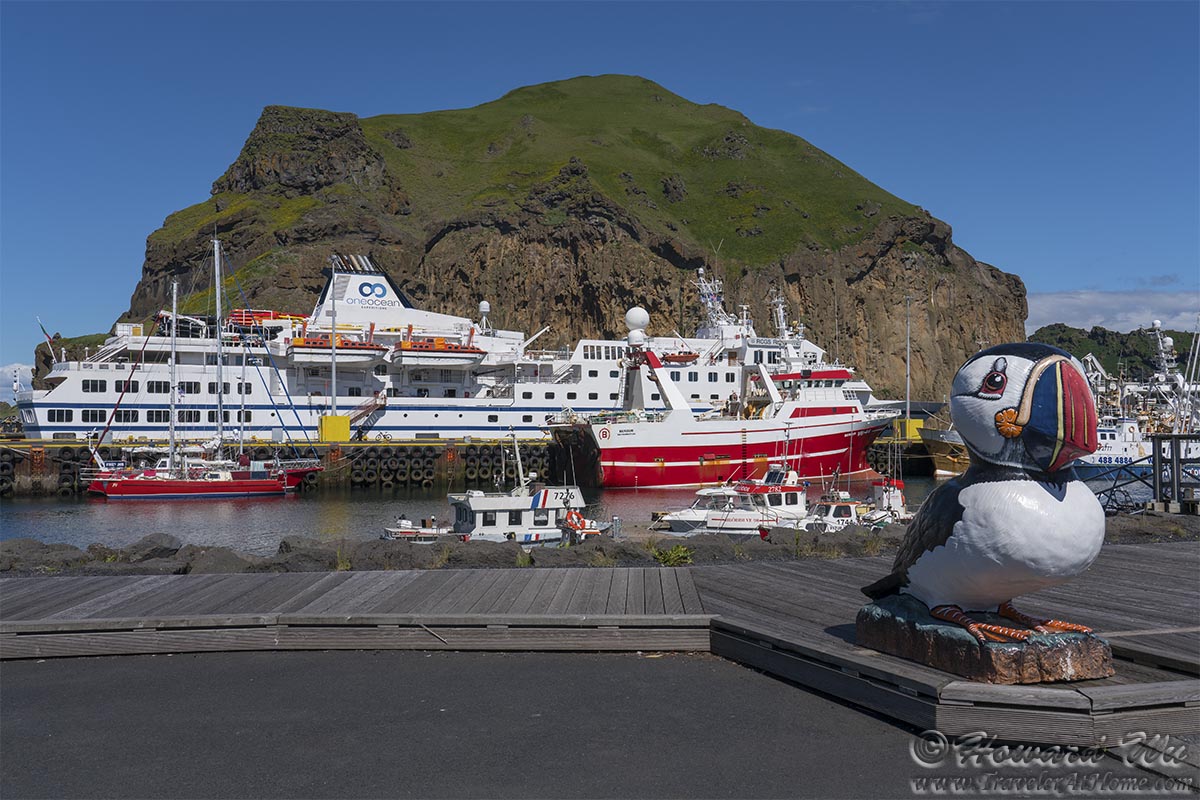
Heimaey
In my idle mode, I also photographed some gulls circling around the harbor.
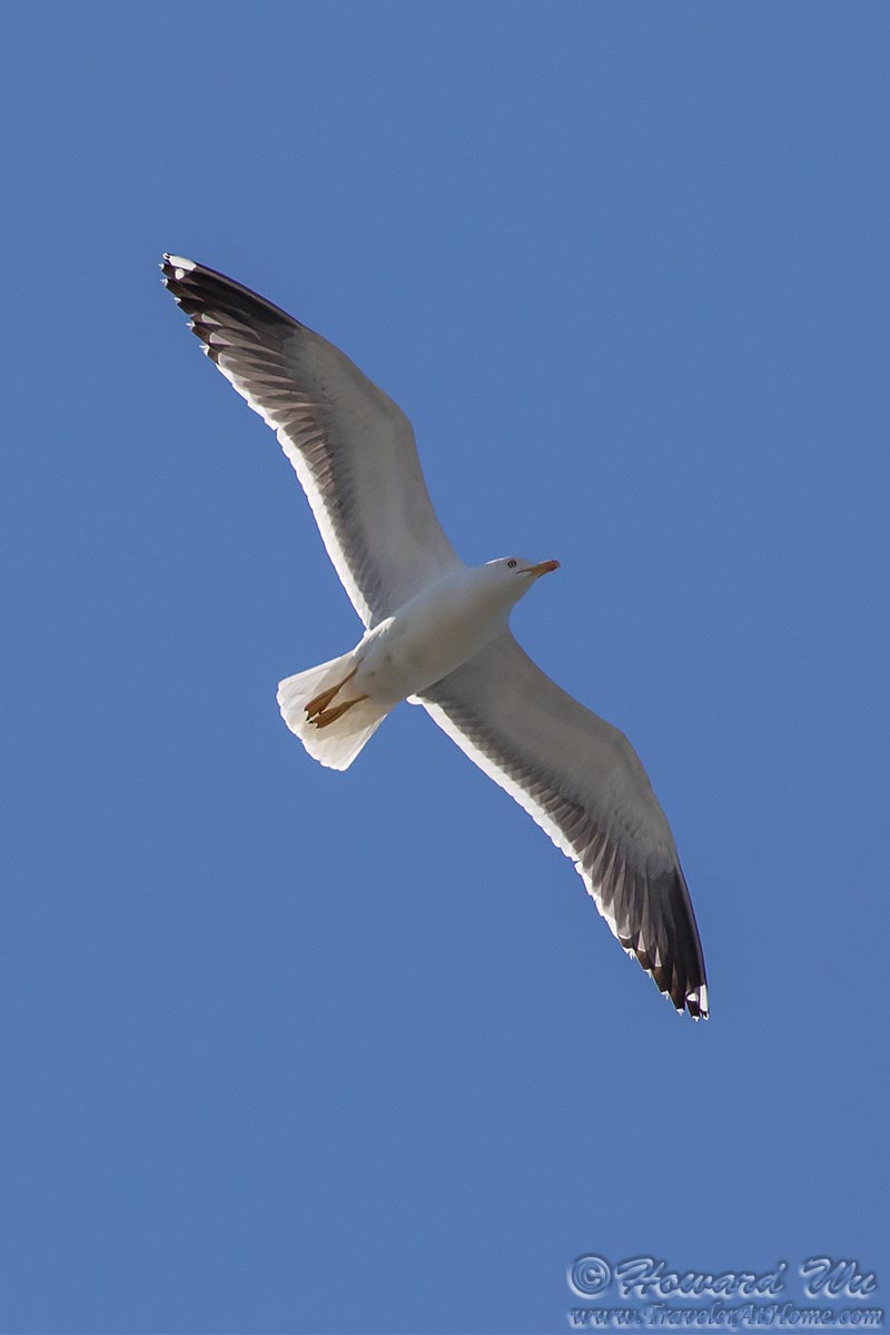
Lesser Black-backed Gull
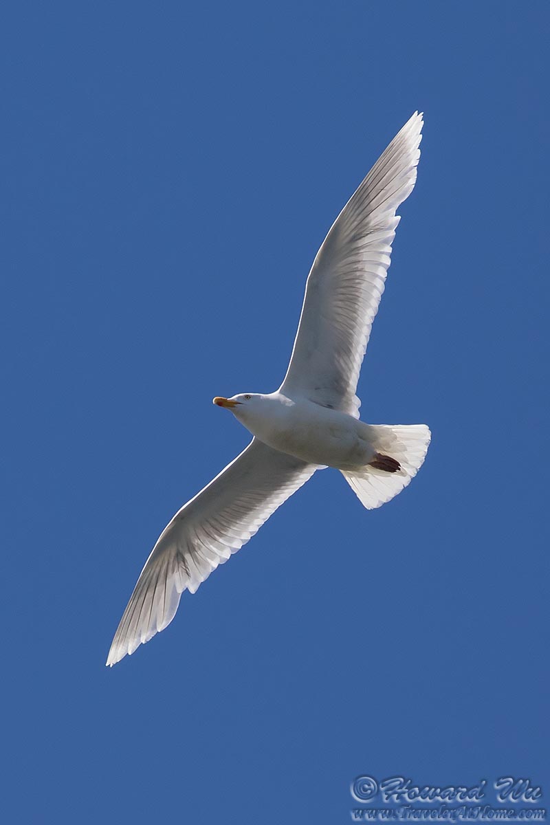
Glaucous Gull
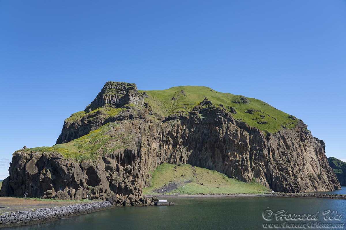
Finally, we boarded our ferry. As it pulled out of the harbor, we had a chance to study the rocky cliffs again.
Heimaey
As Heimaey and the Westman Islands receded from view on the ferry, we reflected on this trip: it was somewhat hurried and disappointing (as far as viewing the puffins), and on hindsight, we should have brought our car with us. But in the end, it was still a nice side excursion under the perfect sky.
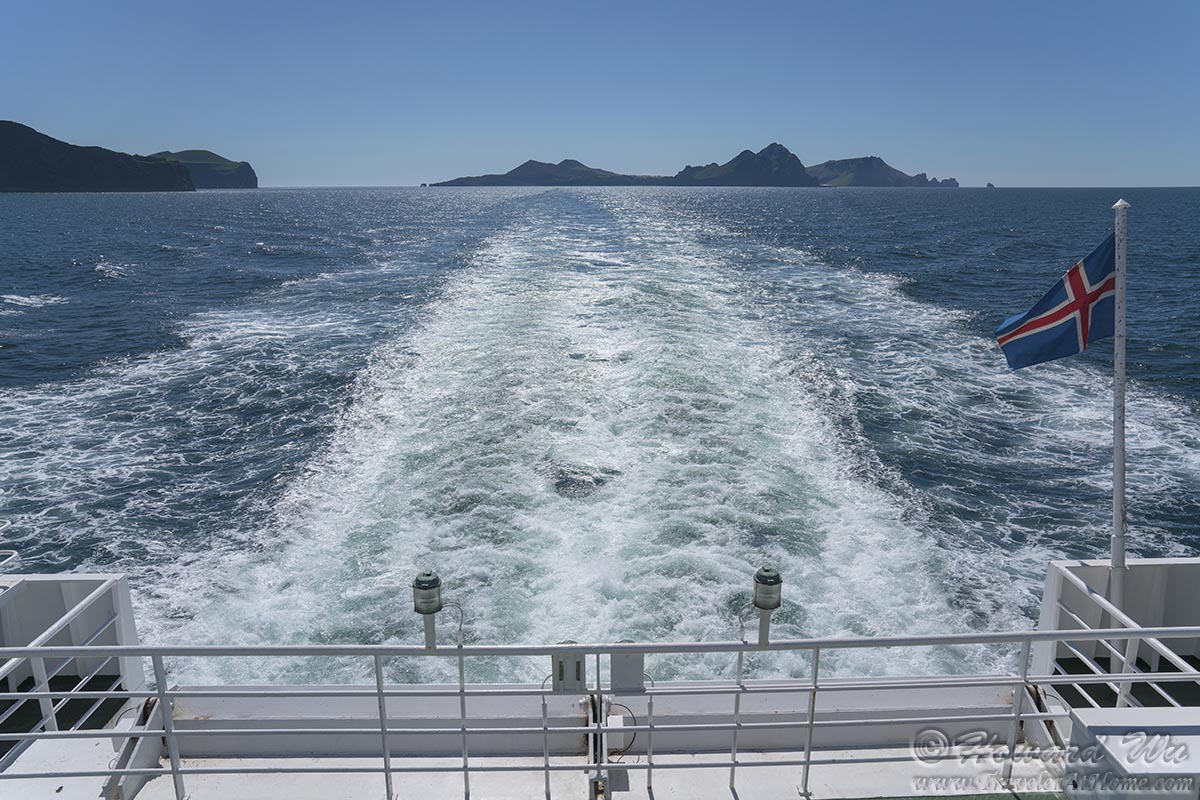
Heimaey
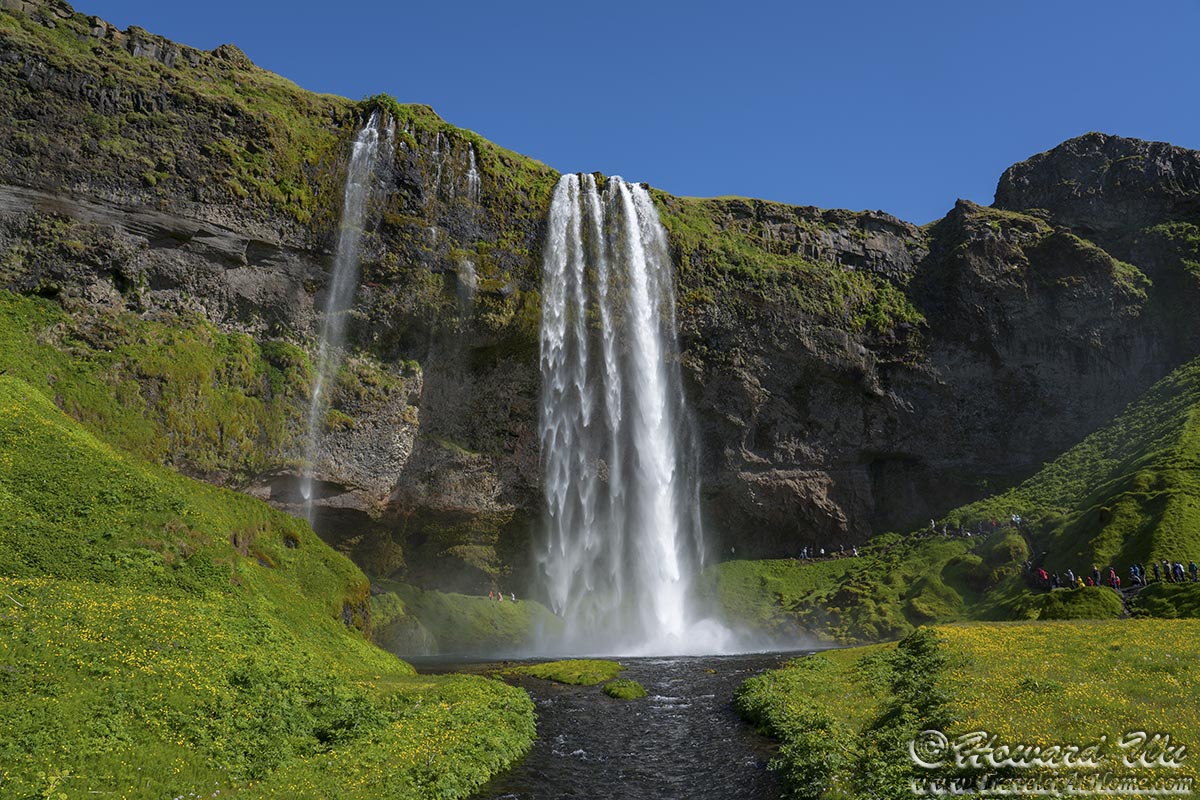
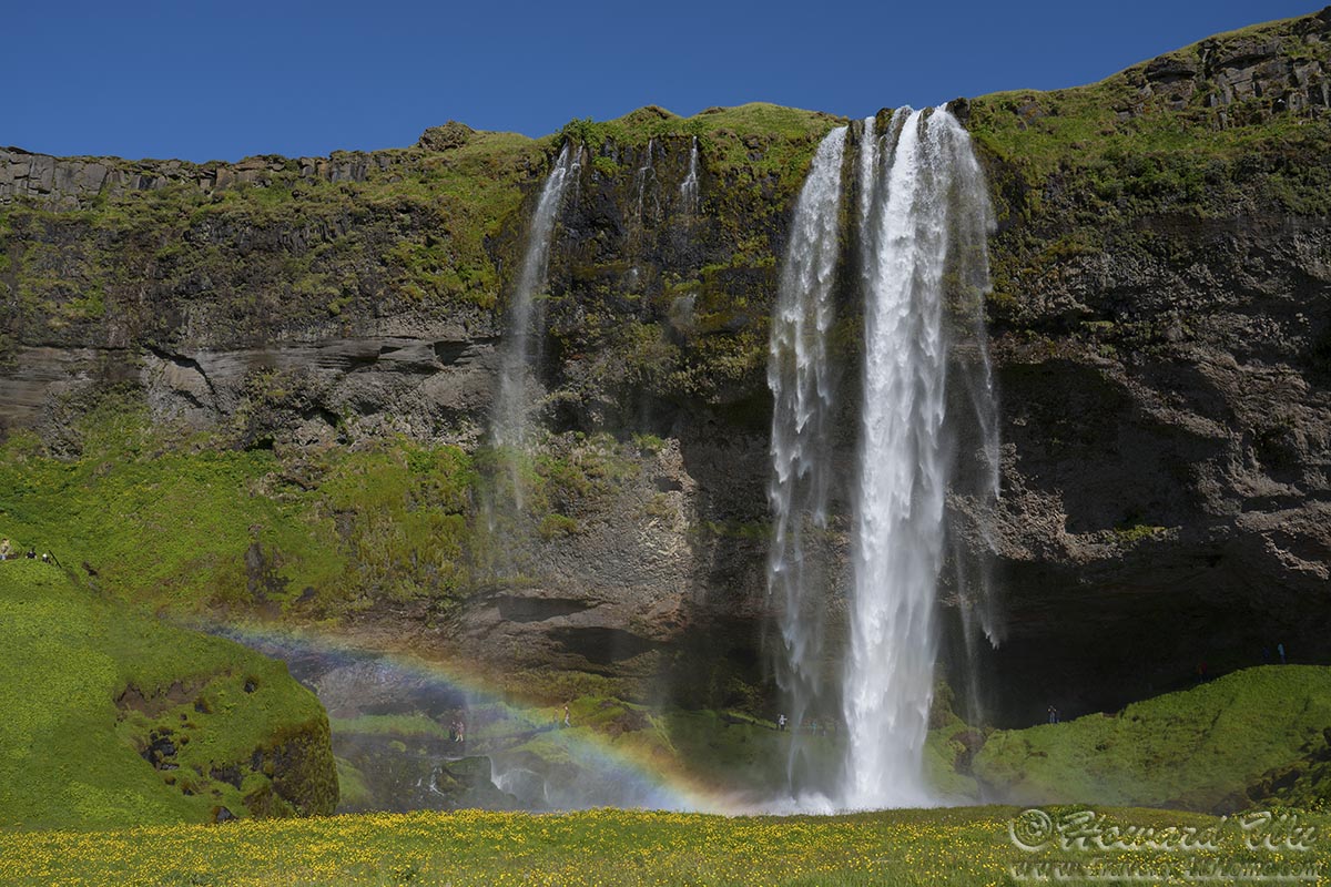
After our side excursion to Heimaey, we drove back to Seljalandsfoss. This time, the waterfalls were properly lit.
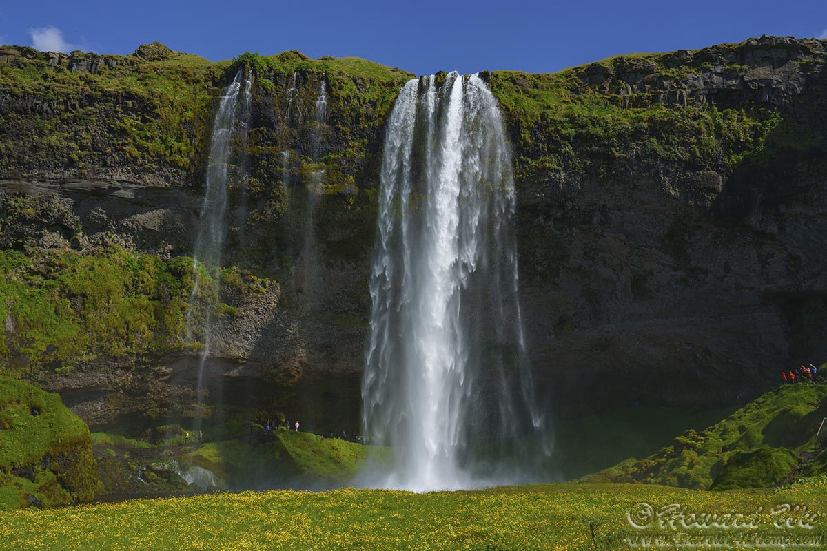
Seljalandsfoss
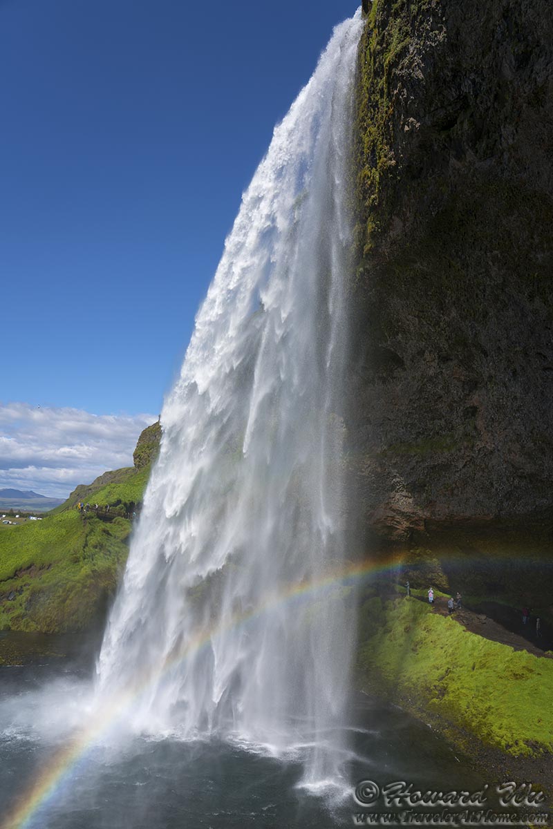
One of the special things about Seljalandsfoss is that one can walk behind the waterfall. And when the sunlight is in the right direction, rainbows appear. We walked a round behind the waterfall. It's easy to get a drenching from the spray of water, and I had to hurriedly snap some pictures on the slippery path.
The scene from behind the waterfall reminded me of Hamilton Pool in central Texas, but on a much grander scale.
Seljalandsfoss
Seljalandsfoss

Seljalandsfoss
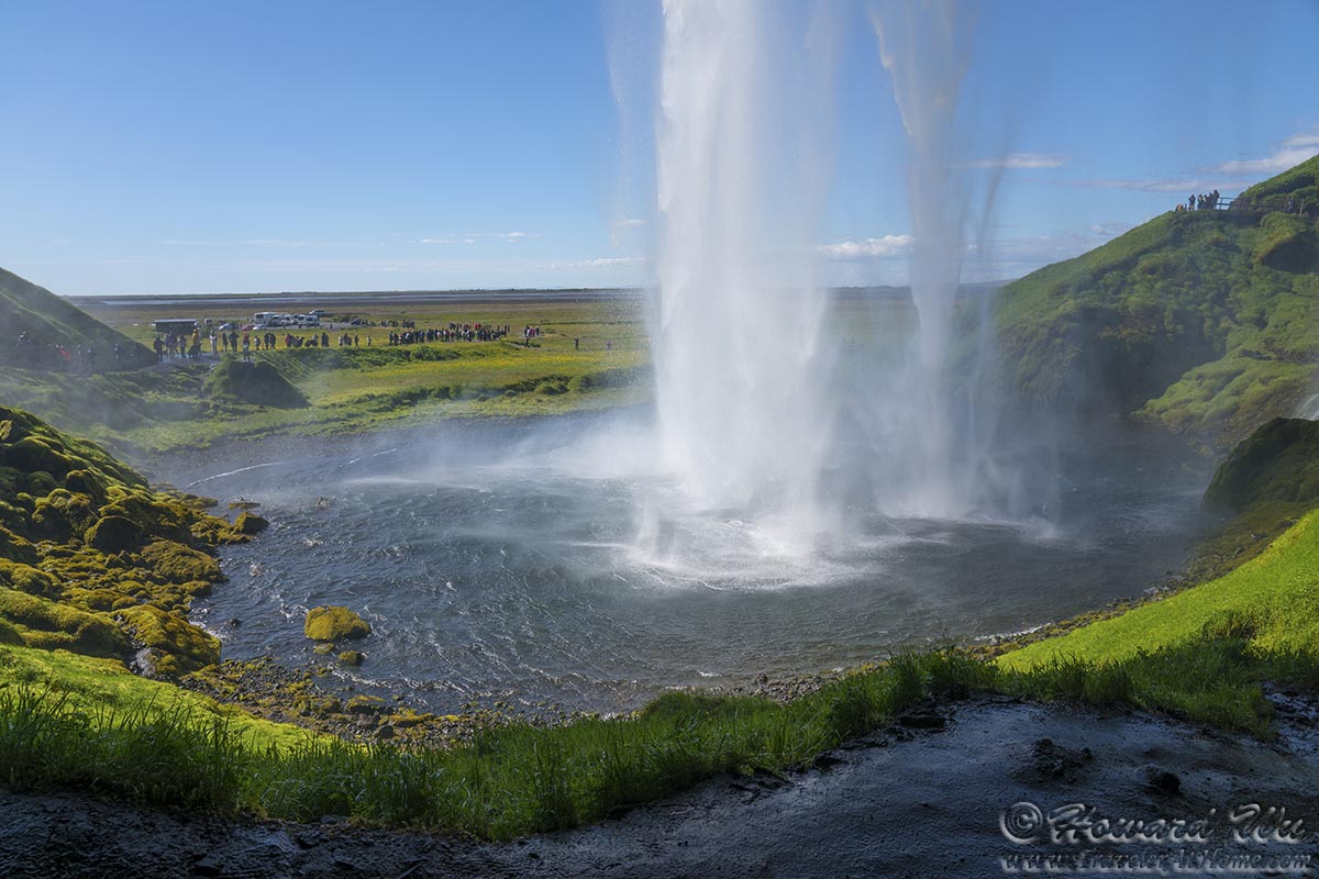
We walked along the path, admiring the powerful waterfall from different angles.
Seljalandsfoss
Seljalandsfoss
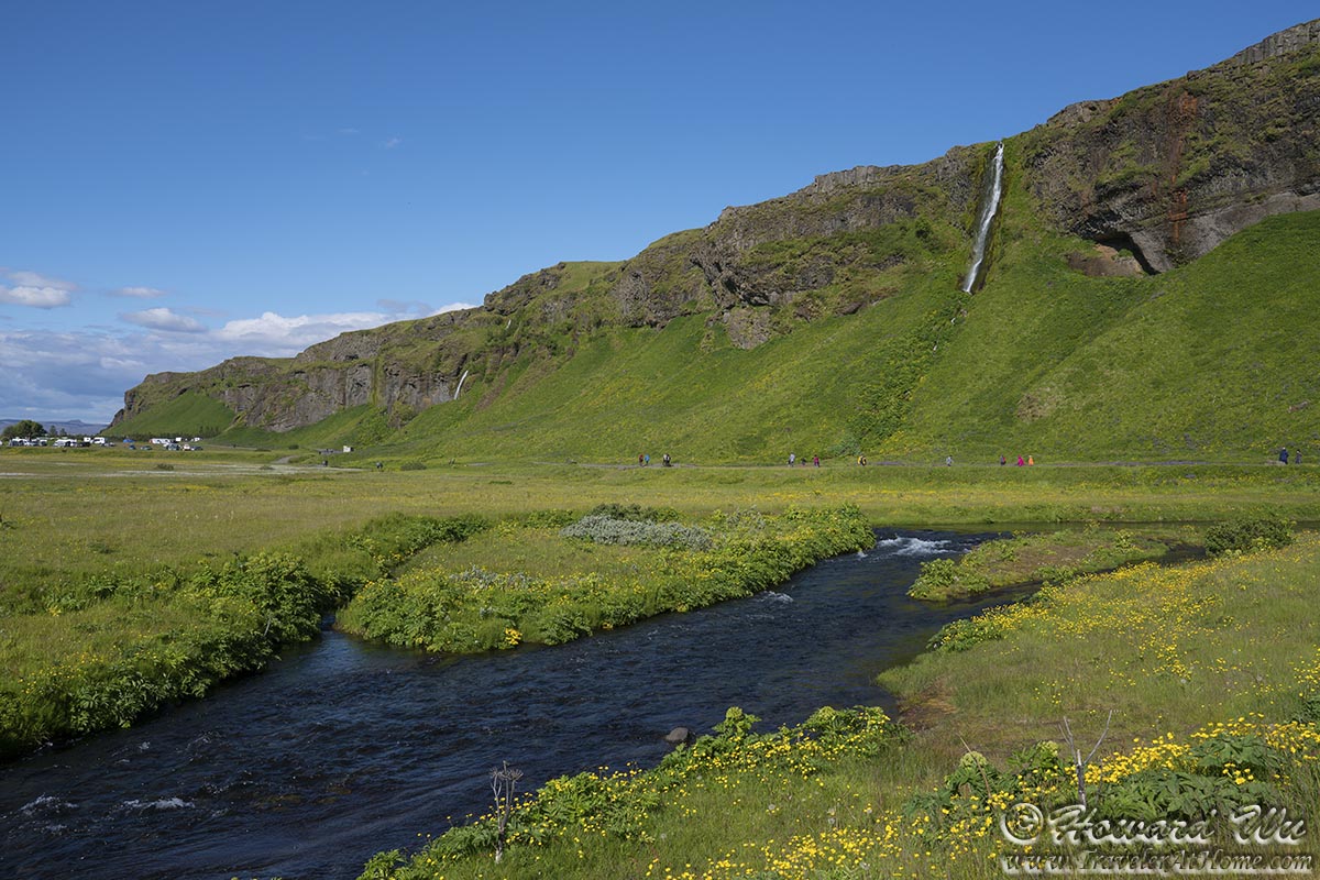
Seljalandsfoss is not the only waterfall in this valley, there are a couple of other waterfalls down the path. I envy those who camped there, as they can take more time to enjoy all this. It is the traveler's curse again and we must move on.
Seljalandsfoss
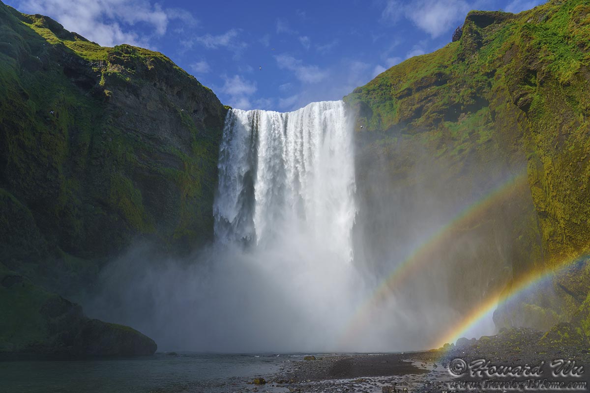
Our next stop was at Skogafoss, another spectacular water on the southern coast. The massive waterfall tumbles down a sheer cliff, it has the reputation of consistently produces a single or double rainbow. This reputation was clearly intact at the time of our visit.
Skogafoss
Here I also got close views of two birds (two species of birds) which I had seen on this trip but until then only distant views. One was an Eurasian Oystercatcher that actually walked about in the gravel parking lot. Another is the Northern Fulmar. There were hundreds of them nesting on the cliff around the waterfall. I saw some pairs with displays of affection in the nest.
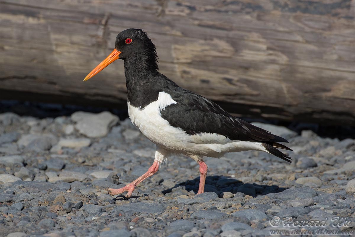
Eurasian Oystercatcher
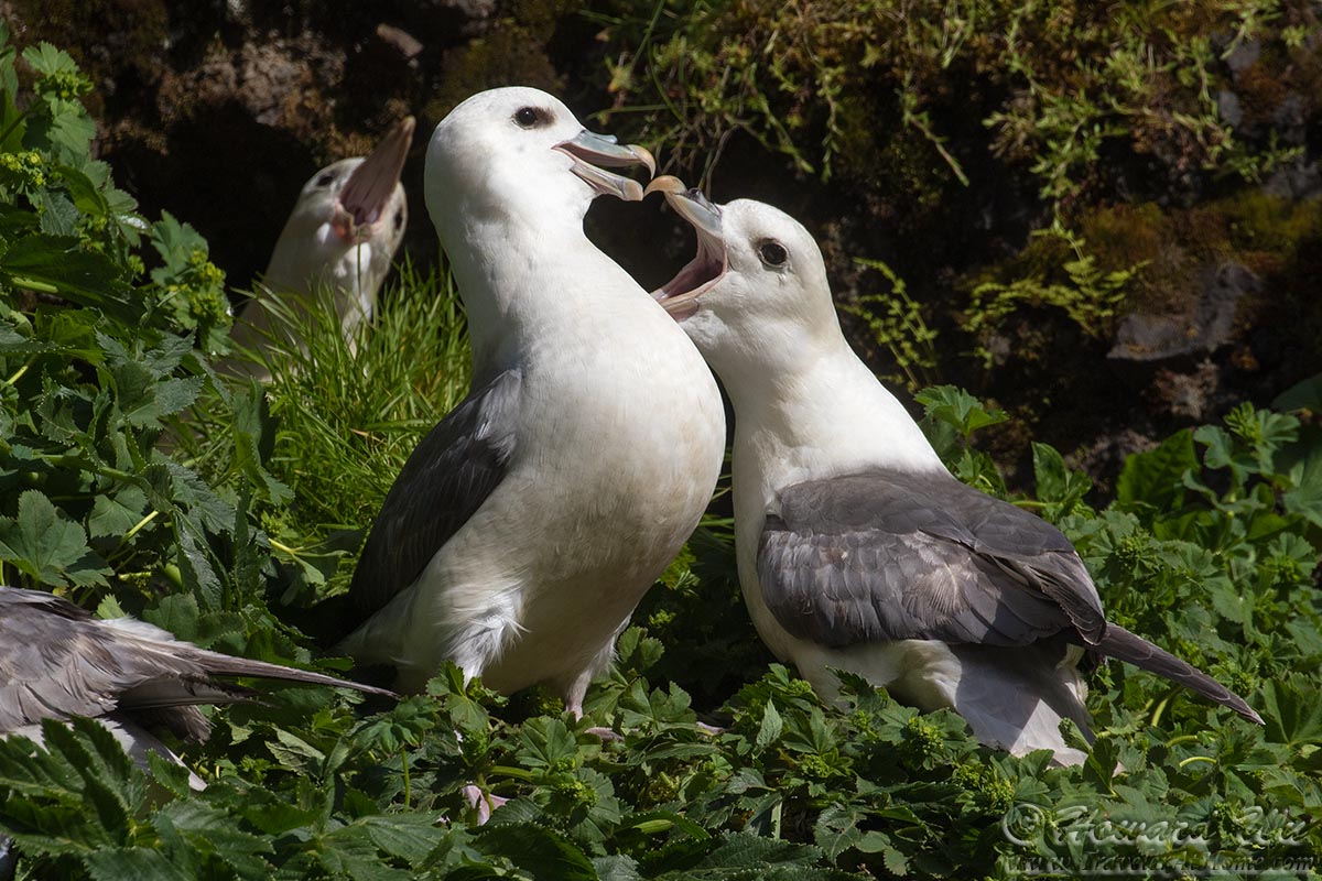
Northern Fulmars
There is a trail with steer staircase on the slope beside the waterfall leading to the top of it. We climbed to the top. While the view of the waterfall was the best from the bottom, from the slope, the view of the coastal plain was expansive and liberating of one's spirit. It is hard to imagine that the cliff that Skogafoss tumbles down from was once a sea cliff, now the ocean seemed rather far away. We could also see Dyrholaey, the sea arch, in the distance.
From the top of the waterfall, there is also a view of the glacier-fed Skoga River.
Coastal Plain
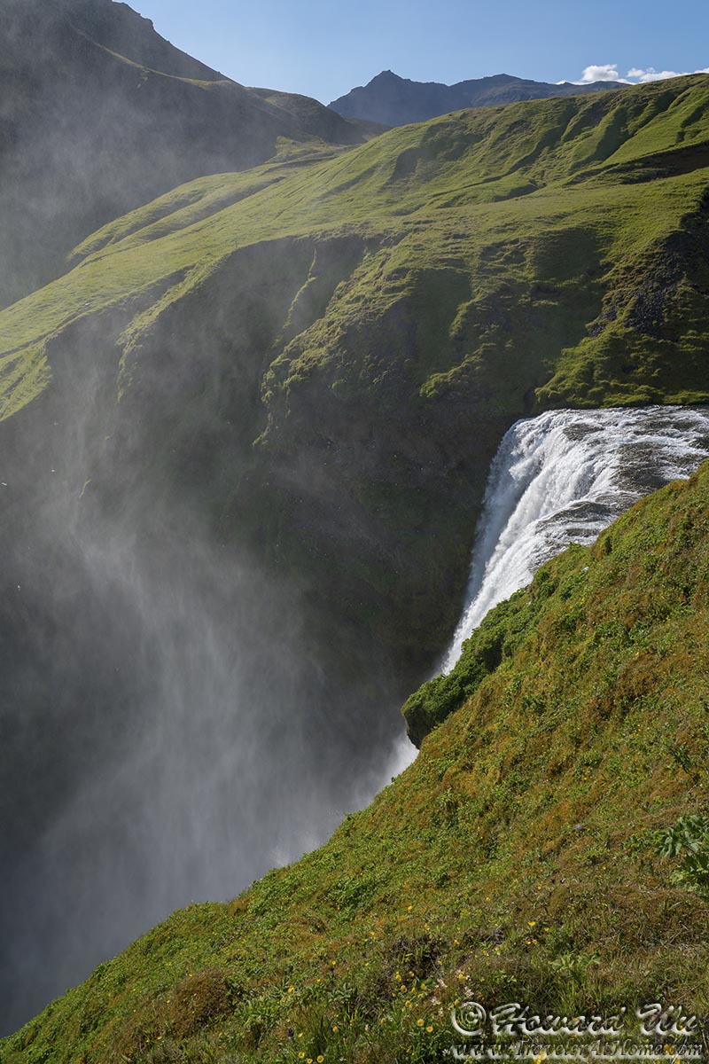
Skogafoss
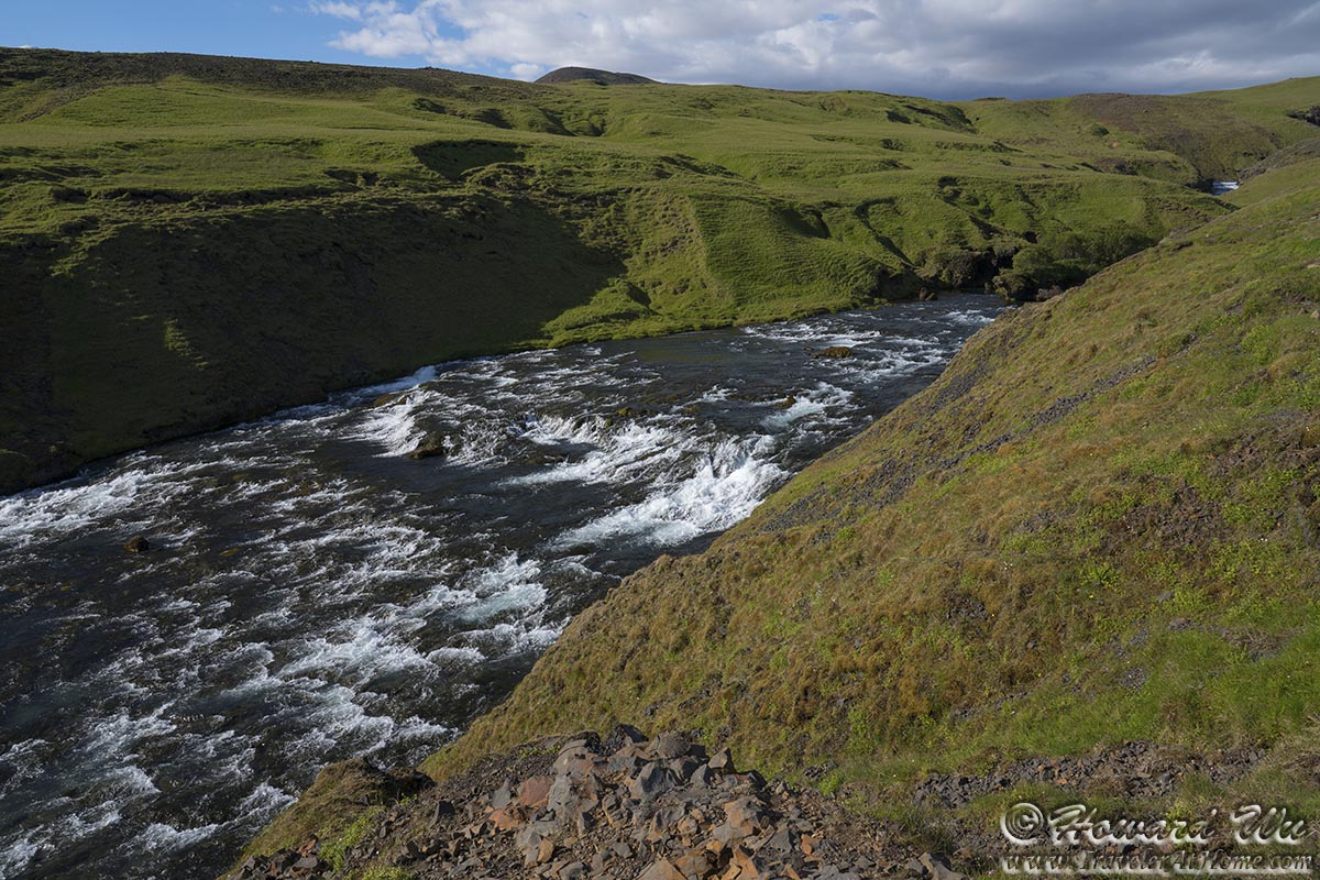
Skoga River
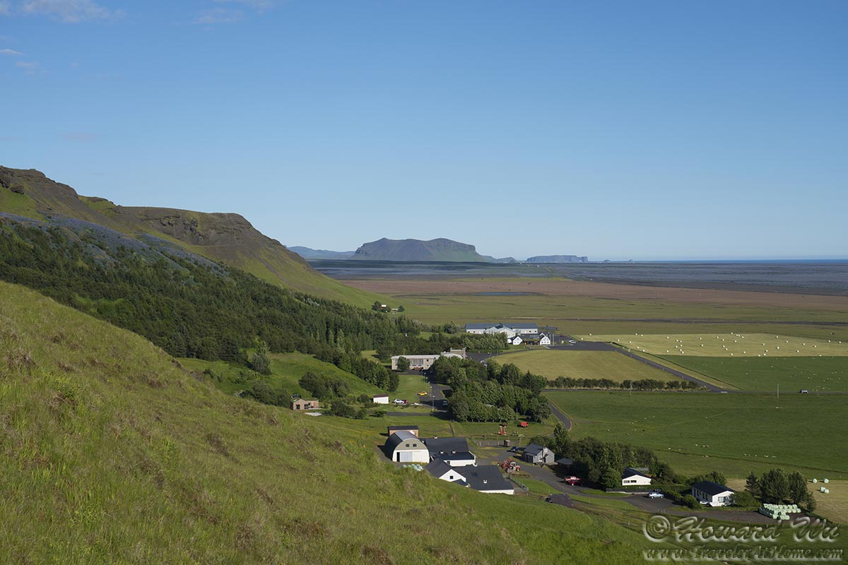
There are hotels and cabins in the flat land below the waterfall. From there, one could also see the Eyjafjallajokull glacier that is the source of the Skogafoss.
Cabins
The grounds were carpeted with lupine. This was certainly a pretty scene, but I did not know at that time that this plant is not a native in Iceland but an introduced species from Alaska. It has become an invasive nuisance in Iceland.
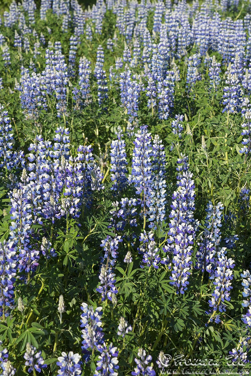
Lupine
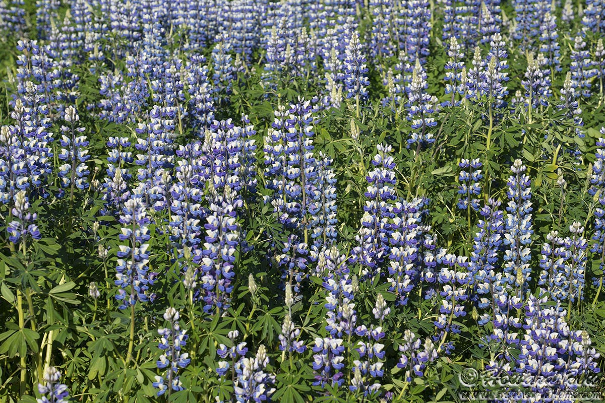
Lupine
We kept driving east and arrived in Reynisfjara, the black sand beach. Reynisfjara is also known for its geometrical basalt columns, however, people climb on top of them (I think climbing should be banned), and it is difficult to get a clean shot without people posing on them.
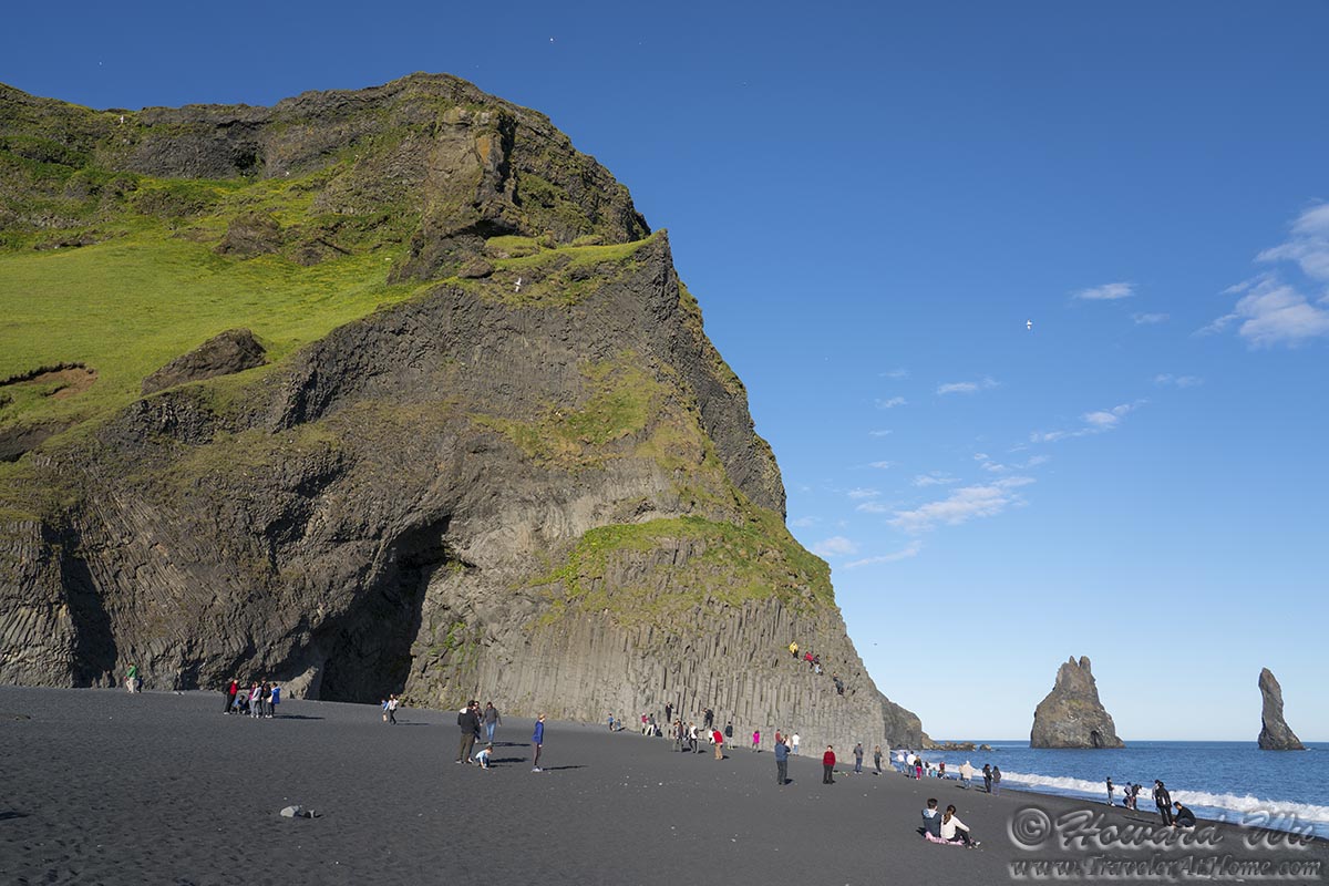
Reynisfjara
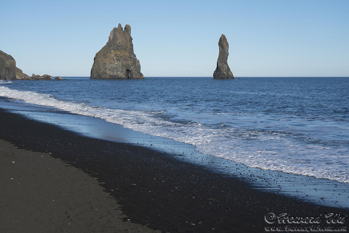
Reynisfjara (with Reynisdrangar the sea stacks off shore)
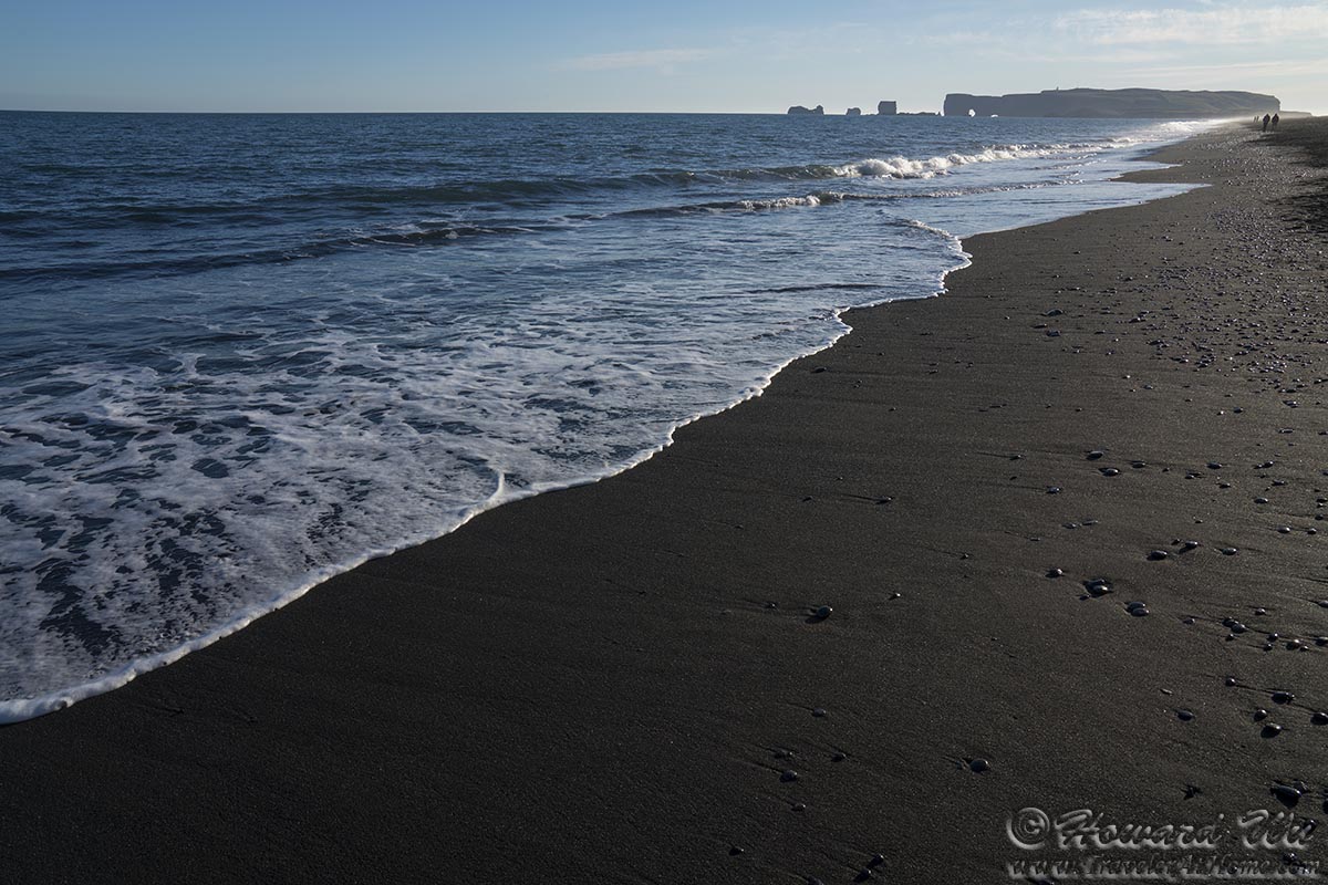
Reynisfjara (with Dyrholaey the sea arch in the distance)
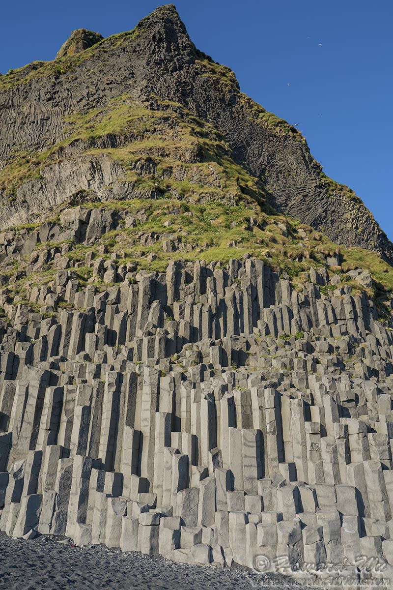
Reynisfjara (basalt columns)
There is a basalt cave nearby, allowing us to look closely at the basalt columns.

Basalt cave
Reynisdrangar are sea stacks off shore. Icelandic legends have it that they are frozen trolls. They are certainly in fantastic shapes. The following is one of the sea stacks, I rather have a different idea of what it looks like, but I am not going to say :-)
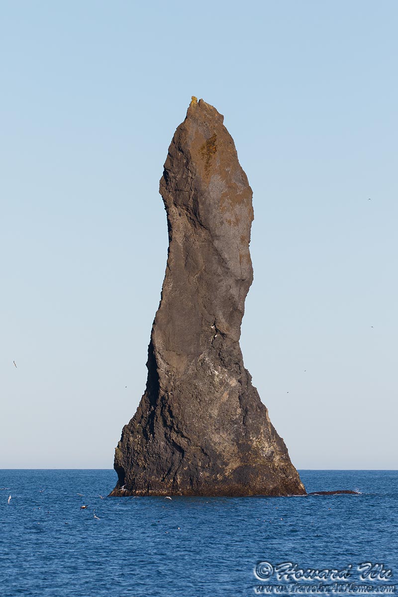
Reynisdrangar
We ended our day in the town of Vik.
Click the image below to return to the index page of 2019 trip to Iceland: